Divide Draw Topo Map Texas
To zoom in, hover over the map of Divide Draw
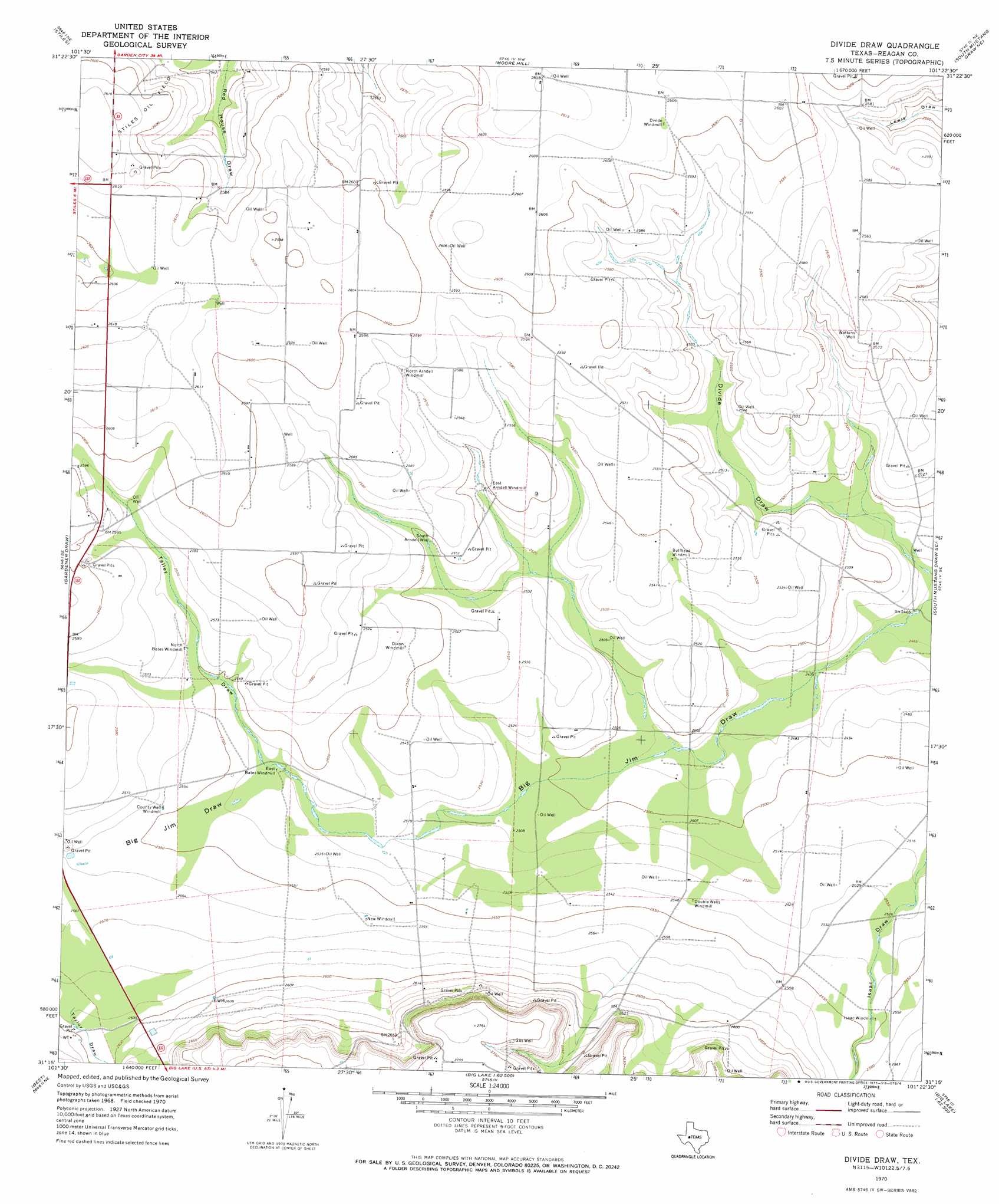
USGS Topo Quad 31101c4 - 1:24,000 scale
| Topo Map Name: | Divide Draw |
| USGS Topo Quad ID: | 31101c4 |
| Print Size: | ca. 21 1/4" wide x 27" high |
| Southeast Coordinates: | 31.25° N latitude / 101.375° W longitude |
| Map Center Coordinates: | 31.3125° N latitude / 101.4375° W longitude |
| U.S. State: | TX |
| Filename: | o31101c4.jpg |
| Download Map JPG Image: | Divide Draw topo map 1:24,000 scale |
| Map Type: | Topographic |
| Topo Series: | 7.5´ |
| Map Scale: | 1:24,000 |
| Source of Map Images: | United States Geological Survey (USGS) |
| Alternate Map Versions: |
Divide Draw TX 1970, updated 1973 Download PDF Buy paper map Divide Draw TX 2010 Download PDF Buy paper map Divide Draw TX 2013 Download PDF Buy paper map Divide Draw TX 2016 Download PDF Buy paper map |
1:24,000 Topo Quads surrounding Divide Draw
Slager Lake |
Saint Lawrence Se |
Three Bluff Draw Sw |
Three Bluff Draw |
Hay Hollow |
Stiles Nw |
Stiles |
Moore Hill |
South Mustang Draw Ne |
Causey Draw |
Garrison Draw |
Gardener Draw |
Divide Draw |
South Mustang Draw Se |
Rocker B Ranch |
Texon |
Best |
Big Lake |
Witco |
Barnhart |
Lone Mountain |
Texon Se |
Big Lake Sw |
Big Lake Se |
Barnhart Sw |
> Back to 31101a1 at 1:100,000 scale
> Back to 31100a1 at 1:250,000 scale
> Back to U.S. Topo Maps home
Divide Draw topo map: Gazetteer
Divide Draw: Valleys
Talley Draw elevation 773m 2536′Taylor Draw elevation 789m 2588′
Divide Draw: Wells
South Arndell Well elevation 778m 2552′Watkins Well elevation 787m 2582′
Divide Draw digital topo map on disk
Buy this Divide Draw topo map showing relief, roads, GPS coordinates and other geographical features, as a high-resolution digital map file on DVD: