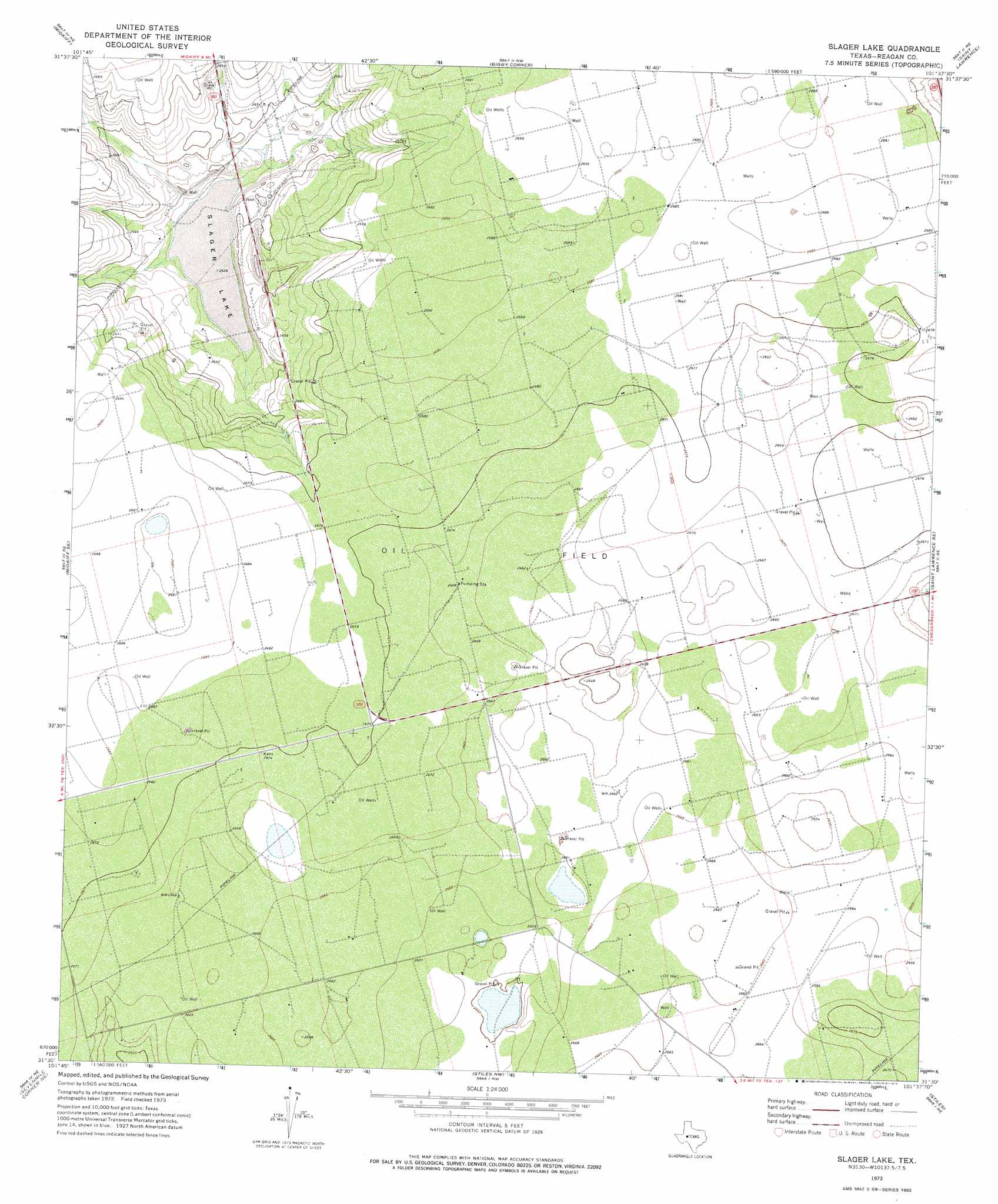
Slager Lake Topo Map Texas
To zoom in, hover over the map of Slager Lake
USGS Topo Quad 31101e6 - 1:24,000 scale
| Topo Map Name: | Slager Lake |
| USGS Topo Quad ID: | 31101e6 |
| Print Size: | ca. 21 1/4" wide x 27" high |
| Southeast Coordinates: | 31.5° N latitude / 101.625° W longitude |
| Map Center Coordinates: | 31.5625° N latitude / 101.6875° W longitude |
| U.S. State: | TX |
| Filename: | o31101e6.jpg |
| Download Map JPG Image: | Slager Lake topo map 1:24,000 scale |
| Map Type: | Topographic |
| Topo Series: | 7.5´ |
| Map Scale: | 1:24,000 |
| Source of Map Images: | United States Geological Survey (USGS) |
| Alternate Map Versions: |
Slager Lake TX 1973, updated 1976 Download PDF Buy paper map Slager Lake TX 2010 Download PDF Buy paper map Slager Lake TX 2012 Download PDF Buy paper map Slager Lake TX 2016 Download PDF Buy paper map |
1:24,000 Topo Quads surrounding Slager Lake
Salt Lake |
Pecks Lake |
Patterson Lake |
Dewey Lake Se |
Garden City |
Midkiff Nw |
Midkiff |
Bigby Corner |
Saint Lawrence |
Three Bluff Draw Nw |
Midkiff Sw |
Midkiff Se |
Slager Lake |
Saint Lawrence Se |
Three Bluff Draw Sw |
Lindsey Ranch |
Sevenmile Corner Ne |
Stiles Nw |
Stiles |
Moore Hill |
Sevenmile Corner |
Sevenmile Corner Se |
Garrison Draw |
Gardener Draw |
Divide Draw |
> Back to 31101e1 at 1:100,000 scale
> Back to 31100a1 at 1:250,000 scale
> Back to U.S. Topo Maps home
Slager Lake digital topo map on disk
Buy this Slager Lake topo map showing relief, roads, GPS coordinates and other geographical features, as a high-resolution digital map file on DVD: