Glass Ranch Topo Map Texas
To zoom in, hover over the map of Glass Ranch
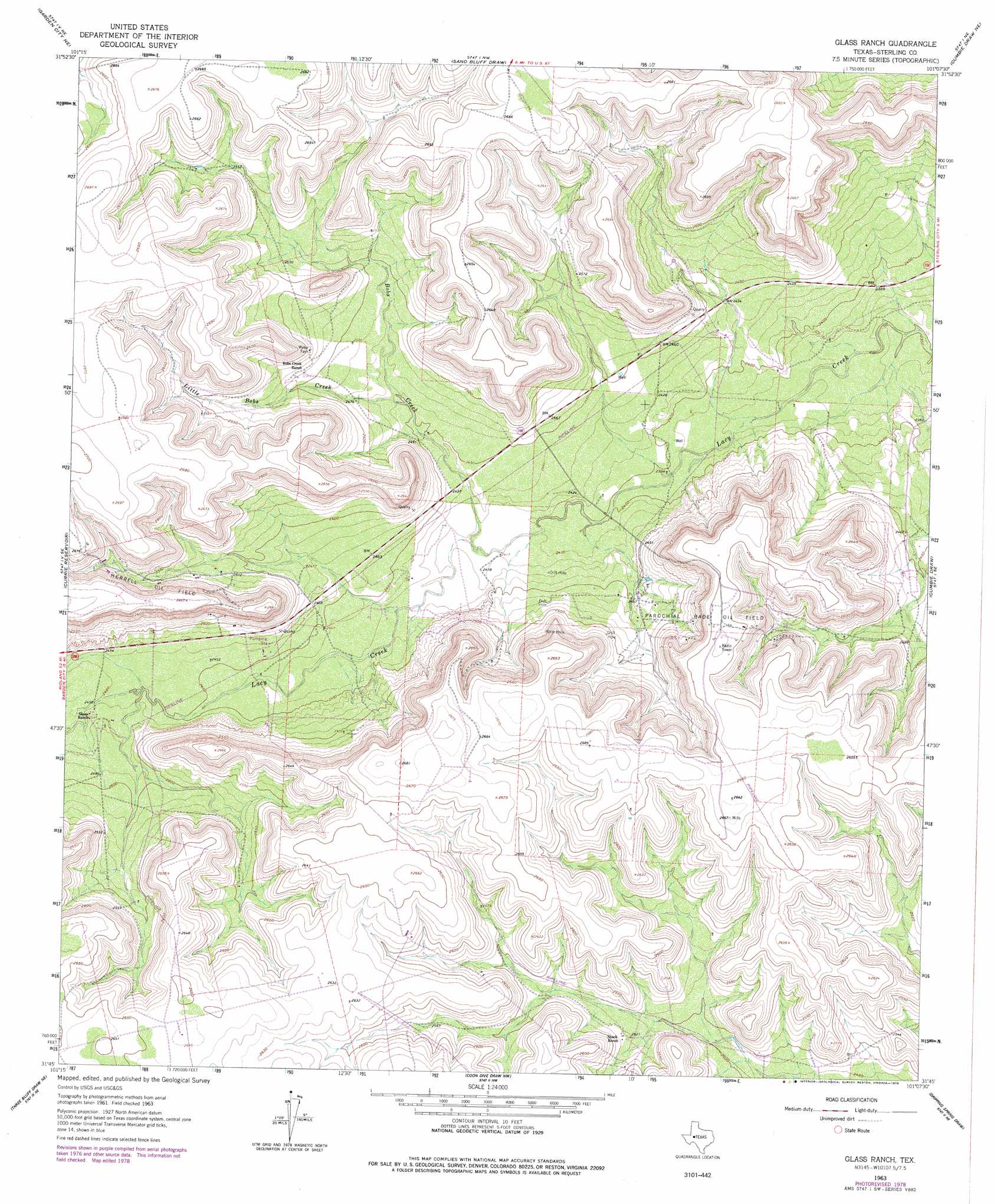
USGS Topo Quad 31101g2 - 1:24,000 scale
| Topo Map Name: | Glass Ranch |
| USGS Topo Quad ID: | 31101g2 |
| Print Size: | ca. 21 1/4" wide x 27" high |
| Southeast Coordinates: | 31.75° N latitude / 101.125° W longitude |
| Map Center Coordinates: | 31.8125° N latitude / 101.1875° W longitude |
| U.S. State: | TX |
| Filename: | o31101g2.jpg |
| Download Map JPG Image: | Glass Ranch topo map 1:24,000 scale |
| Map Type: | Topographic |
| Topo Series: | 7.5´ |
| Map Scale: | 1:24,000 |
| Source of Map Images: | United States Geological Survey (USGS) |
| Alternate Map Versions: |
Glass Ranch TX 1963, updated 1964 Download PDF Buy paper map Glass Ranch TX 1963, updated 1978 Download PDF Buy paper map Glass Ranch TX 2010 Download PDF Buy paper map Glass Ranch TX 2012 Download PDF Buy paper map Glass Ranch TX 2016 Download PDF Buy paper map |
1:24,000 Topo Quads surrounding Glass Ranch
Lees |
Forsan |
Hayrick Mountain |
Buffalo Draw |
Mcwhorter Mountain |
Ballinger Ranch |
Garden City Ne |
Sand Bluff Draw |
Cumbie Draw Ne |
Sterling City Nw |
Garden City |
Currie Reservoir |
Glass Ranch |
Cumbie Draw |
Sterling City |
Three Bluff Draw Nw |
Three Bluff Draw Ne |
Coon Dive Draw Nw |
Dripping Springs Draw |
Dog Creek Nw |
Three Bluff Draw Sw |
Three Bluff Draw |
Hay Hollow |
Coon Dive Draw |
Dog Creek Sw |
> Back to 31101e1 at 1:100,000 scale
> Back to 31100a1 at 1:250,000 scale
> Back to U.S. Topo Maps home
Glass Ranch topo map: Gazetteer
Glass Ranch: Oilfields
Herrell Oil Field elevation 790m 2591′Parochial Bade Oil Field elevation 783m 2568′
Glass Ranch: Streams
Bobs Creek elevation 735m 2411′Little Bobs Creek elevation 735m 2411′
Glass Ranch digital topo map on disk
Buy this Glass Ranch topo map showing relief, roads, GPS coordinates and other geographical features, as a high-resolution digital map file on DVD: