Garden City Topo Map Texas
To zoom in, hover over the map of Garden City
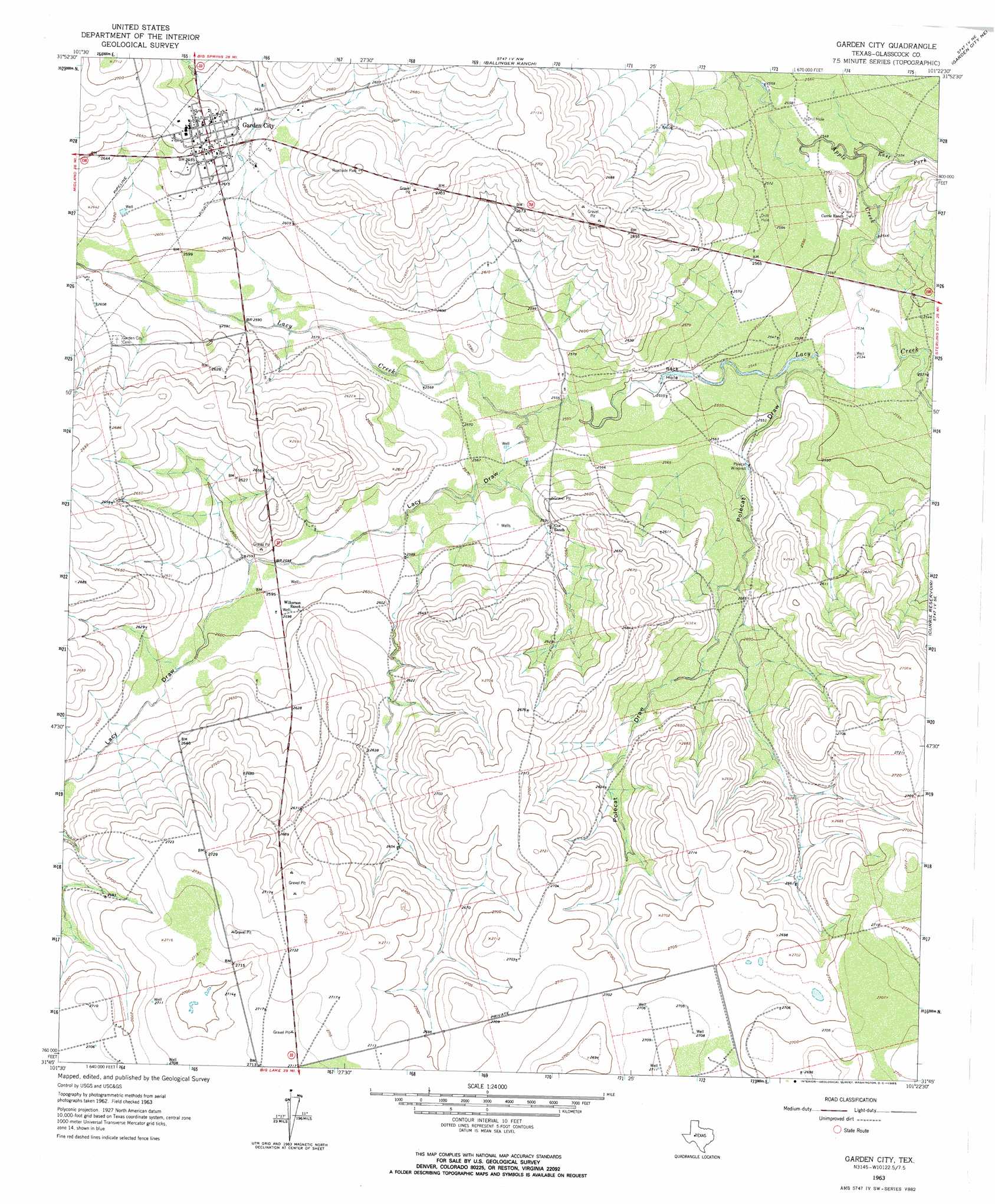
USGS Topo Quad 31101g4 - 1:24,000 scale
| Topo Map Name: | Garden City |
| USGS Topo Quad ID: | 31101g4 |
| Print Size: | ca. 21 1/4" wide x 27" high |
| Southeast Coordinates: | 31.75° N latitude / 101.375° W longitude |
| Map Center Coordinates: | 31.8125° N latitude / 101.4375° W longitude |
| U.S. State: | TX |
| Filename: | o31101g4.jpg |
| Download Map JPG Image: | Garden City topo map 1:24,000 scale |
| Map Type: | Topographic |
| Topo Series: | 7.5´ |
| Map Scale: | 1:24,000 |
| Source of Map Images: | United States Geological Survey (USGS) |
| Alternate Map Versions: |
Garden City TX 1963, updated 1965 Download PDF Buy paper map Garden City TX 2010 Download PDF Buy paper map Garden City TX 2012 Download PDF Buy paper map Garden City TX 2016 Download PDF Buy paper map |
1:24,000 Topo Quads surrounding Garden City
Houston Ranch |
Lucian Wells Ranch |
Lees |
Forsan |
Hayrick Mountain |
Dewey Lake |
Dewey Lake Ne |
Ballinger Ranch |
Garden City Ne |
Sand Bluff Draw |
Patterson Lake |
Dewey Lake Se |
Garden City |
Currie Reservoir |
Glass Ranch |
Bigby Corner |
Saint Lawrence |
Three Bluff Draw Nw |
Three Bluff Draw Ne |
Coon Dive Draw Nw |
Slager Lake |
Saint Lawrence Se |
Three Bluff Draw Sw |
Three Bluff Draw |
Hay Hollow |
> Back to 31101e1 at 1:100,000 scale
> Back to 31100a1 at 1:250,000 scale
> Back to U.S. Topo Maps home
Garden City topo map: Gazetteer
Garden City: Lakes
Rock Hole elevation 776m 2545′Garden City: Populated Places
Garden City elevation 804m 2637′Garden City: Streams
Apple Creek elevation 771m 2529′East Fork Apple Creek elevation 774m 2539′
Garden City: Valleys
Lacy Draw elevation 781m 2562′Polecat Draw elevation 773m 2536′
Garden City digital topo map on disk
Buy this Garden City topo map showing relief, roads, GPS coordinates and other geographical features, as a high-resolution digital map file on DVD: