Stephenson Lake Topo Map Texas
To zoom in, hover over the map of Stephenson Lake
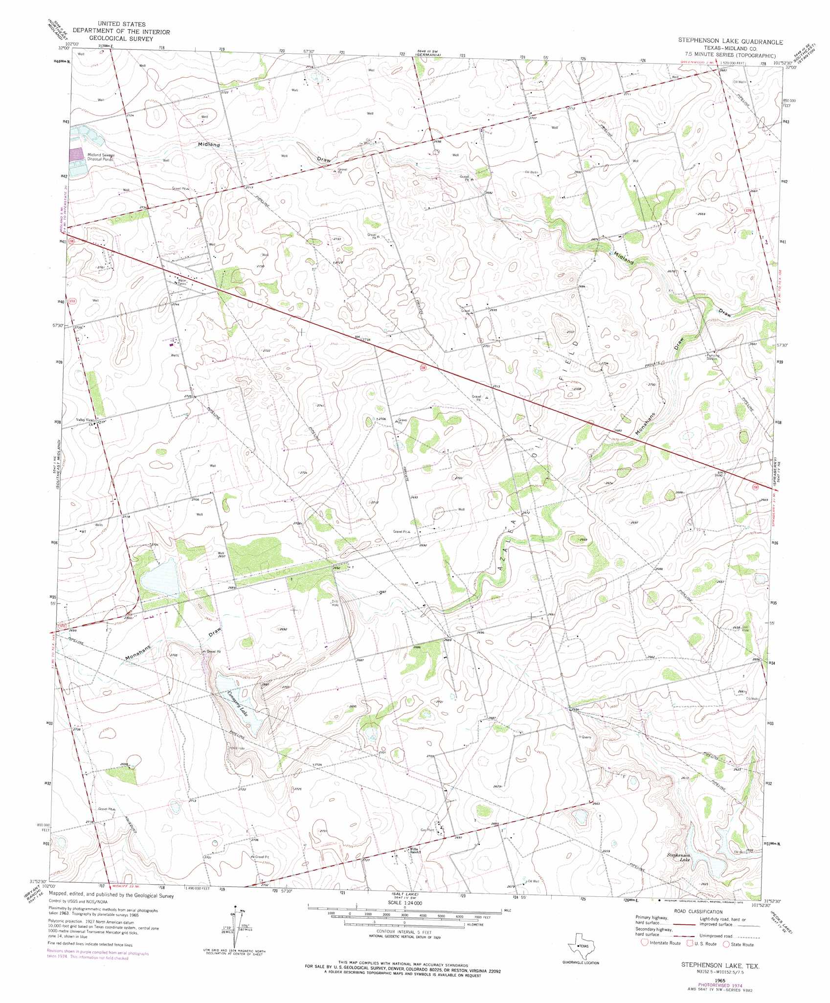
USGS Topo Quad 31101h8 - 1:24,000 scale
| Topo Map Name: | Stephenson Lake |
| USGS Topo Quad ID: | 31101h8 |
| Print Size: | ca. 21 1/4" wide x 27" high |
| Southeast Coordinates: | 31.875° N latitude / 101.875° W longitude |
| Map Center Coordinates: | 31.9375° N latitude / 101.9375° W longitude |
| U.S. State: | TX |
| Filename: | o31101h8.jpg |
| Download Map JPG Image: | Stephenson Lake topo map 1:24,000 scale |
| Map Type: | Topographic |
| Topo Series: | 7.5´ |
| Map Scale: | 1:24,000 |
| Source of Map Images: | United States Geological Survey (USGS) |
| Alternate Map Versions: |
Stephenson Lake TX 1965, updated 1966 Download PDF Buy paper map Stephenson Lake TX 1965, updated 1975 Download PDF Buy paper map Stephenson Lake TX 2010 Download PDF Buy paper map Stephenson Lake TX 2012 Download PDF Buy paper map Stephenson Lake TX 2016 Download PDF Buy paper map |
1:24,000 Topo Quads surrounding Stephenson Lake
Mabee Ranch |
North Curtis Ranch |
Dickenson Ranch |
Stanton |
Natural Dam Lake |
Northwest Midland |
Northeast Midland |
Germania |
Stanton Se |
Houston Ranch |
Southwest Midland |
Southeast Midland |
Stephenson Lake |
Spraberry |
Dewey Lake |
Parks |
Bryant Ranch |
Salt Lake |
Pecks Lake |
Patterson Lake |
Benge Corner Nw |
Benge Corner |
Midkiff Nw |
Midkiff |
Bigby Corner |
> Back to 31101e1 at 1:100,000 scale
> Back to 31100a1 at 1:250,000 scale
> Back to U.S. Topo Maps home
Stephenson Lake topo map: Gazetteer
Stephenson Lake: Lakes
Consavvy Lake elevation 814m 2670′Stephenson Lake elevation 791m 2595′
Stephenson Lake: Oilfields
Azalea Oil Field elevation 820m 2690′Stephenson Lake: Valleys
Monahans Draw elevation 808m 2650′Stephenson Lake digital topo map on disk
Buy this Stephenson Lake topo map showing relief, roads, GPS coordinates and other geographical features, as a high-resolution digital map file on DVD: