Mccamey South Topo Map Texas
To zoom in, hover over the map of Mccamey South
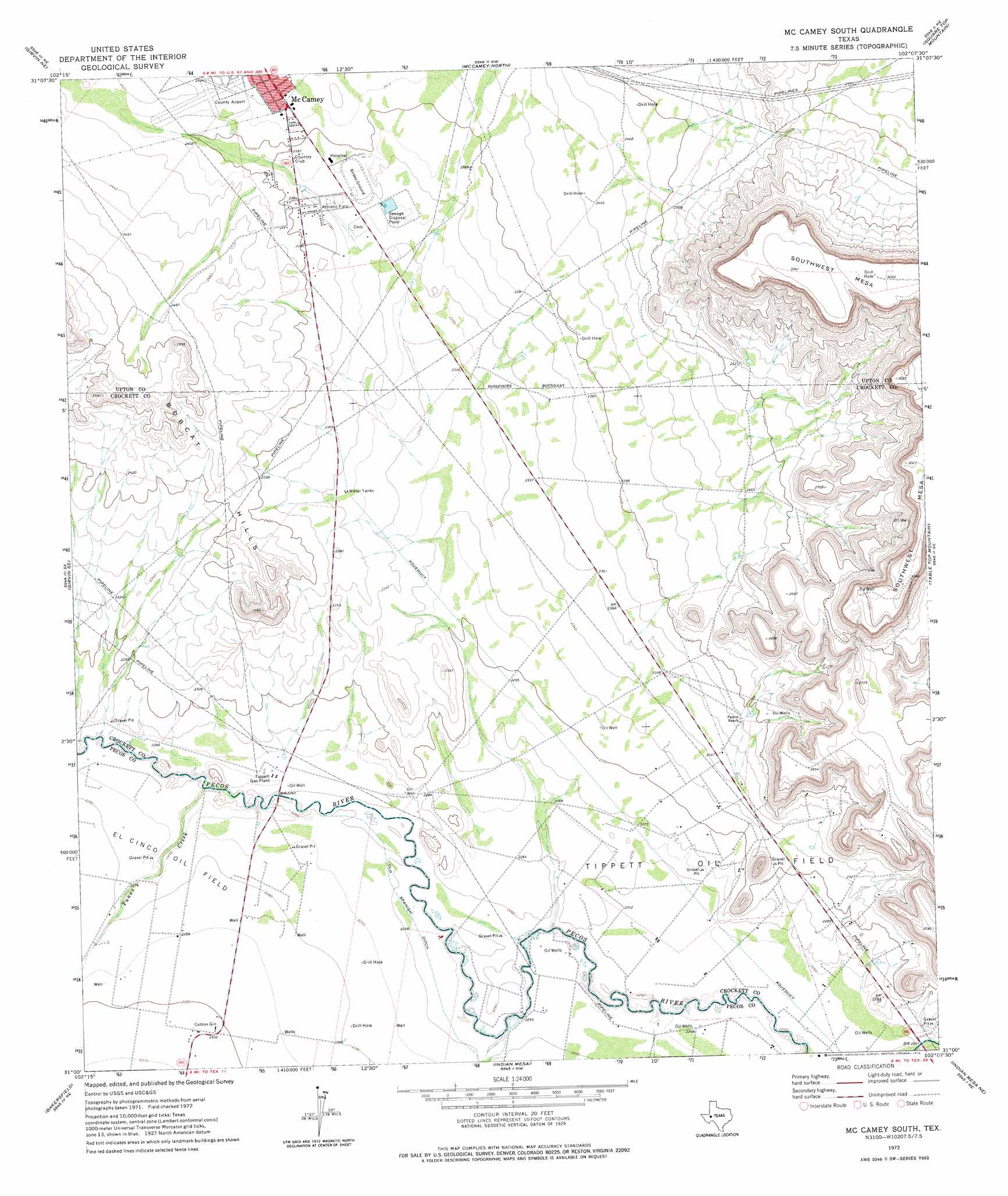
USGS Topo Quad 31102a2 - 1:24,000 scale
| Topo Map Name: | Mccamey South |
| USGS Topo Quad ID: | 31102a2 |
| Print Size: | ca. 21 1/4" wide x 27" high |
| Southeast Coordinates: | 31° N latitude / 102.125° W longitude |
| Map Center Coordinates: | 31.0625° N latitude / 102.1875° W longitude |
| U.S. State: | TX |
| Filename: | o31102a2.jpg |
| Download Map JPG Image: | Mccamey South topo map 1:24,000 scale |
| Map Type: | Topographic |
| Topo Series: | 7.5´ |
| Map Scale: | 1:24,000 |
| Source of Map Images: | United States Geological Survey (USGS) |
| Alternate Map Versions: |
McCamey South TX 1972, updated 1974 Download PDF Buy paper map McCamey South TX 2010 Download PDF Buy paper map McCamey South TX 2013 Download PDF Buy paper map McCamey South TX 2016 Download PDF Buy paper map |
1:24,000 Topo Quads surrounding Mccamey South
Crane Sw |
Castle Gap |
Marlboro Canyon |
Marlboro Canyon Se |
Sevenmile Corner |
Girvin Nw |
Girvin Ne |
Mccamey North |
Square Top Mountain |
Rankin |
Girvin |
Girvin Se |
Mccamey South |
Table Top Mountain |
Cedar Canyon |
Bootleg Canyon |
Bakersfield |
Indian Mesa |
Indian Mesa Ne |
Iraan |
Skyscraper Peak |
Sherbino Mesa |
Sherbino Ranch |
Indian Mesa Se |
Divide Country |
> Back to 31102a1 at 1:100,000 scale
> Back to 31102a1 at 1:250,000 scale
> Back to U.S. Topo Maps home
Mccamey South topo map: Gazetteer
Mccamey South: Oilfields
Tippett Gas Plant elevation 692m 2270′Tippett Oil Field elevation 703m 2306′
Mccamey South: Streams
Tunas Creek elevation 689m 2260′Mccamey South digital topo map on disk
Buy this Mccamey South topo map showing relief, roads, GPS coordinates and other geographical features, as a high-resolution digital map file on DVD: