Girvin Topo Map Texas
To zoom in, hover over the map of Girvin
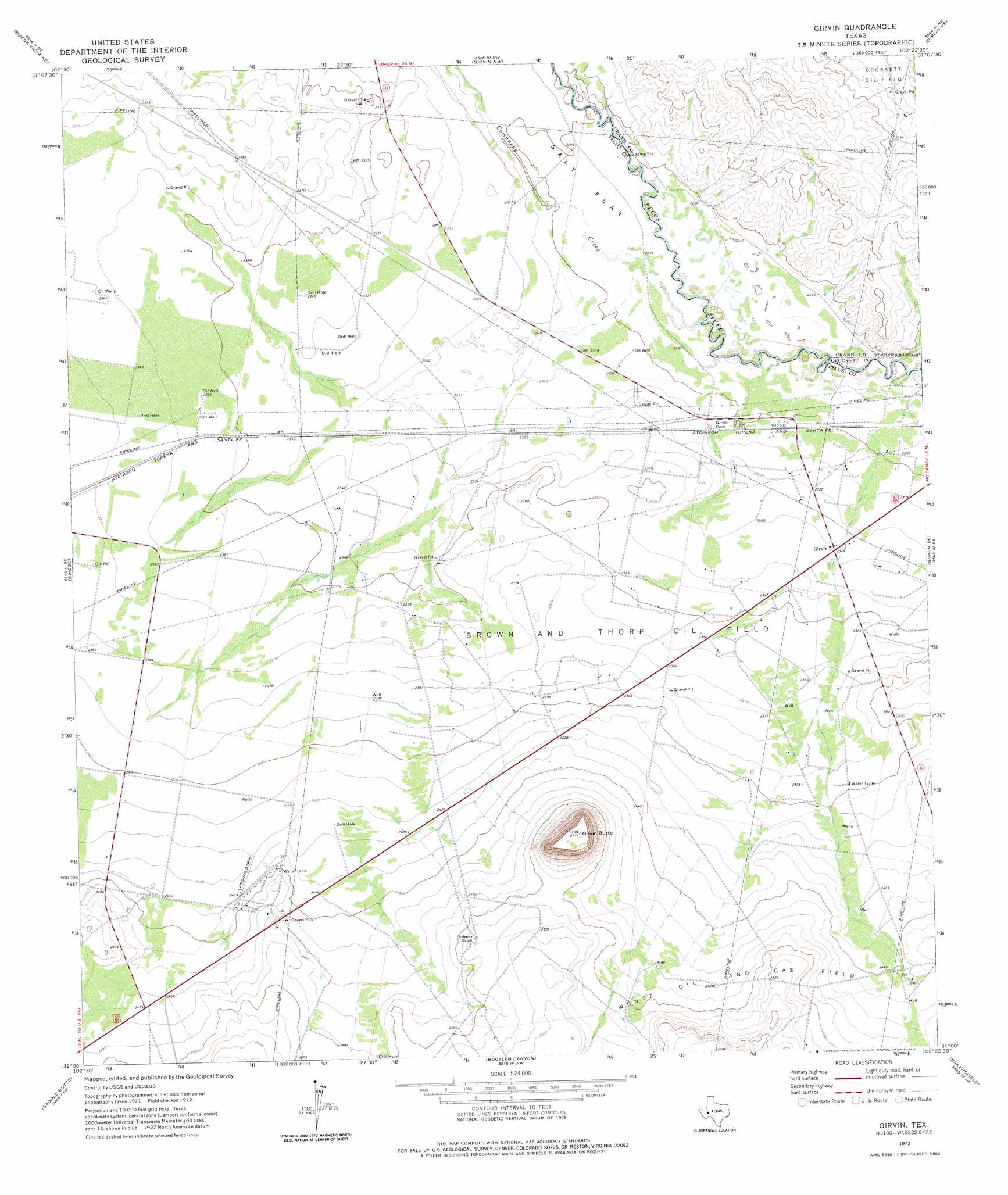
USGS Topo Quad 31102a4 - 1:24,000 scale
| Topo Map Name: | Girvin |
| USGS Topo Quad ID: | 31102a4 |
| Print Size: | ca. 21 1/4" wide x 27" high |
| Southeast Coordinates: | 31° N latitude / 102.375° W longitude |
| Map Center Coordinates: | 31.0625° N latitude / 102.4375° W longitude |
| U.S. State: | TX |
| Filename: | o31102a4.jpg |
| Download Map JPG Image: | Girvin topo map 1:24,000 scale |
| Map Type: | Topographic |
| Topo Series: | 7.5´ |
| Map Scale: | 1:24,000 |
| Source of Map Images: | United States Geological Survey (USGS) |
| Alternate Map Versions: |
Girvin TX 1972, updated 1975 Download PDF Buy paper map Girvin TX 2010 Download PDF Buy paper map Girvin TX 2012 Download PDF Buy paper map Girvin TX 2016 Download PDF Buy paper map |
1:24,000 Topo Quads surrounding Girvin
Imperial |
Juan Cordona Lake |
Crane Sw |
Castle Gap |
Marlboro Canyon |
Buena Vista |
Buena Vista Ne |
Girvin Nw |
Girvin Ne |
Mccamey North |
Buena Vista Sw |
Owego |
Girvin |
Girvin Se |
Mccamey South |
East Mesa |
Saddle Butte |
Bootleg Canyon |
Bakersfield |
Indian Mesa |
East Mesa Sw |
Panther Bluff |
Skyscraper Peak |
Sherbino Mesa |
Sherbino Ranch |
> Back to 31102a1 at 1:100,000 scale
> Back to 31102a1 at 1:250,000 scale
> Back to U.S. Topo Maps home
Girvin topo map: Gazetteer
Girvin: Oilfields
Brown and Thorp Oil Field elevation 719m 2358′Wentz Oil and Gas Field elevation 758m 2486′
Girvin: Populated Places
Girvin elevation 709m 2326′Girvin: Streams
Comanche Creek elevation 696m 2283′Girvin: Summits
Girvin Butte elevation 844m 2769′Girvin digital topo map on disk
Buy this Girvin topo map showing relief, roads, GPS coordinates and other geographical features, as a high-resolution digital map file on DVD: