Square Top Mountain Topo Map Texas
To zoom in, hover over the map of Square Top Mountain
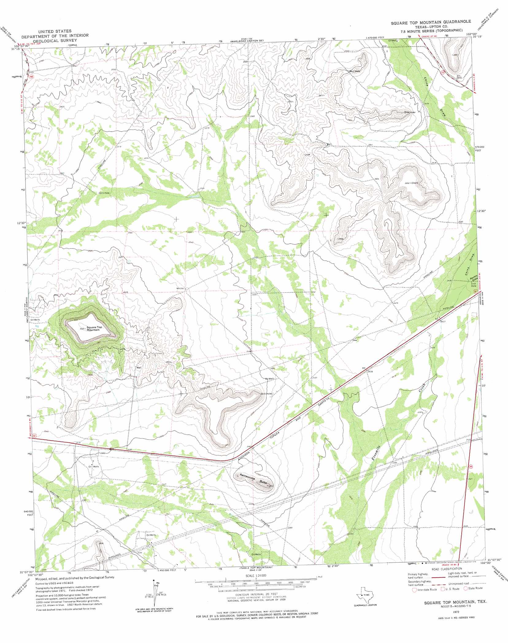
USGS Topo Quad 31102b1 - 1:24,000 scale
| Topo Map Name: | Square Top Mountain |
| USGS Topo Quad ID: | 31102b1 |
| Print Size: | ca. 21 1/4" wide x 27" high |
| Southeast Coordinates: | 31.125° N latitude / 102° W longitude |
| Map Center Coordinates: | 31.1875° N latitude / 102.0625° W longitude |
| U.S. State: | TX |
| Filename: | o31102b1.jpg |
| Download Map JPG Image: | Square Top Mountain topo map 1:24,000 scale |
| Map Type: | Topographic |
| Topo Series: | 7.5´ |
| Map Scale: | 1:24,000 |
| Source of Map Images: | United States Geological Survey (USGS) |
| Alternate Map Versions: |
Square Top Mountain TX 1972, updated 1975 Download PDF Buy paper map Square Top Mountain TX 2010 Download PDF Buy paper map Square Top Mountain TX 2012 Download PDF Buy paper map Square Top Mountain TX 2016 Download PDF Buy paper map |
1:24,000 Topo Quads surrounding Square Top Mountain
Crane |
Mcelroy Ranch |
Hanks Ranch |
Lindsey Ranch |
Sevenmile Corner Ne |
Castle Gap |
Marlboro Canyon |
Marlboro Canyon Se |
Sevenmile Corner |
Sevenmile Corner Se |
Girvin Ne |
Mccamey North |
Square Top Mountain |
Rankin |
Rankin Ne |
Girvin Se |
Mccamey South |
Table Top Mountain |
Cedar Canyon |
Rankin Se |
Bakersfield |
Indian Mesa |
Indian Mesa Ne |
Iraan |
Twelvemile Camp |
> Back to 31102a1 at 1:100,000 scale
> Back to 31102a1 at 1:250,000 scale
> Back to U.S. Topo Maps home
Square Top Mountain topo map: Gazetteer
Square Top Mountain: Summits
Rattlesnake Butte elevation 803m 2634′Square Top Mountain elevation 921m 3021′
Square Top Mountain: Valleys
China Draw elevation 739m 2424′Rankin Draw elevation 739m 2424′
Square Top Mountain digital topo map on disk
Buy this Square Top Mountain topo map showing relief, roads, GPS coordinates and other geographical features, as a high-resolution digital map file on DVD: