Diamond Y Spring Ne Topo Map Texas
To zoom in, hover over the map of Diamond Y Spring Ne
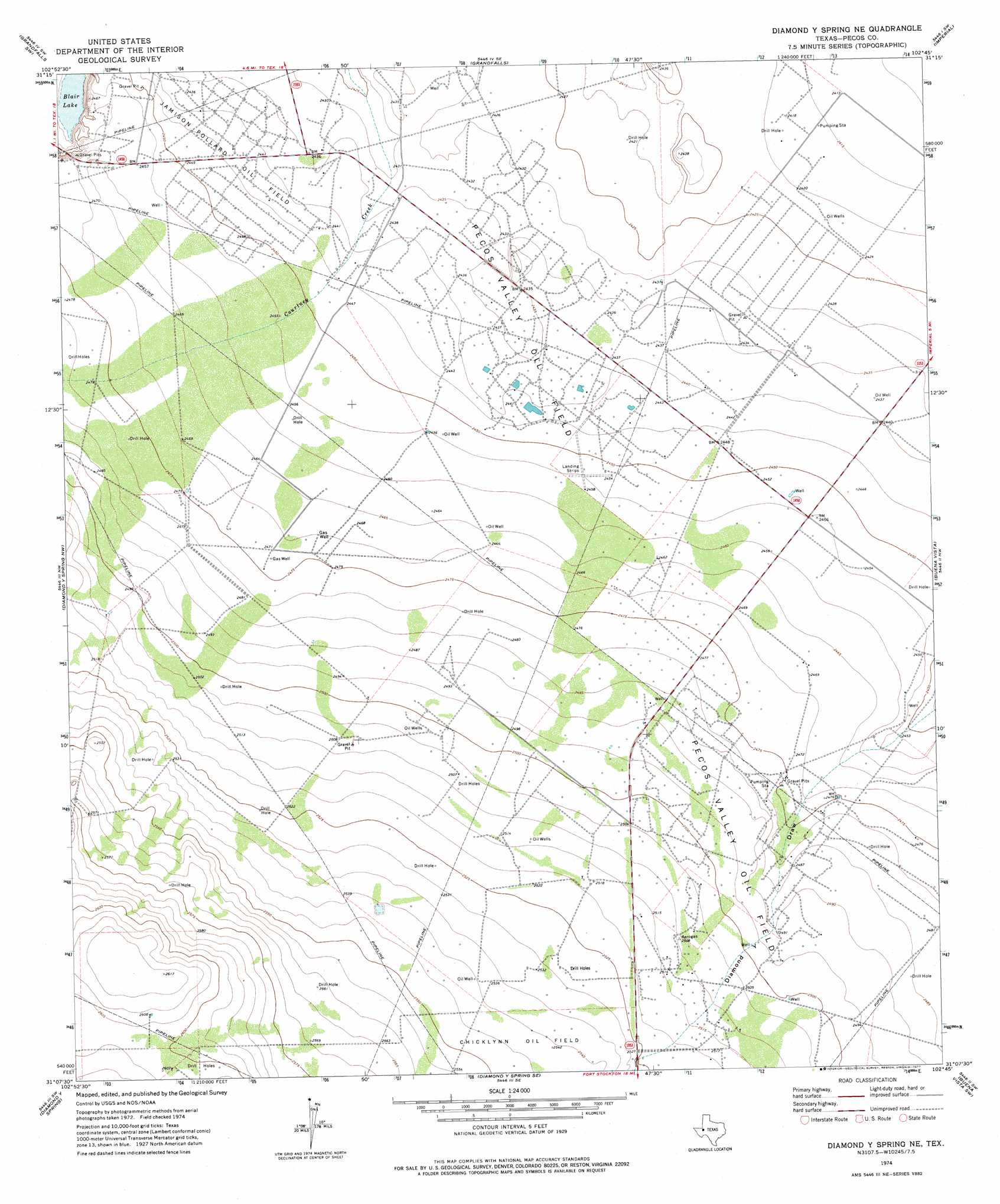
USGS Topo Quad 31102b7 - 1:24,000 scale
| Topo Map Name: | Diamond Y Spring Ne |
| USGS Topo Quad ID: | 31102b7 |
| Print Size: | ca. 21 1/4" wide x 27" high |
| Southeast Coordinates: | 31.125° N latitude / 102.75° W longitude |
| Map Center Coordinates: | 31.1875° N latitude / 102.8125° W longitude |
| U.S. State: | TX |
| Filename: | o31102b7.jpg |
| Download Map JPG Image: | Diamond Y Spring Ne topo map 1:24,000 scale |
| Map Type: | Topographic |
| Topo Series: | 7.5´ |
| Map Scale: | 1:24,000 |
| Source of Map Images: | United States Geological Survey (USGS) |
| Alternate Map Versions: |
Diamond Y Spring NE TX 1974, updated 1977 Download PDF Buy paper map Diamond Y Spring NE TX 2010 Download PDF Buy paper map Diamond Y Spring NE TX 2012 Download PDF Buy paper map Diamond Y Spring NE TX 2016 Download PDF Buy paper map |
1:24,000 Topo Quads surrounding Diamond Y Spring Ne
China Lake Ne |
7 L Ranch |
Ozark Lake |
Imperial Nw |
Tubbs Corner |
Rio Pecos Ranch |
Grandfalls Sw |
Grandfalls |
Imperial |
Juan Cordona Lake |
Coyanosa |
Diamond Y Spring Nw |
Diamond Y Spring Ne |
Buena Vista |
Buena Vista Ne |
Coyanosa Se |
Diamond Y Spring |
Diamond Y Spring Se |
Buena Vista Sw |
Owego |
Belding Ne |
Fort Stockton West |
Fort Stockton East |
East Mesa |
Saddle Butte |
> Back to 31102a1 at 1:100,000 scale
> Back to 31102a1 at 1:250,000 scale
> Back to U.S. Topo Maps home
Diamond Y Spring Ne topo map: Gazetteer
Diamond Y Spring Ne: Lakes
Blair Lake elevation 742m 2434′Diamond Y Spring Ne: Oilfields
Jamison Pollard Oil Field elevation 745m 2444′Pecos Valley Oil Field elevation 750m 2460′
Diamond Y Spring Ne digital topo map on disk
Buy this Diamond Y Spring Ne topo map showing relief, roads, GPS coordinates and other geographical features, as a high-resolution digital map file on DVD: