Grandfalls Sw Topo Map Texas
To zoom in, hover over the map of Grandfalls Sw
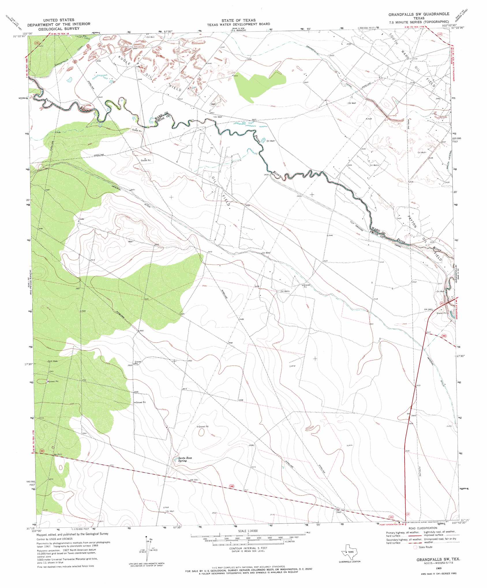
USGS Topo Quad 31102c8 - 1:24,000 scale
| Topo Map Name: | Grandfalls Sw |
| USGS Topo Quad ID: | 31102c8 |
| Print Size: | ca. 21 1/4" wide x 27" high |
| Southeast Coordinates: | 31.25° N latitude / 102.875° W longitude |
| Map Center Coordinates: | 31.3125° N latitude / 102.9375° W longitude |
| U.S. State: | TX |
| Filename: | o31102c8.jpg |
| Download Map JPG Image: | Grandfalls Sw topo map 1:24,000 scale |
| Map Type: | Topographic |
| Topo Series: | 7.5´ |
| Map Scale: | 1:24,000 |
| Source of Map Images: | United States Geological Survey (USGS) |
| Alternate Map Versions: |
Grandfalls SW TX 2010 Download PDF Buy paper map Grandfalls SW TX 2012 Download PDF Buy paper map Grandfalls SW TX 2016 Download PDF Buy paper map |
1:24,000 Topo Quads surrounding Grandfalls Sw
Pyote West |
Pyote East |
Monahans |
Monahans Se |
Penwell Sw |
China Lake |
China Lake Ne |
7 L Ranch |
Ozark Lake |
Imperial Nw |
Ligon Ranch |
Rio Pecos Ranch |
Grandfalls Sw |
Grandfalls |
Imperial |
Coyanosa Nw |
Coyanosa |
Diamond Y Spring Nw |
Diamond Y Spring Ne |
Buena Vista |
Coyanosa Sw |
Coyanosa Se |
Diamond Y Spring |
Diamond Y Spring Se |
Buena Vista Sw |
> Back to 31102a1 at 1:100,000 scale
> Back to 31102a1 at 1:250,000 scale
> Back to U.S. Topo Maps home
Grandfalls Sw topo map: Gazetteer
Grandfalls Sw: Canals
Imperial Ditch elevation 753m 2470′Grandfalls Sw: Oilfields
Kugle Oil Field elevation 746m 2447′Grandfalls Sw: Springs
Santa Rosa Spring elevation 768m 2519′Santa Rosa Spring elevation 768m 2519′
Grandfalls Sw digital topo map on disk
Buy this Grandfalls Sw topo map showing relief, roads, GPS coordinates and other geographical features, as a high-resolution digital map file on DVD: