Tubbs Corner Topo Map Texas
To zoom in, hover over the map of Tubbs Corner
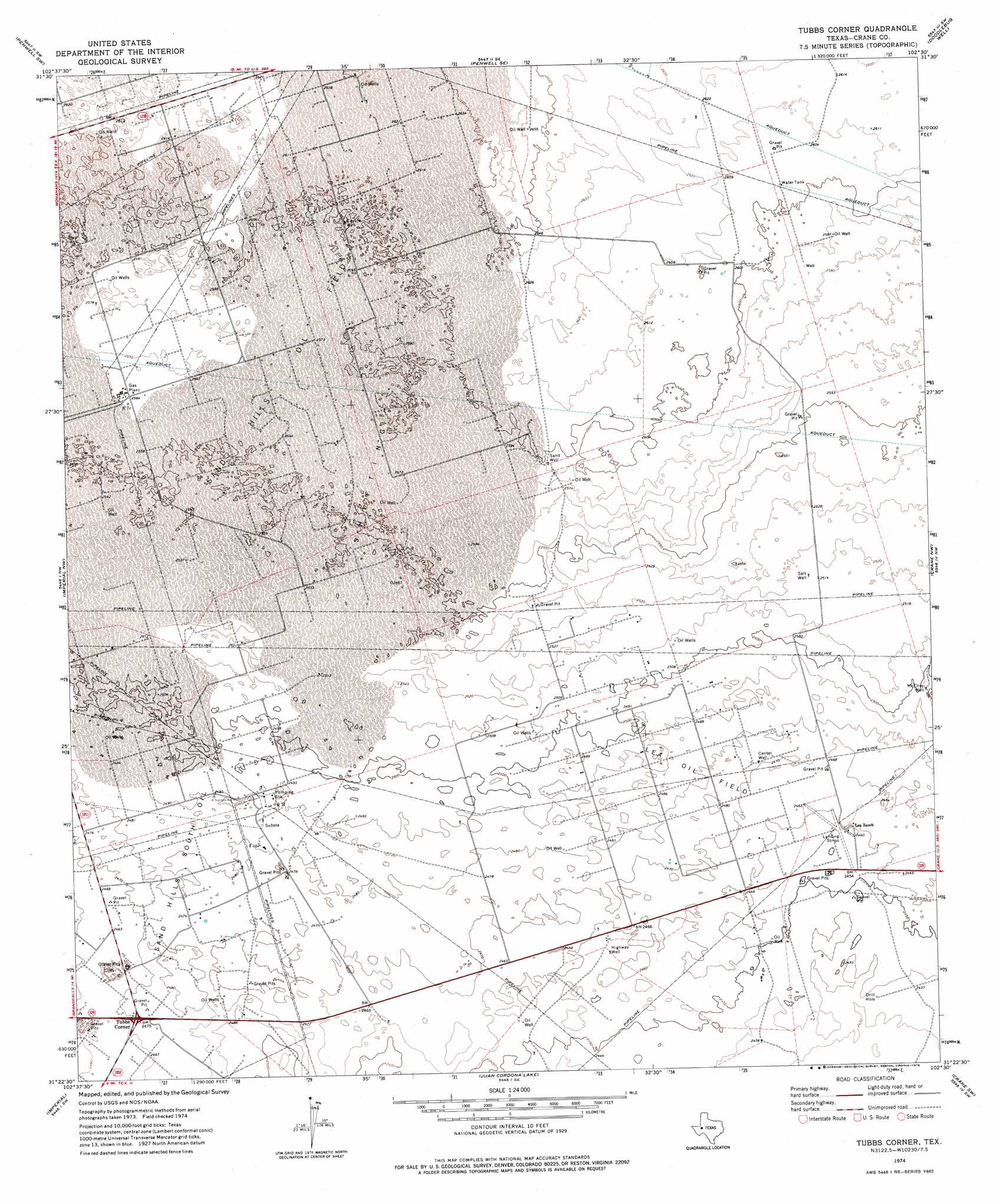
USGS Topo Quad 31102d5 - 1:24,000 scale
| Topo Map Name: | Tubbs Corner |
| USGS Topo Quad ID: | 31102d5 |
| Print Size: | ca. 21 1/4" wide x 27" high |
| Southeast Coordinates: | 31.375° N latitude / 102.5° W longitude |
| Map Center Coordinates: | 31.4375° N latitude / 102.5625° W longitude |
| U.S. State: | TX |
| Filename: | o31102d5.jpg |
| Download Map JPG Image: | Tubbs Corner topo map 1:24,000 scale |
| Map Type: | Topographic |
| Topo Series: | 7.5´ |
| Map Scale: | 1:24,000 |
| Source of Map Images: | United States Geological Survey (USGS) |
| Alternate Map Versions: |
Tubbs Corner TX 1974, updated 1976 Download PDF Buy paper map Tubbs Corner TX 2010 Download PDF Buy paper map Tubbs Corner TX 2012 Download PDF Buy paper map Tubbs Corner TX 2016 Download PDF Buy paper map |
1:24,000 Topo Quads surrounding Tubbs Corner
Cowden Place |
Metz |
Penwell |
Clark Brothers Ranch |
South Cowden Ranch |
Monahans Se |
Penwell Sw |
Penwell Se |
Doodle Bug Well |
Perkins Lake |
Ozark Lake |
Imperial Nw |
Tubbs Corner |
Crane Nw |
Crane |
Grandfalls |
Imperial |
Juan Cordona Lake |
Crane Sw |
Castle Gap |
Diamond Y Spring Ne |
Buena Vista |
Buena Vista Ne |
Girvin Nw |
Girvin Ne |
> Back to 31102a1 at 1:100,000 scale
> Back to 31102a1 at 1:250,000 scale
> Back to U.S. Topo Maps home
Tubbs Corner topo map: Gazetteer
Tubbs Corner: Oilfields
Lea Oil Field elevation 757m 2483′Sand Hills Oil Field elevation 793m 2601′
Sand Hills South Oil Field elevation 754m 2473′
Tubbs Corner: Populated Places
Tubbs Corner elevation 753m 2470′Tubbs Corner: Wells
Center Well elevation 753m 2470′Coyote Well elevation 793m 2601′
Highway Well elevation 750m 2460′
McElroy Well elevation 762m 2500′
Salt Well elevation 768m 2519′
Sand Well elevation 791m 2595′
Tubbs Corner digital topo map on disk
Buy this Tubbs Corner topo map showing relief, roads, GPS coordinates and other geographical features, as a high-resolution digital map file on DVD: