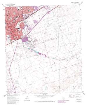
Odessa Se Topo Map Texas
To zoom in, hover over the map of Odessa Se
USGS Topo Quad 31102g3 - 1:24,000 scale
| Topo Map Name: | Odessa Se |
| USGS Topo Quad ID: | 31102g3 |
| Print Size: | ca. 21 1/4" wide x 27" high |
| Southeast Coordinates: | 31.75° N latitude / 102.25° W longitude |
| Map Center Coordinates: | 31.8125° N latitude / 102.3125° W longitude |
| U.S. State: | TX |
| Filename: | o31102g3.jpg |
| Download Map JPG Image: | Odessa Se topo map 1:24,000 scale |
| Map Type: | Topographic |
| Topo Series: | 7.5´ |
| Map Scale: | 1:24,000 |
| Source of Map Images: | United States Geological Survey (USGS) |
| Alternate Map Versions: |
Odessa SE TX 1964, updated 1966 Download PDF Buy paper map Odessa SE TX 1964, updated 1975 Download PDF Buy paper map Odessa SE TX 1964, updated 1981 Download PDF Buy paper map Odessa SE TX 2010 Download PDF Buy paper map Odessa SE TX 2012 Download PDF Buy paper map Odessa SE TX 2016 Download PDF Buy paper map |
1:24,000 Topo Quads surrounding Odessa Se
> Back to 31102e1 at 1:100,000 scale
> Back to 31102a1 at 1:250,000 scale
> Back to U.S. Topo Maps home
Odessa Se topo map: Gazetteer
Odessa Se: Dams
Averitt Number 2 Dam elevation 867m 2844′Averitt Number 3 Dam elevation 866m 2841′
Odessa Se: Oilfields
Dora Roberts Oil Field elevation 862m 2828′Odessa Se: Parks
Casa Bella Park elevation 894m 2933′Central Park elevation 889m 2916′
East Side Park elevation 884m 2900′
Jim Parker Park elevation 899m 2949′
LaFiesta Park elevation 882m 2893′
Lakeview Park elevation 898m 2946′
McKinney Park elevation 873m 2864′
O'Connor Park elevation 881m 2890′
Progressive Park elevation 882m 2893′
Royalty Park elevation 888m 2913′
South Side Community Park elevation 879m 2883′
Woodson Park elevation 884m 2900′
Odessa Se: Populated Places
Odessa elevation 884m 2900′Odessa Se: Reservoirs
Averitt Number 2 Lake elevation 867m 2844′Averitt Number 3 Lake elevation 866m 2841′
Odessa Se: Valleys
Muskingum Draw elevation 872m 2860′Odessa Se: Wells
West Willow Well elevation 867m 2844′Willow Well elevation 868m 2847′
Odessa Se digital topo map on disk
Buy this Odessa Se topo map showing relief, roads, GPS coordinates and other geographical features, as a high-resolution digital map file on DVD:


