Old X Ranch Topo Map Texas
To zoom in, hover over the map of Old X Ranch
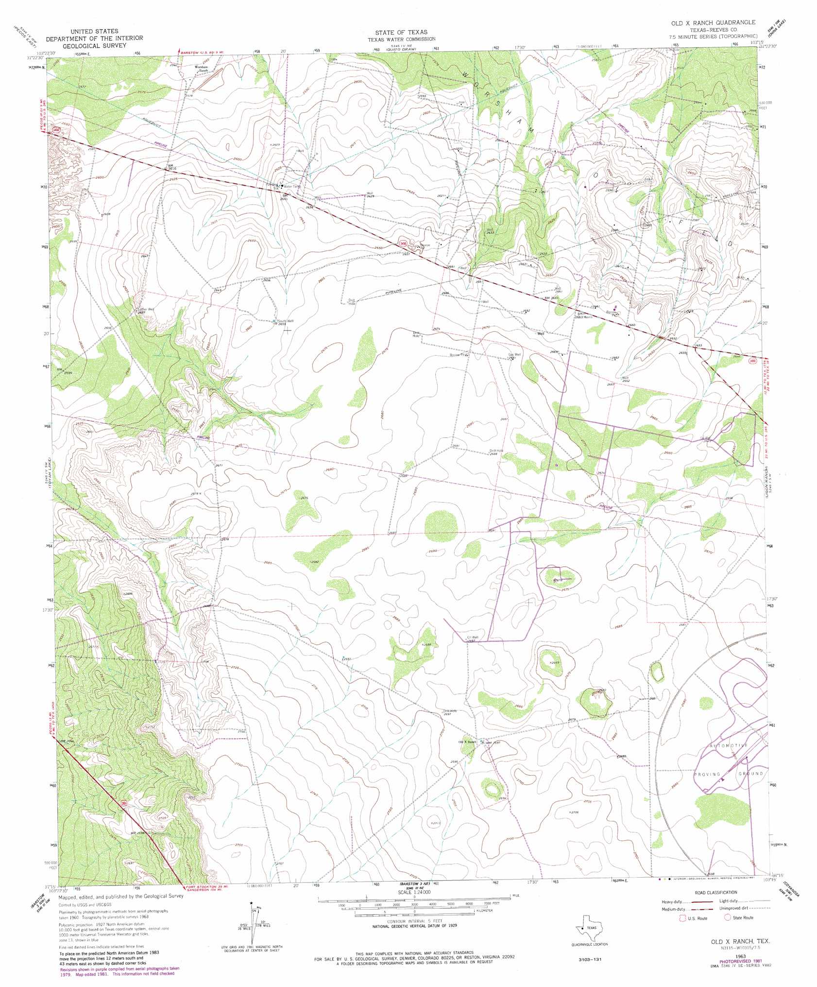
USGS Topo Quad 31103c3 - 1:24,000 scale
| Topo Map Name: | Old X Ranch |
| USGS Topo Quad ID: | 31103c3 |
| Print Size: | ca. 21 1/4" wide x 27" high |
| Southeast Coordinates: | 31.25° N latitude / 103.25° W longitude |
| Map Center Coordinates: | 31.3125° N latitude / 103.3125° W longitude |
| U.S. State: | TX |
| Filename: | o31103c3.jpg |
| Download Map JPG Image: | Old X Ranch topo map 1:24,000 scale |
| Map Type: | Topographic |
| Topo Series: | 7.5´ |
| Map Scale: | 1:24,000 |
| Source of Map Images: | United States Geological Survey (USGS) |
| Alternate Map Versions: |
Old X Ranch TX 1963, updated 1965 Download PDF Buy paper map Old X Ranch TX 1963, updated 1981 Download PDF Buy paper map Old X Ranch TX 2010 Download PDF Buy paper map Old X Ranch TX 2012 Download PDF Buy paper map Old X Ranch TX 2016 Download PDF Buy paper map |
1:24,000 Topo Quads surrounding Old X Ranch
Sand Lake |
Soda Lake |
Soda Lake Se |
Pyote West |
Pyote East |
Pecos West |
Pecos East |
Quito Draw |
China Lake |
China Lake Ne |
Worsham |
Toyah Lake |
Old X Ranch |
Ligon Ranch |
Rio Pecos Ranch |
Verhalen North |
Barstow 3 Nw |
Barstow 3 Ne |
Coyanosa Nw |
Coyanosa |
Verhalen South |
Barstow 3 Sw |
Barstow 3 Se |
Coyanosa Sw |
Coyanosa Se |
> Back to 31103a1 at 1:100,000 scale
> Back to 31102a1 at 1:250,000 scale
> Back to U.S. Topo Maps home
Old X Ranch topo map: Gazetteer
Old X Ranch: Oilfields
Worsham Oil Field elevation 792m 2598′Old X Ranch: Wells
Luther Well elevation 801m 2627′South Well elevation 811m 2660′
Old X Ranch digital topo map on disk
Buy this Old X Ranch topo map showing relief, roads, GPS coordinates and other geographical features, as a high-resolution digital map file on DVD: