Soda Lake Se Topo Map Texas
To zoom in, hover over the map of Soda Lake Se
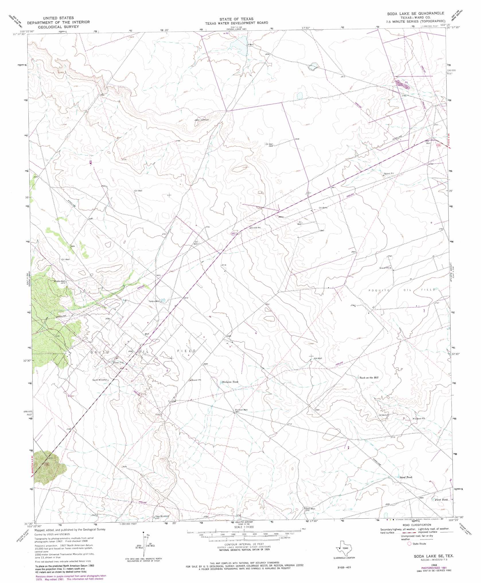
USGS Topo Quad 31103e3 - 1:24,000 scale
| Topo Map Name: | Soda Lake Se |
| USGS Topo Quad ID: | 31103e3 |
| Print Size: | ca. 21 1/4" wide x 27" high |
| Southeast Coordinates: | 31.5° N latitude / 103.25° W longitude |
| Map Center Coordinates: | 31.5625° N latitude / 103.3125° W longitude |
| U.S. State: | TX |
| Filename: | o31103e3.jpg |
| Download Map JPG Image: | Soda Lake Se topo map 1:24,000 scale |
| Map Type: | Topographic |
| Topo Series: | 7.5´ |
| Map Scale: | 1:24,000 |
| Source of Map Images: | United States Geological Survey (USGS) |
| Alternate Map Versions: |
Soda Lake SE TX 1968, updated 1970 Download PDF Buy paper map Soda Lake SE TX 1968, updated 1981 Download PDF Buy paper map Soda Lake SE TX 2010 Download PDF Buy paper map Soda Lake SE TX 2013 Download PDF Buy paper map Soda Lake SE TX 2016 Download PDF Buy paper map |
1:24,000 Topo Quads surrounding Soda Lake Se
Rudd Draw |
Cheyenne Draw Sw |
Cheyenne Draw Se |
Wink North |
Kermit |
Mentone |
Soda Lake Nw |
Soda Lake Ne |
Wink South |
Pyote Ne |
Sand Lake |
Soda Lake |
Soda Lake Se |
Pyote West |
Pyote East |
Pecos West |
Pecos East |
Quito Draw |
China Lake |
China Lake Ne |
Worsham |
Toyah Lake |
Old X Ranch |
Ligon Ranch |
Rio Pecos Ranch |
> Back to 31103e1 at 1:100,000 scale
> Back to 31102a1 at 1:250,000 scale
> Back to U.S. Topo Maps home
Soda Lake Se topo map: Gazetteer
Soda Lake Se: Oilfields
Poquito Oil Field elevation 843m 2765′Quito Oil Field elevation 820m 2690′
Soda Lake Se: Reservoirs
Division Tank elevation 810m 2657′First Tank elevation 814m 2670′
Sand Tank elevation 817m 2680′
Tank on the Hill elevation 848m 2782′
Soda Lake Se: Wells
Division Well elevation 815m 2673′Middle Well elevation 814m 2670′
Shell Well elevation 836m 2742′
Yarbro Well elevation 814m 2670′
Soda Lake Se digital topo map on disk
Buy this Soda Lake Se topo map showing relief, roads, GPS coordinates and other geographical features, as a high-resolution digital map file on DVD: