Pyote Ne Topo Map Texas
To zoom in, hover over the map of Pyote Ne
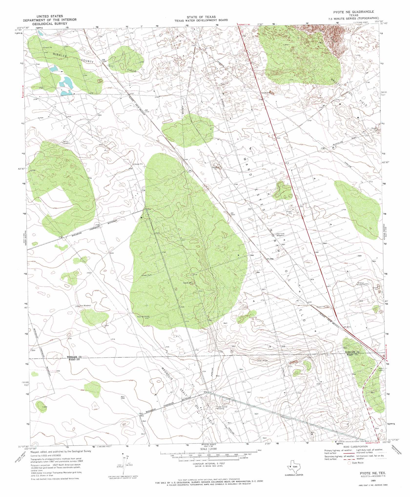
USGS Topo Quad 31103f1 - 1:24,000 scale
| Topo Map Name: | Pyote Ne |
| USGS Topo Quad ID: | 31103f1 |
| Print Size: | ca. 21 1/4" wide x 27" high |
| Southeast Coordinates: | 31.625° N latitude / 103° W longitude |
| Map Center Coordinates: | 31.6875° N latitude / 103.0625° W longitude |
| U.S. State: | TX |
| Filename: | o31103f1.jpg |
| Download Map JPG Image: | Pyote Ne topo map 1:24,000 scale |
| Map Type: | Topographic |
| Topo Series: | 7.5´ |
| Map Scale: | 1:24,000 |
| Source of Map Images: | United States Geological Survey (USGS) |
| Alternate Map Versions: |
Pyote NE TX 1969, updated 1971 Download PDF Buy paper map Pyote NE TX 2010 Download PDF Buy paper map Pyote NE TX 2012 Download PDF Buy paper map Pyote NE TX 2016 Download PDF Buy paper map |
1:24,000 Topo Quads surrounding Pyote Ne
Cheyenne Draw |
Kermit Nw |
Vesrue |
Notrees Nw |
Notrees |
Cheyenne Draw Se |
Wink North |
Kermit |
Wheeler Ranch |
Amburgey Ranch |
Soda Lake Ne |
Wink South |
Pyote Ne |
China Ranch |
Cowden Place |
Soda Lake Se |
Pyote West |
Pyote East |
Monahans |
Monahans Se |
Quito Draw |
China Lake |
China Lake Ne |
7 L Ranch |
Ozark Lake |
> Back to 31103e1 at 1:100,000 scale
> Back to 31102a1 at 1:250,000 scale
> Back to U.S. Topo Maps home
Pyote Ne topo map: Gazetteer
Pyote Ne: Oilfields
Magnolia Sealy Oil Field elevation 830m 2723′Winkler County Oil Field elevation 839m 2752′
Pyote Ne: Populated Places
Three Corner Windmill elevation 826m 2709′Pyote Ne digital topo map on disk
Buy this Pyote Ne topo map showing relief, roads, GPS coordinates and other geographical features, as a high-resolution digital map file on DVD: