Cheyenne Draw Se Topo Map Texas
To zoom in, hover over the map of Cheyenne Draw Se
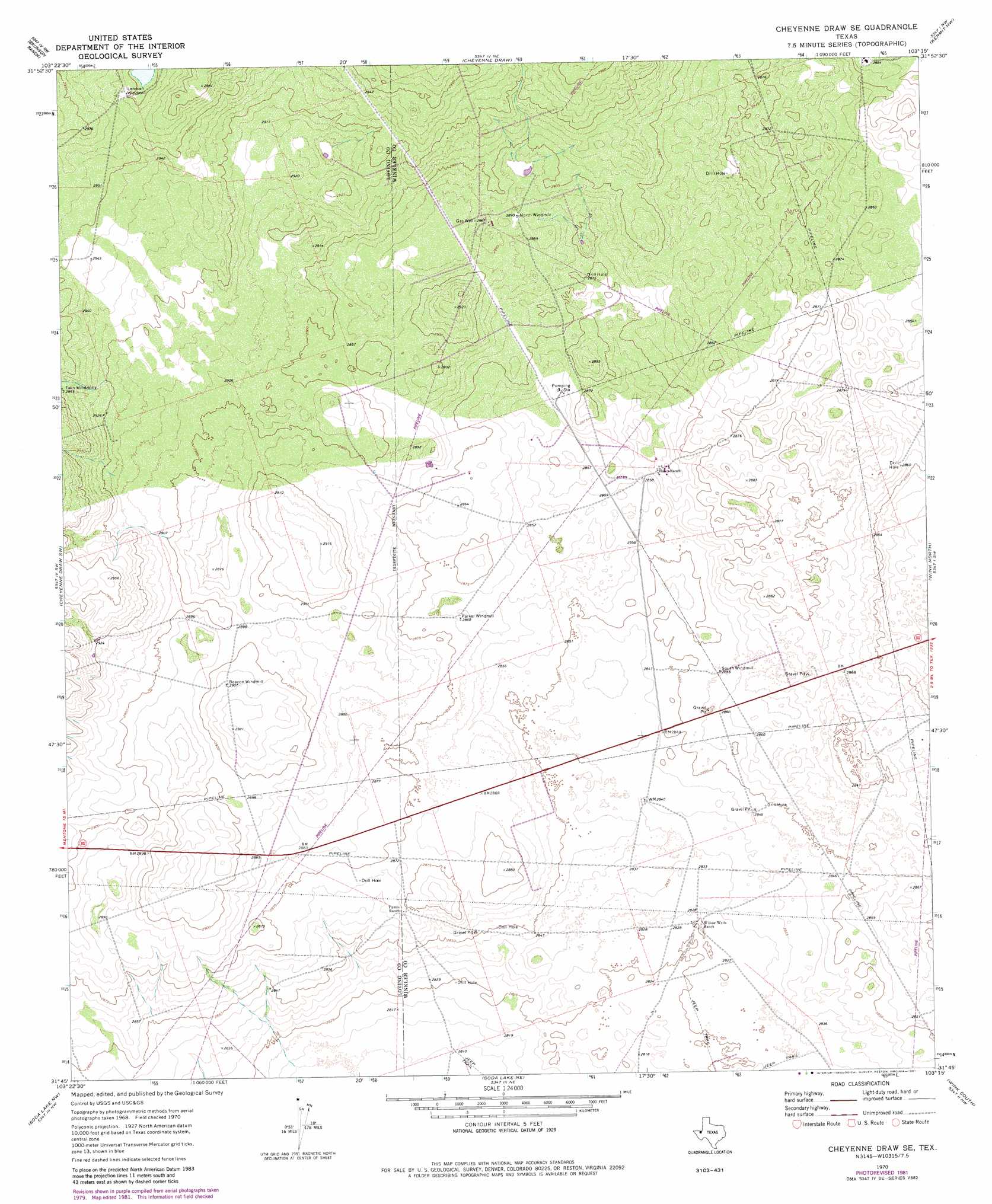
USGS Topo Quad 31103g3 - 1:24,000 scale
| Topo Map Name: | Cheyenne Draw Se |
| USGS Topo Quad ID: | 31103g3 |
| Print Size: | ca. 21 1/4" wide x 27" high |
| Southeast Coordinates: | 31.75° N latitude / 103.25° W longitude |
| Map Center Coordinates: | 31.8125° N latitude / 103.3125° W longitude |
| U.S. State: | TX |
| Filename: | o31103g3.jpg |
| Download Map JPG Image: | Cheyenne Draw Se topo map 1:24,000 scale |
| Map Type: | Topographic |
| Topo Series: | 7.5´ |
| Map Scale: | 1:24,000 |
| Source of Map Images: | United States Geological Survey (USGS) |
| Alternate Map Versions: |
Cheyenne Draw SE TX 1970, updated 1973 Download PDF Buy paper map Cheyenne Draw SE TX 1970, updated 1981 Download PDF Buy paper map Cheyenne Draw SE TX 2010 Download PDF Buy paper map Cheyenne Draw SE TX 2012 Download PDF Buy paper map Cheyenne Draw SE TX 2016 Download PDF Buy paper map |
1:24,000 Topo Quads surrounding Cheyenne Draw Se
Paduca Breaks East |
Andrews Place |
Javelina Basin |
Jal |
Jal Se |
Rudd Draw Ne |
Brunson Ranch |
Cheyenne Draw |
Kermit Nw |
Vesrue |
Rudd Draw |
Cheyenne Draw Sw |
Cheyenne Draw Se |
Wink North |
Kermit |
Mentone |
Soda Lake Nw |
Soda Lake Ne |
Wink South |
Pyote Ne |
Sand Lake |
Soda Lake |
Soda Lake Se |
Pyote West |
Pyote East |
> Back to 31103e1 at 1:100,000 scale
> Back to 31102a1 at 1:250,000 scale
> Back to U.S. Topo Maps home
No gazetteer data is available for the Cheyenne Draw Se topo map sheet.
Cheyenne Draw Se digital topo map on disk
Buy this Cheyenne Draw Se topo map showing relief, roads, GPS coordinates and other geographical features, as a high-resolution digital map file on DVD: