Rudd Draw Ne Topo Map Texas
To zoom in, hover over the map of Rudd Draw Ne
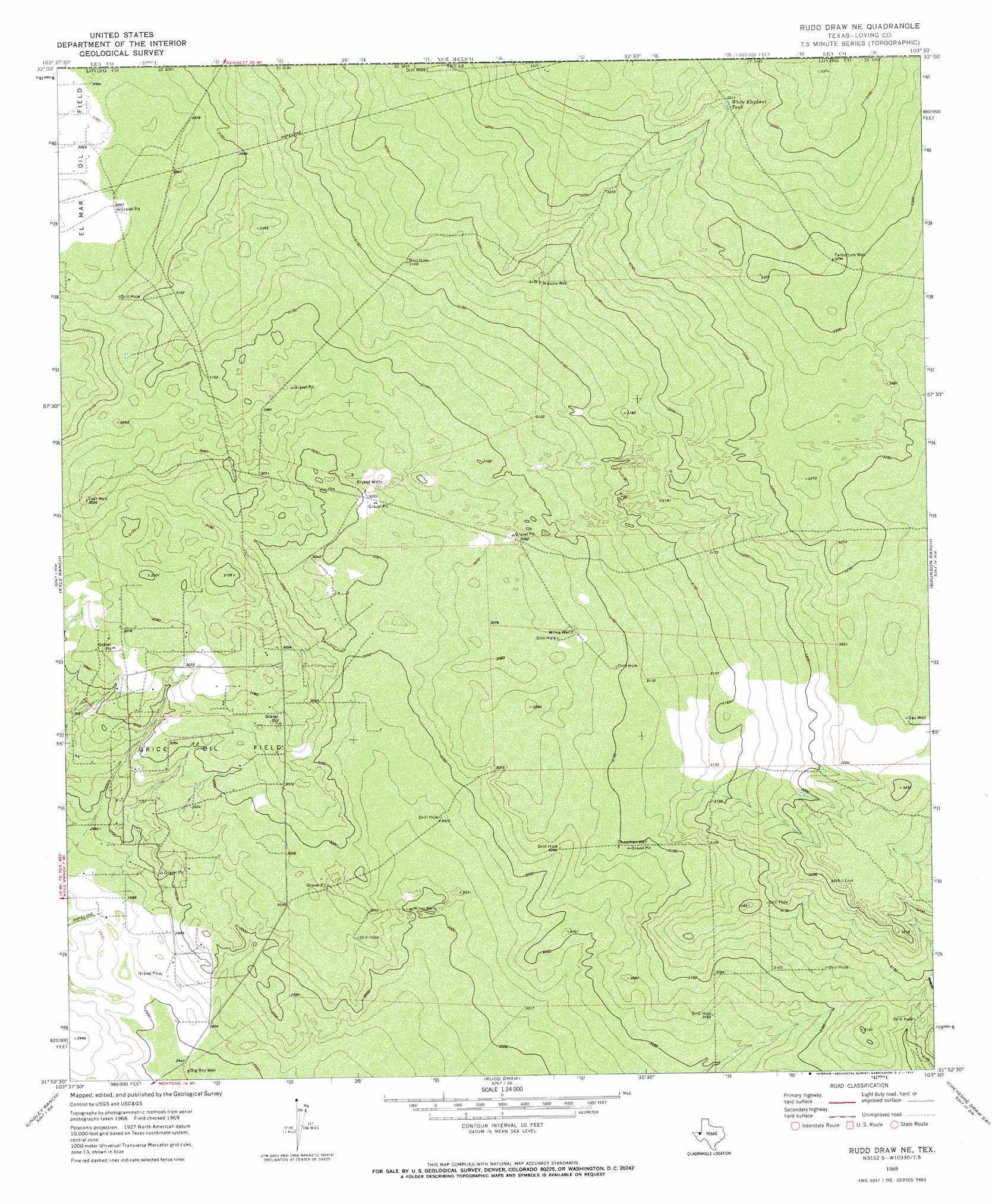
USGS Topo Quad 31103h5 - 1:24,000 scale
| Topo Map Name: | Rudd Draw Ne |
| USGS Topo Quad ID: | 31103h5 |
| Print Size: | ca. 21 1/4" wide x 27" high |
| Southeast Coordinates: | 31.875° N latitude / 103.5° W longitude |
| Map Center Coordinates: | 31.9375° N latitude / 103.5625° W longitude |
| U.S. State: | TX |
| Filename: | o31103h5.jpg |
| Download Map JPG Image: | Rudd Draw Ne topo map 1:24,000 scale |
| Map Type: | Topographic |
| Topo Series: | 7.5´ |
| Map Scale: | 1:24,000 |
| Source of Map Images: | United States Geological Survey (USGS) |
| Alternate Map Versions: |
Rudd Draw NE TX 1969, updated 1972 Download PDF Buy paper map Rudd Draw NE TX 2010 Download PDF Buy paper map Rudd Draw NE TX 2012 Download PDF Buy paper map Rudd Draw NE TX 2016 Download PDF Buy paper map |
1:24,000 Topo Quads surrounding Rudd Draw Ne
Big Sinks |
Paduca Breaks Nw |
Bell Lake |
Woodley Flat |
Custer Mountain |
Phatom Banks |
Paduca Breaks West |
Paduca Breaks East |
Andrews Place |
Javelina Basin |
Orla Ne |
Kyle Ranch |
Rudd Draw Ne |
Brunson Ranch |
Cheyenne Draw |
Orla Se |
Lindley Ranch |
Rudd Draw |
Cheyenne Draw Sw |
Cheyenne Draw Se |
Narrow Bow Draw |
Anderson Ranch |
Mentone |
Soda Lake Nw |
Soda Lake Ne |
> Back to 31103e1 at 1:100,000 scale
> Back to 31102a1 at 1:250,000 scale
> Back to U.S. Topo Maps home
Rudd Draw Ne topo map: Gazetteer
Rudd Draw Ne: Oilfields
Grice Oil Field elevation 927m 3041′Rudd Draw Ne: Reservoirs
White Elephant Tank elevation 1010m 3313′Rudd Draw Ne: Wells
Big Boy Well elevation 898m 2946′Bryant Wells elevation 931m 3054′
Chapman Well elevation 944m 3097′
East Well elevation 933m 3061′
Malone Well elevation 969m 3179′
Miller Wells elevation 914m 2998′
Tarbottom Well elevation 1006m 3300′
Wilkie Well elevation 939m 3080′
Rudd Draw Ne digital topo map on disk
Buy this Rudd Draw Ne topo map showing relief, roads, GPS coordinates and other geographical features, as a high-resolution digital map file on DVD: