Fencepost Draw Topo Map Texas
To zoom in, hover over the map of Fencepost Draw
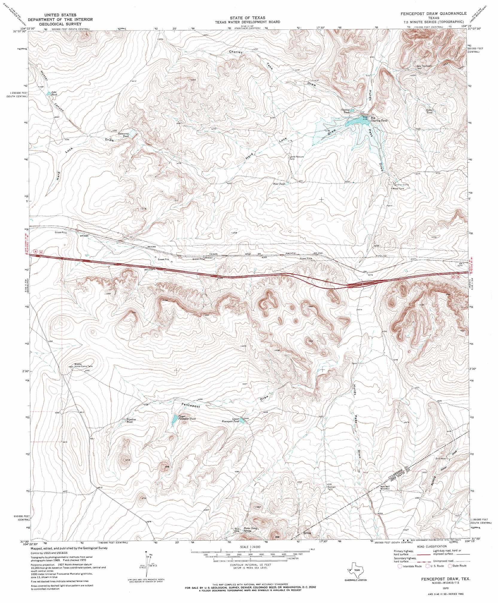
USGS Topo Quad 31104a3 - 1:24,000 scale
| Topo Map Name: | Fencepost Draw |
| USGS Topo Quad ID: | 31104a3 |
| Print Size: | ca. 21 1/4" wide x 27" high |
| Southeast Coordinates: | 31° N latitude / 104.25° W longitude |
| Map Center Coordinates: | 31.0625° N latitude / 104.3125° W longitude |
| U.S. State: | TX |
| Filename: | o31104a3.jpg |
| Download Map JPG Image: | Fencepost Draw topo map 1:24,000 scale |
| Map Type: | Topographic |
| Topo Series: | 7.5´ |
| Map Scale: | 1:24,000 |
| Source of Map Images: | United States Geological Survey (USGS) |
| Alternate Map Versions: |
Fencepost Draw TX 1970, updated 1973 Download PDF Buy paper map Fencepost Draw TX 2010 Download PDF Buy paper map Fencepost Draw TX 2013 Download PDF Buy paper map Fencepost Draw TX 2016 Download PDF Buy paper map |
1:24,000 Topo Quads surrounding Fencepost Draw
Seven Heart Gap |
Dome Hill |
Hopper Draw West |
Hopper Draw East |
Burnt Spring Hills Se |
Goat Canyon |
East Hunter Canyon |
Panther Canyon |
Iron Mountain |
San Martine |
Plateau |
Boracho |
Fencepost Draw |
Kent |
Gomez Peak |
Chispa Mountain Ne |
Boracho Peak |
Herds Pass |
Echo Canyon |
Buckhorn Mountain |
Mayfield Hills |
Boggy Draw |
Bare Mountain |
Robbers Roost Canyon |
Friend Mountain |
> Back to 31104a1 at 1:100,000 scale
> Back to 31104a1 at 1:250,000 scale
> Back to U.S. Topo Maps home
Fencepost Draw topo map: Gazetteer
Fencepost Draw: Dams
Reynolds Cattle Company Dam elevation 1259m 4130′Fencepost Draw: Reservoirs
Big Charley Tank elevation 1270m 4166′Big Charlie Tank elevation 1259m 4130′
Cedar Tank elevation 1281m 4202′
Charley Tank elevation 1262m 4140′
Democrat Tank elevation 1320m 4330′
Duncan Tank elevation 1384m 4540′
Jake Tank elevation 1360m 4461′
Lamb Pasture Tank elevation 1282m 4206′
Lower Fencepost Tank elevation 1359m 4458′
Middle Horse Camp Tank elevation 1404m 4606′
New Thompson Tank elevation 1277m 4189′
Pipeline Tank elevation 1375m 4511′
Upper Fencepost Tank elevation 1368m 4488′
Water Tank elevation 1285m 4215′
West Tank elevation 1284m 4212′
Fencepost Draw: Springs
Horse Camp Spring elevation 1411m 4629′Fencepost Draw: Valleys
Charley Tank Draw elevation 1262m 4140′Fencepost Draw elevation 1328m 4356′
Hard Luck Draw elevation 1262m 4140′
Hunter Canyon elevation 1333m 4373′
Fencepost Draw digital topo map on disk
Buy this Fencepost Draw topo map showing relief, roads, GPS coordinates and other geographical features, as a high-resolution digital map file on DVD: