Goat Canyon Topo Map Texas
To zoom in, hover over the map of Goat Canyon
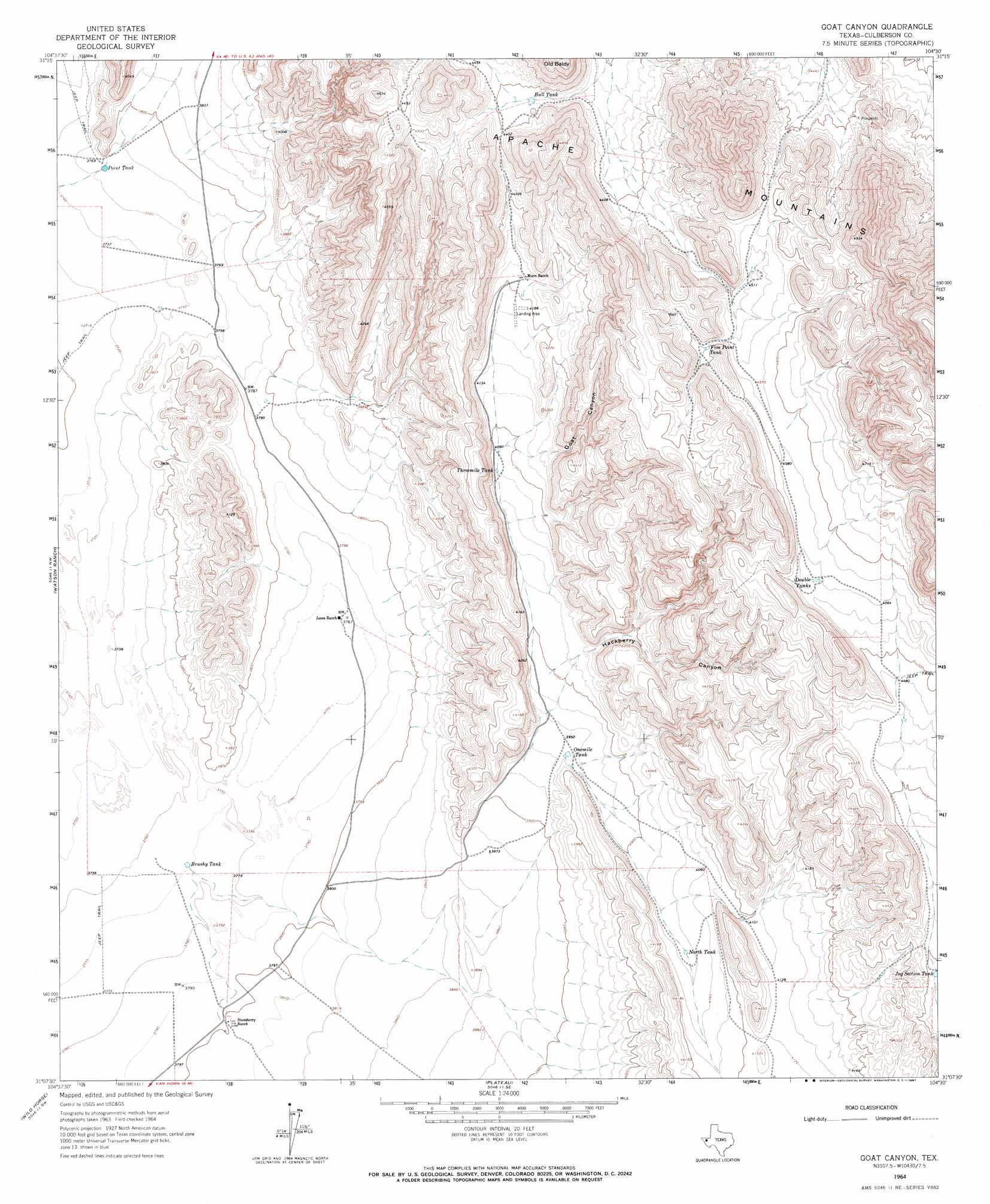
USGS Topo Quad 31104b5 - 1:24,000 scale
| Topo Map Name: | Goat Canyon |
| USGS Topo Quad ID: | 31104b5 |
| Print Size: | ca. 21 1/4" wide x 27" high |
| Southeast Coordinates: | 31.125° N latitude / 104.5° W longitude |
| Map Center Coordinates: | 31.1875° N latitude / 104.5625° W longitude |
| U.S. State: | TX |
| Filename: | o31104b5.jpg |
| Download Map JPG Image: | Goat Canyon topo map 1:24,000 scale |
| Map Type: | Topographic |
| Topo Series: | 7.5´ |
| Map Scale: | 1:24,000 |
| Source of Map Images: | United States Geological Survey (USGS) |
| Alternate Map Versions: |
Goat Canyon TX 1964, updated 1967 Download PDF Buy paper map Goat Canyon TX 2010 Download PDF Buy paper map Goat Canyon TX 2012 Download PDF Buy paper map Goat Canyon TX 2016 Download PDF Buy paper map |
1:24,000 Topo Quads surrounding Goat Canyon
Figure Two Ranch |
Seven Heart Gap Nw |
Delaware Ranch |
Loneman Mountain |
Dellahunt Draw West |
Victorio Peak |
Square Mesa |
Seven Heart Gap |
Dome Hill |
Hopper Draw West |
Nutt Ranch |
Watson Ranch |
Goat Canyon |
East Hunter Canyon |
Panther Canyon |
Van Horn |
Wild Horse |
Plateau |
Boracho |
Fencepost Draw |
Van Horn Wells |
Chispa Mountain Nw |
Chispa Mountain Ne |
Boracho Peak |
Herds Pass |
> Back to 31104a1 at 1:100,000 scale
> Back to 31104a1 at 1:250,000 scale
> Back to U.S. Topo Maps home
Goat Canyon topo map: Gazetteer
Goat Canyon: Reservoirs
Brushy Tank elevation 1150m 3772′Bull Tank elevation 1336m 4383′
Double Tanks elevation 1389m 4557′
Five Point Tank elevation 1397m 4583′
Jog Section Tank Number 4 elevation 1309m 4294′
North Tank elevation 1231m 4038′
Onemile Tank elevation 1207m 3959′
Point Tank elevation 1148m 3766′
Threemile Tank elevation 1245m 4084′
Goat Canyon: Valleys
Goat Canyon elevation 1266m 4153′Hackberry Canyon elevation 1232m 4041′
Goat Canyon digital topo map on disk
Buy this Goat Canyon topo map showing relief, roads, GPS coordinates and other geographical features, as a high-resolution digital map file on DVD: