Nutt Ranch Topo Map Texas
To zoom in, hover over the map of Nutt Ranch
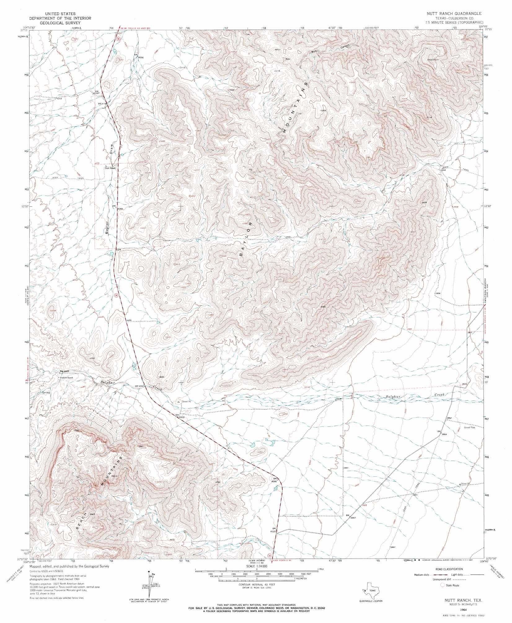
USGS Topo Quad 31104b7 - 1:24,000 scale
| Topo Map Name: | Nutt Ranch |
| USGS Topo Quad ID: | 31104b7 |
| Print Size: | ca. 21 1/4" wide x 27" high |
| Southeast Coordinates: | 31.125° N latitude / 104.75° W longitude |
| Map Center Coordinates: | 31.1875° N latitude / 104.8125° W longitude |
| U.S. State: | TX |
| Filename: | o31104b7.jpg |
| Download Map JPG Image: | Nutt Ranch topo map 1:24,000 scale |
| Map Type: | Topographic |
| Topo Series: | 7.5´ |
| Map Scale: | 1:24,000 |
| Source of Map Images: | United States Geological Survey (USGS) |
| Alternate Map Versions: |
Nutt Ranch TX 1964, updated 1967 Download PDF Buy paper map Nutt Ranch TX 2010 Download PDF Buy paper map Nutt Ranch TX 2013 Download PDF Buy paper map Nutt Ranch TX 2016 Download PDF Buy paper map |
1:24,000 Topo Quads surrounding Nutt Ranch
Sneed Mountain Ne |
Apache Peak |
Figure Two Ranch |
Seven Heart Gap Nw |
Delaware Ranch |
Sneed Mountain |
Collier Mesa |
Victorio Peak |
Square Mesa |
Seven Heart Gap |
Bean Hills |
Sheep Peak |
Nutt Ranch |
Watson Ranch |
Goat Canyon |
Allamoore |
Hackett Peak |
Van Horn |
Wild Horse |
Plateau |
Eagle Mountains Ne |
Bass Canyon |
Van Horn Wells |
Chispa Mountain Nw |
Chispa Mountain Ne |
> Back to 31104a1 at 1:100,000 scale
> Back to 31104a1 at 1:250,000 scale
> Back to U.S. Topo Maps home
Nutt Ranch topo map: Gazetteer
Nutt Ranch: Ranges
Baylor Mountains elevation 1698m 5570′Nutt Ranch: Summits
Beach Mountains elevation 1761m 5777′Nutt Ranch digital topo map on disk
Buy this Nutt Ranch topo map showing relief, roads, GPS coordinates and other geographical features, as a high-resolution digital map file on DVD: