Dome Hill Topo Map Texas
To zoom in, hover over the map of Dome Hill
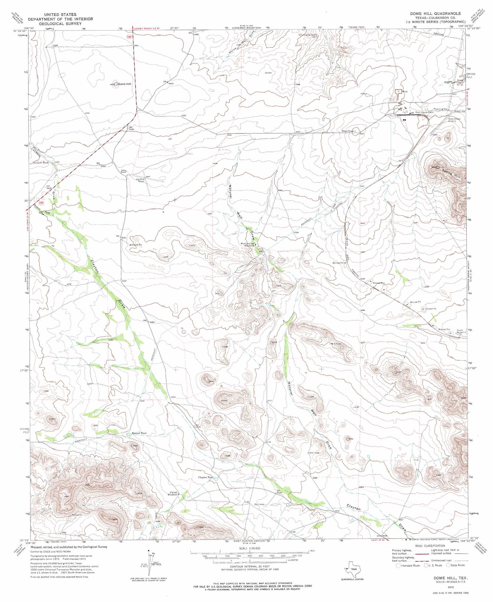
USGS Topo Quad 31104c4 - 1:24,000 scale
| Topo Map Name: | Dome Hill |
| USGS Topo Quad ID: | 31104c4 |
| Print Size: | ca. 21 1/4" wide x 27" high |
| Southeast Coordinates: | 31.25° N latitude / 104.375° W longitude |
| Map Center Coordinates: | 31.3125° N latitude / 104.4375° W longitude |
| U.S. State: | TX |
| Filename: | o31104c4.jpg |
| Download Map JPG Image: | Dome Hill topo map 1:24,000 scale |
| Map Type: | Topographic |
| Topo Series: | 7.5´ |
| Map Scale: | 1:24,000 |
| Source of Map Images: | United States Geological Survey (USGS) |
| Alternate Map Versions: |
Dome Hill TX 1973, updated 1976 Download PDF Buy paper map Dome Hill TX 2010 Download PDF Buy paper map Dome Hill TX 2012 Download PDF Buy paper map Dome Hill TX 2016 Download PDF Buy paper map |
1:24,000 Topo Quads surrounding Dome Hill
Burro Canyon |
Emory Corral |
Kc Ranch |
Two Mill Draw West |
Two Mill Draw East |
Seven Heart Gap Nw |
Delaware Ranch |
Loneman Mountain |
Dellahunt Draw West |
Dellahunt Draw East |
Square Mesa |
Seven Heart Gap |
Dome Hill |
Hopper Draw West |
Hopper Draw East |
Watson Ranch |
Goat Canyon |
East Hunter Canyon |
Panther Canyon |
Iron Mountain |
Wild Horse |
Plateau |
Boracho |
Fencepost Draw |
Kent |
> Back to 31104a1 at 1:100,000 scale
> Back to 31104a1 at 1:250,000 scale
> Back to U.S. Topo Maps home
Dome Hill topo map: Gazetteer
Dome Hill: Reservoirs
Clayton Tank elevation 1279m 4196′Luckett Tank elevation 1362m 4468′
Manuel Tank elevation 1302m 4271′
Dome Hill: Summits
Dome Hill elevation 1411m 4629′Spring Hill elevation 1503m 4931′
Dome Hill: Valleys
Bronco Mule Draw elevation 1338m 4389′Luckett Draw elevation 1341m 4399′
Natural Well Draw elevation 1231m 4038′
Dome Hill digital topo map on disk
Buy this Dome Hill topo map showing relief, roads, GPS coordinates and other geographical features, as a high-resolution digital map file on DVD: