Square Mesa Topo Map Texas
To zoom in, hover over the map of Square Mesa
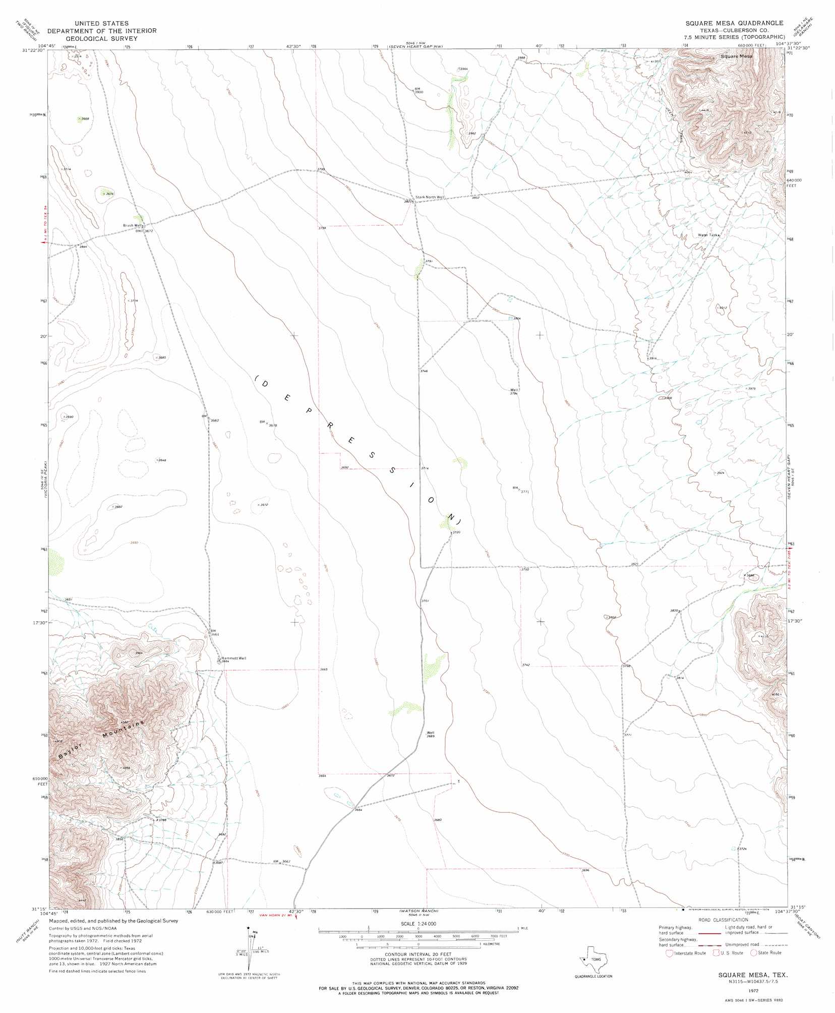
USGS Topo Quad 31104c6 - 1:24,000 scale
| Topo Map Name: | Square Mesa |
| USGS Topo Quad ID: | 31104c6 |
| Print Size: | ca. 21 1/4" wide x 27" high |
| Southeast Coordinates: | 31.25° N latitude / 104.625° W longitude |
| Map Center Coordinates: | 31.3125° N latitude / 104.6875° W longitude |
| U.S. State: | TX |
| Filename: | o31104c6.jpg |
| Download Map JPG Image: | Square Mesa topo map 1:24,000 scale |
| Map Type: | Topographic |
| Topo Series: | 7.5´ |
| Map Scale: | 1:24,000 |
| Source of Map Images: | United States Geological Survey (USGS) |
| Alternate Map Versions: |
Square Mesa TX 1972, updated 1976 Download PDF Buy paper map Square Mesa TX 2010 Download PDF Buy paper map Square Mesa TX 2012 Download PDF Buy paper map Square Mesa TX 2016 Download PDF Buy paper map |
1:24,000 Topo Quads surrounding Square Mesa
Bitter Well Mountain Sw |
Bitter Well Mountain |
Burro Canyon |
Emory Corral |
Kc Ranch |
Apache Peak |
Figure Two Ranch |
Seven Heart Gap Nw |
Delaware Ranch |
Loneman Mountain |
Collier Mesa |
Victorio Peak |
Square Mesa |
Seven Heart Gap |
Dome Hill |
Sheep Peak |
Nutt Ranch |
Watson Ranch |
Goat Canyon |
East Hunter Canyon |
Hackett Peak |
Van Horn |
Wild Horse |
Plateau |
Boracho |
> Back to 31104a1 at 1:100,000 scale
> Back to 31104a1 at 1:250,000 scale
> Back to U.S. Topo Maps home
Square Mesa topo map: Gazetteer
Square Mesa: Summits
Square Mesa elevation 1509m 4950′Square Mesa: Wells
Brush Well elevation 1122m 3681′Hammett Well elevation 1117m 3664′
Stark North Well elevation 1165m 3822′
Square Mesa digital topo map on disk
Buy this Square Mesa topo map showing relief, roads, GPS coordinates and other geographical features, as a high-resolution digital map file on DVD: