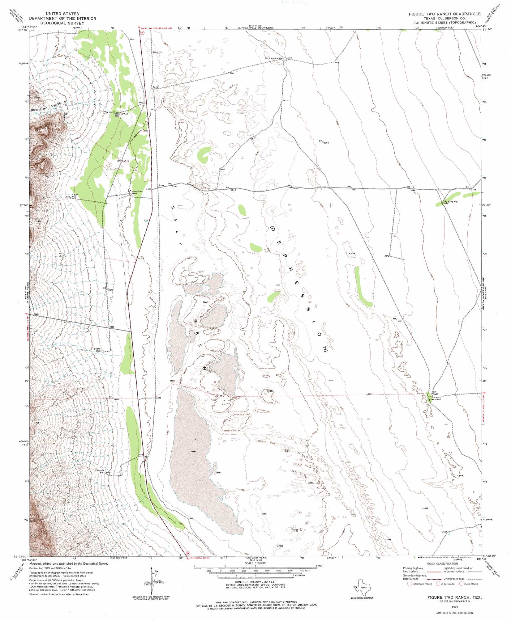
Figure Two Ranch Topo Map Texas
To zoom in, hover over the map of Figure Two Ranch
USGS Topo Quad 31104d7 - 1:24,000 scale
| Topo Map Name: | Figure Two Ranch |
| USGS Topo Quad ID: | 31104d7 |
| Print Size: | ca. 21 1/4" wide x 27" high |
| Southeast Coordinates: | 31.375° N latitude / 104.75° W longitude |
| Map Center Coordinates: | 31.4375° N latitude / 104.8125° W longitude |
| U.S. State: | TX |
| Filename: | o31104d7.jpg |
| Download Map JPG Image: | Figure Two Ranch topo map 1:24,000 scale |
| Map Type: | Topographic |
| Topo Series: | 7.5´ |
| Map Scale: | 1:24,000 |
| Source of Map Images: | United States Geological Survey (USGS) |
| Alternate Map Versions: |
Figure Two Ranch TX 1973, updated 1976 Download PDF Buy paper map Figure Two Ranch TX 2010 Download PDF Buy paper map Figure Two Ranch TX 2013 Download PDF Buy paper map Figure Two Ranch TX 2016 Download PDF Buy paper map |
1:24,000 Topo Quads surrounding Figure Two Ranch
Salt Flat |
Bitter Well Mountain Nw |
Six Bar Ranch |
Chico Draw West |
Chico Draw East |
Babb Canyon |
Bitter Well Mountain Sw |
Bitter Well Mountain |
Burro Canyon |
Emory Corral |
Sneed Mountain Ne |
Apache Peak |
Figure Two Ranch |
Seven Heart Gap Nw |
Delaware Ranch |
Sneed Mountain |
Collier Mesa |
Victorio Peak |
Square Mesa |
Seven Heart Gap |
Bean Hills |
Sheep Peak |
Nutt Ranch |
Watson Ranch |
Goat Canyon |
> Back to 31104a1 at 1:100,000 scale
> Back to 31104a1 at 1:250,000 scale
> Back to U.S. Topo Maps home
Figure Two Ranch topo map: Gazetteer
Figure Two Ranch: Basins
Salt Basin elevation 1098m 3602′Figure Two Ranch: Valleys
Black John Canyon elevation 1156m 3792′Figure Two Ranch: Wells
Dry Bone Well elevation 1133m 3717′Fivemile Well elevation 1131m 3710′
House Well elevation 1113m 3651′
Penn Well elevation 1127m 3697′
Sal Hepatica Well elevation 1110m 3641′
Snake Well elevation 1122m 3681′
Stevens Well elevation 1107m 3631′
Figure Two Ranch digital topo map on disk
Buy this Figure Two Ranch topo map showing relief, roads, GPS coordinates and other geographical features, as a high-resolution digital map file on DVD: