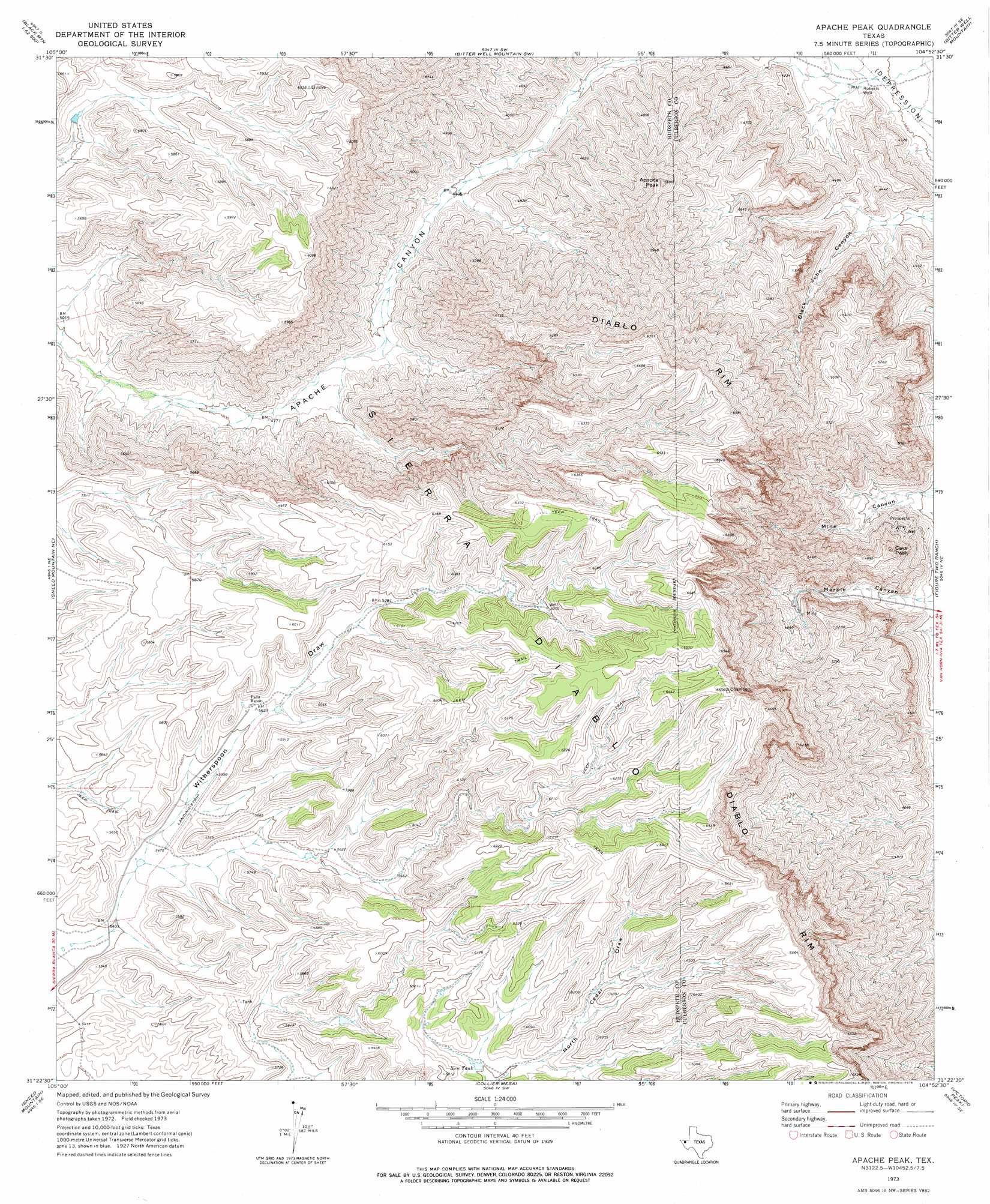
Apache Peak Topo Map Texas
To zoom in, hover over the map of Apache Peak
USGS Topo Quad 31104d8 - 1:24,000 scale
| Topo Map Name: | Apache Peak |
| USGS Topo Quad ID: | 31104d8 |
| Print Size: | ca. 21 1/4" wide x 27" high |
| Southeast Coordinates: | 31.375° N latitude / 104.875° W longitude |
| Map Center Coordinates: | 31.4375° N latitude / 104.9375° W longitude |
| U.S. State: | TX |
| Filename: | o31104d8.jpg |
| Download Map JPG Image: | Apache Peak topo map 1:24,000 scale |
| Map Type: | Topographic |
| Topo Series: | 7.5´ |
| Map Scale: | 1:24,000 |
| Source of Map Images: | United States Geological Survey (USGS) |
| Alternate Map Versions: |
Apache Peak TX 1973, updated 1976 Download PDF Buy paper map Apache Peak TX 2011 Download PDF Buy paper map Apache Peak TX 2013 Download PDF Buy paper map Apache Peak TX 2016 Download PDF Buy paper map |
1:24,000 Topo Quads surrounding Apache Peak
Black Mountains Nw |
Salt Flat |
Bitter Well Mountain Nw |
Six Bar Ranch |
Chico Draw West |
Black Mountains |
Babb Canyon |
Bitter Well Mountain Sw |
Bitter Well Mountain |
Burro Canyon |
Norton Mesa |
Sneed Mountain Ne |
Apache Peak |
Figure Two Ranch |
Seven Heart Gap Nw |
Movie Mountain |
Sneed Mountain |
Collier Mesa |
Victorio Peak |
Square Mesa |
Dome Peak |
Bean Hills |
Sheep Peak |
Nutt Ranch |
Watson Ranch |
> Back to 31104a1 at 1:100,000 scale
> Back to 31104a1 at 1:250,000 scale
> Back to U.S. Topo Maps home
Apache Peak topo map: Gazetteer
Apache Peak: Cliffs
Diablo Rim elevation 1999m 6558′Apache Peak: Ranges
Sierra Diablo elevation 2005m 6578′Apache Peak: Reservoirs
New Tank elevation 1770m 5807′Apache Peak: Springs
Apache Spring elevation 1485m 4872′Apache Peak: Summits
Apache Peak elevation 1736m 5695′Cave Peak elevation 1530m 5019′
Apache Peak: Valleys
Marble Canyon elevation 1254m 4114′Mine Canyon elevation 1229m 4032′
Apache Peak: Wells
Roberts Well elevation 1169m 3835′Apache Peak digital topo map on disk
Buy this Apache Peak topo map showing relief, roads, GPS coordinates and other geographical features, as a high-resolution digital map file on DVD: