Bitter Well Mountain Topo Map Texas
To zoom in, hover over the map of Bitter Well Mountain
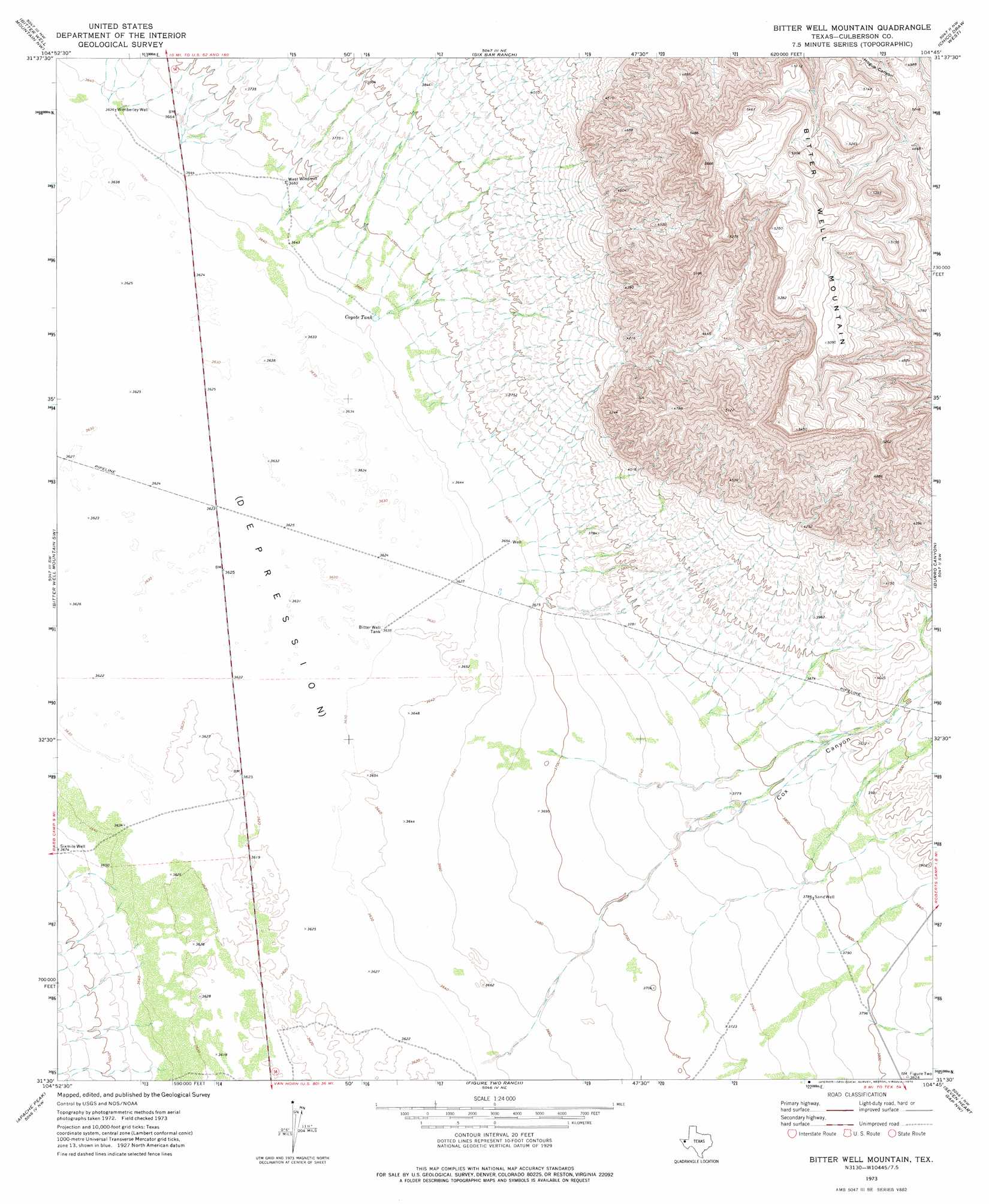
USGS Topo Quad 31104e7 - 1:24,000 scale
| Topo Map Name: | Bitter Well Mountain |
| USGS Topo Quad ID: | 31104e7 |
| Print Size: | ca. 21 1/4" wide x 27" high |
| Southeast Coordinates: | 31.5° N latitude / 104.75° W longitude |
| Map Center Coordinates: | 31.5625° N latitude / 104.8125° W longitude |
| U.S. State: | TX |
| Filename: | o31104e7.jpg |
| Download Map JPG Image: | Bitter Well Mountain topo map 1:24,000 scale |
| Map Type: | Topographic |
| Topo Series: | 7.5´ |
| Map Scale: | 1:24,000 |
| Source of Map Images: | United States Geological Survey (USGS) |
| Alternate Map Versions: |
Bitter Well Mountain TX 1973, updated 1976 Download PDF Buy paper map Bitter Well Mountain TX 2010 Download PDF Buy paper map Bitter Well Mountain TX 2012 Download PDF Buy paper map Bitter Well Mountain TX 2016 Download PDF Buy paper map |
1:24,000 Topo Quads surrounding Bitter Well Mountain
Linda Lake South |
Patterson Hills |
Guadalupe Pass |
Long Point |
Cow Mountain |
Salt Flat |
Bitter Well Mountain Nw |
Six Bar Ranch |
Chico Draw West |
Chico Draw East |
Babb Canyon |
Bitter Well Mountain Sw |
Bitter Well Mountain |
Burro Canyon |
Emory Corral |
Sneed Mountain Ne |
Apache Peak |
Figure Two Ranch |
Seven Heart Gap Nw |
Delaware Ranch |
Sneed Mountain |
Collier Mesa |
Victorio Peak |
Square Mesa |
Seven Heart Gap |
> Back to 31104e1 at 1:100,000 scale
> Back to 31104a1 at 1:250,000 scale
> Back to U.S. Topo Maps home
Bitter Well Mountain topo map: Gazetteer
Bitter Well Mountain: Reservoirs
Bitter Well Tank elevation 1107m 3631′Coyote Tank elevation 1112m 3648′
Bitter Well Mountain: Summits
Bitter Well Mountain elevation 1569m 5147′Bitter Well Mountain: Valleys
Cox Canyon elevation 1110m 3641′Bitter Well Mountain: Wells
Sand Well elevation 1156m 3792′Wimberley Well elevation 1109m 3638′
Bitter Well Mountain digital topo map on disk
Buy this Bitter Well Mountain topo map showing relief, roads, GPS coordinates and other geographical features, as a high-resolution digital map file on DVD: