Seven L Peak Topo Map Texas
To zoom in, hover over the map of Seven L Peak
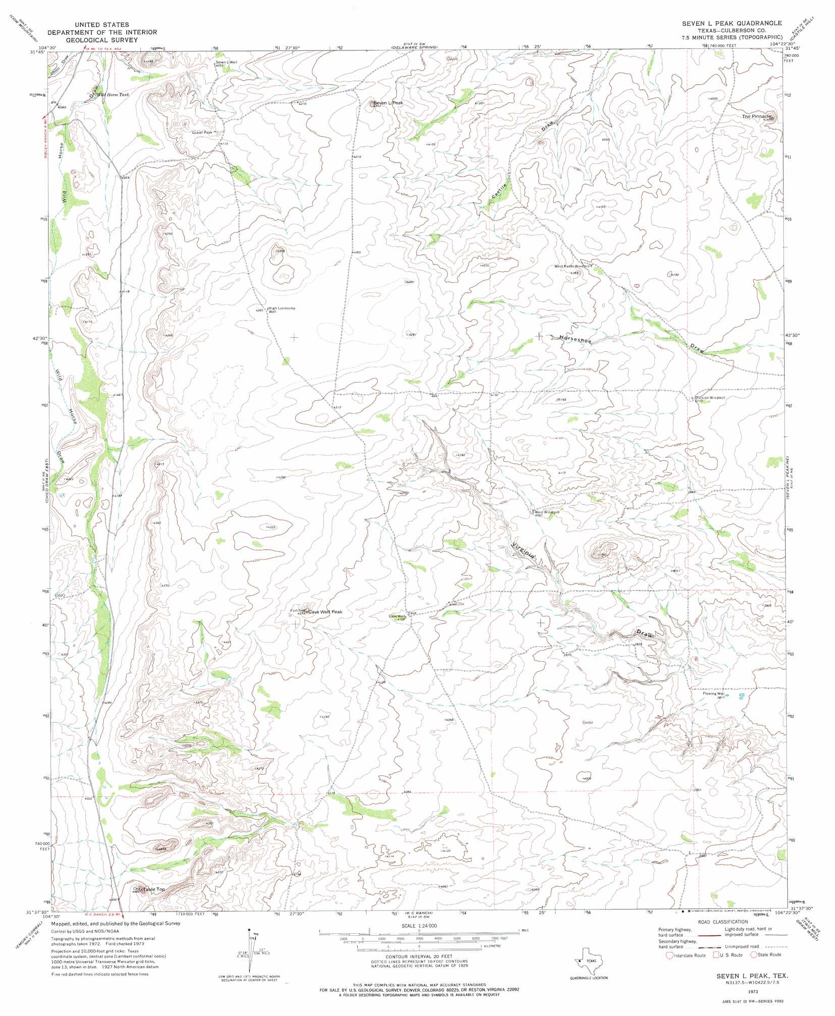
USGS Topo Quad 31104f4 - 1:24,000 scale
| Topo Map Name: | Seven L Peak |
| USGS Topo Quad ID: | 31104f4 |
| Print Size: | ca. 21 1/4" wide x 27" high |
| Southeast Coordinates: | 31.625° N latitude / 104.375° W longitude |
| Map Center Coordinates: | 31.6875° N latitude / 104.4375° W longitude |
| U.S. State: | TX |
| Filename: | o31104f4.jpg |
| Download Map JPG Image: | Seven L Peak topo map 1:24,000 scale |
| Map Type: | Topographic |
| Topo Series: | 7.5´ |
| Map Scale: | 1:24,000 |
| Source of Map Images: | United States Geological Survey (USGS) |
| Alternate Map Versions: |
Seven L Peak TX 1973, updated 1975 Download PDF Buy paper map Seven L Peak TX 2010 Download PDF Buy paper map Seven L Peak TX 2013 Download PDF Buy paper map Seven L Peak TX 2016 Download PDF Buy paper map |
1:24,000 Topo Quads surrounding Seven L Peak
Independence Spring |
South Rector Canyon |
Alligator Draw |
Outlaw Spring |
Owl Hills |
Long Point |
Cow Mountain |
Delaware Spring |
Castile Hill |
Screw Bean Draw West |
Chico Draw West |
Chico Draw East |
Seven L Peak |
Seven L Peak Ne |
Rustler Hills |
Burro Canyon |
Emory Corral |
Kc Ranch |
Two Mill Draw West |
Two Mill Draw East |
Seven Heart Gap Nw |
Delaware Ranch |
Loneman Mountain |
Dellahunt Draw West |
Dellahunt Draw East |
> Back to 31104e1 at 1:100,000 scale
> Back to 31104a1 at 1:250,000 scale
> Back to U.S. Topo Maps home
Seven L Peak topo map: Gazetteer
Seven L Peak: Pillars
The Pinnacle elevation 1250m 4101′Seven L Peak: Reservoirs
Wild Horse Tank elevation 1219m 3999′Seven L Peak: Summits
Cave Well Peak elevation 1293m 4242′Seven L Peak elevation 1288m 4225′
Table Top elevation 1344m 4409′
Seven L Peak: Wells
Cave Well elevation 1255m 4117′Flowing Well elevation 1164m 3818′
High Lonesome Well elevation 1300m 4265′
Seven L Well elevation 1236m 4055′
Seven L Peak digital topo map on disk
Buy this Seven L Peak topo map showing relief, roads, GPS coordinates and other geographical features, as a high-resolution digital map file on DVD: