Delaware Spring Topo Map Texas
To zoom in, hover over the map of Delaware Spring
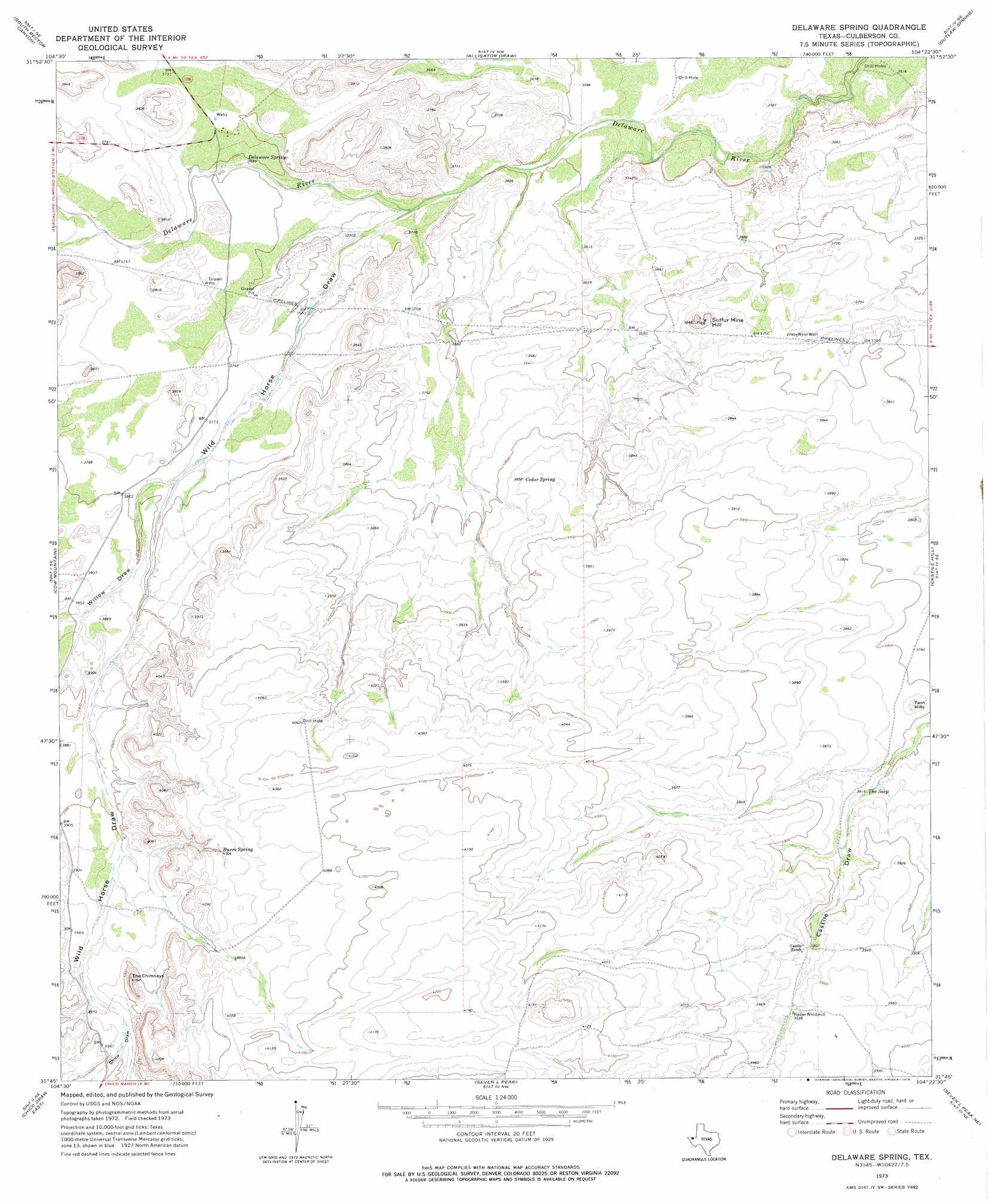
USGS Topo Quad 31104g4 - 1:24,000 scale
| Topo Map Name: | Delaware Spring |
| USGS Topo Quad ID: | 31104g4 |
| Print Size: | ca. 21 1/4" wide x 27" high |
| Southeast Coordinates: | 31.75° N latitude / 104.375° W longitude |
| Map Center Coordinates: | 31.8125° N latitude / 104.4375° W longitude |
| U.S. State: | TX |
| Filename: | o31104g4.jpg |
| Download Map JPG Image: | Delaware Spring topo map 1:24,000 scale |
| Map Type: | Topographic |
| Topo Series: | 7.5´ |
| Map Scale: | 1:24,000 |
| Source of Map Images: | United States Geological Survey (USGS) |
| Alternate Map Versions: |
Delaware Spring TX 1973, updated 1976 Download PDF Buy paper map Delaware Spring TX 2010 Download PDF Buy paper map Delaware Spring TX 2012 Download PDF Buy paper map Delaware Spring TX 2016 Download PDF Buy paper map |
1:24,000 Topo Quads surrounding Delaware Spring
Gunsight Canyon |
Grapevine Draw |
Rattlesnake Spring |
Jumping Spring |
Cottonwood Hills |
Independence Spring |
South Rector Canyon |
Alligator Draw |
Outlaw Spring |
Owl Hills |
Long Point |
Cow Mountain |
Delaware Spring |
Castile Hill |
Screw Bean Draw West |
Chico Draw West |
Chico Draw East |
Seven L Peak |
Seven L Peak Ne |
Rustler Hills |
Burro Canyon |
Emory Corral |
Kc Ranch |
Two Mill Draw West |
Two Mill Draw East |
> Back to 31104e1 at 1:100,000 scale
> Back to 31104a1 at 1:250,000 scale
> Back to U.S. Topo Maps home
Delaware Spring topo map: Gazetteer
Delaware Spring: Ranges
Twin Hills elevation 1177m 3861′Delaware Spring: Springs
Burro Spring elevation 1220m 4002′Cedar Spring elevation 1172m 3845′
Delaware Spring elevation 1128m 3700′
The Seep elevation 1165m 3822′
Delaware Spring: Summits
Sulfur Mine Hill elevation 1170m 3838′The Chimneys elevation 1267m 4156′
Delaware Spring: Valleys
Chico Draw elevation 1212m 3976′Willow Draw elevation 1147m 3763′
Delaware Spring: Wells
West Well elevation 1142m 3746′Delaware Spring digital topo map on disk
Buy this Delaware Spring topo map showing relief, roads, GPS coordinates and other geographical features, as a high-resolution digital map file on DVD: