Sierra Blanca Sw Topo Map Texas
To zoom in, hover over the map of Sierra Blanca Sw
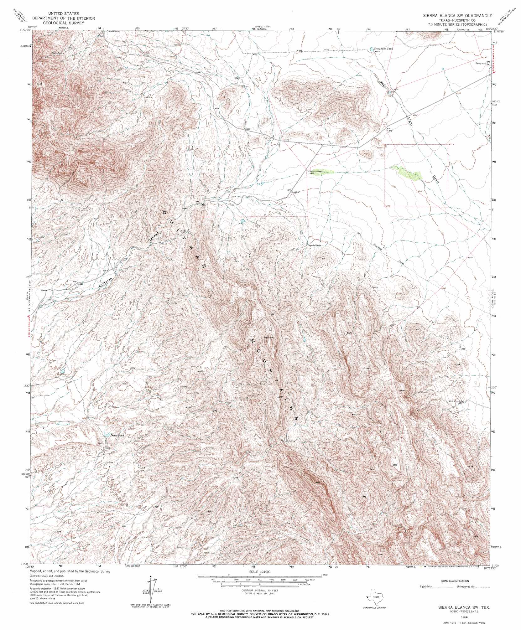
USGS Topo Quad 31105a4 - 1:24,000 scale
| Topo Map Name: | Sierra Blanca Sw |
| USGS Topo Quad ID: | 31105a4 |
| Print Size: | ca. 21 1/4" wide x 27" high |
| Southeast Coordinates: | 31° N latitude / 105.375° W longitude |
| Map Center Coordinates: | 31.0625° N latitude / 105.4375° W longitude |
| U.S. State: | TX |
| Filename: | o31105a4.jpg |
| Download Map JPG Image: | Sierra Blanca Sw topo map 1:24,000 scale |
| Map Type: | Topographic |
| Topo Series: | 7.5´ |
| Map Scale: | 1:24,000 |
| Source of Map Images: | United States Geological Survey (USGS) |
| Alternate Map Versions: |
Sierra Blanca SW TX 1964, updated 1967 Download PDF Buy paper map Sierra Blanca SW TX 2010 Download PDF Buy paper map Sierra Blanca SW TX 2013 Download PDF Buy paper map Sierra Blanca SW TX 2016 Download PDF Buy paper map |
1:24,000 Topo Quads surrounding Sierra Blanca Sw
Campo Grande Mountain |
Small |
Gunsight Hills South |
Pierce Ranch |
Movie Mountain |
Esperanza |
Silver King Canyon |
Lasca |
Sierra Blanca |
Dome Peak |
Neely Canyon |
Sierra Blanca Sw |
Devil Ridge |
Grayton Lake |
|
Schroder Arroyo |
Cedar Arroyo |
Eagle Mountains Nw |
||
Indian Hot Springs |
Eagle Mountains Sw |
> Back to 31105a1 at 1:100,000 scale
> Back to 31104a1 at 1:250,000 scale
> Back to U.S. Topo Maps home
Sierra Blanca Sw topo map: Gazetteer
Sierra Blanca Sw: Reservoirs
Davis Pond elevation 1169m 3835′Sevenmile Tank elevation 1356m 4448′
Sierra Blanca Sw: Wells
Henshaw Well elevation 1333m 4373′Sierra Blanca Sw digital topo map on disk
Buy this Sierra Blanca Sw topo map showing relief, roads, GPS coordinates and other geographical features, as a high-resolution digital map file on DVD: