Sneed Mountain Topo Map Texas
To zoom in, hover over the map of Sneed Mountain
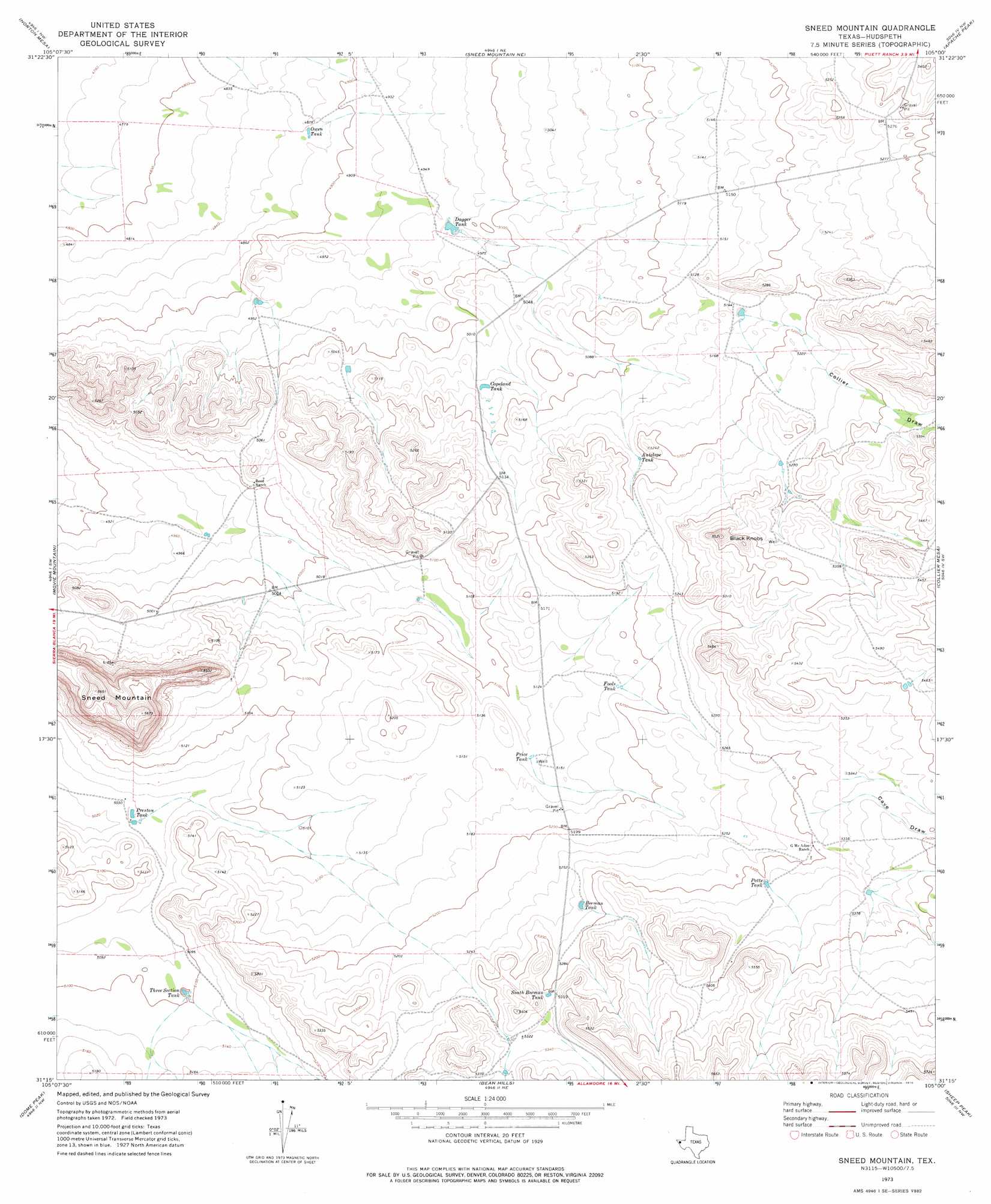
USGS Topo Quad 31105c1 - 1:24,000 scale
| Topo Map Name: | Sneed Mountain |
| USGS Topo Quad ID: | 31105c1 |
| Print Size: | ca. 21 1/4" wide x 27" high |
| Southeast Coordinates: | 31.25° N latitude / 105° W longitude |
| Map Center Coordinates: | 31.3125° N latitude / 105.0625° W longitude |
| U.S. State: | TX |
| Filename: | o31105c1.jpg |
| Download Map JPG Image: | Sneed Mountain topo map 1:24,000 scale |
| Map Type: | Topographic |
| Topo Series: | 7.5´ |
| Map Scale: | 1:24,000 |
| Source of Map Images: | United States Geological Survey (USGS) |
| Alternate Map Versions: |
Sneed Mountain TX 1973, updated 1976 Download PDF Buy paper map Sneed Mountain TX 2010 Download PDF Buy paper map Sneed Mountain TX 2012 Download PDF Buy paper map Sneed Mountain TX 2016 Download PDF Buy paper map |
1:24,000 Topo Quads surrounding Sneed Mountain
Scratch Ranch |
Black Mountains |
Babb Canyon |
Bitter Well Mountain Sw |
Bitter Well Mountain |
Black Hills |
Norton Mesa |
Sneed Mountain Ne |
Apache Peak |
Figure Two Ranch |
Pierce Ranch |
Movie Mountain |
Sneed Mountain |
Collier Mesa |
Victorio Peak |
Sierra Blanca |
Dome Peak |
Bean Hills |
Sheep Peak |
Nutt Ranch |
Devil Ridge |
Grayton Lake |
Allamoore |
Hackett Peak |
Van Horn |
> Back to 31105a1 at 1:100,000 scale
> Back to 31104a1 at 1:250,000 scale
> Back to U.S. Topo Maps home
Sneed Mountain topo map: Gazetteer
Sneed Mountain: Reservoirs
Antelope Tank elevation 1577m 5173′Beeman Tank elevation 1610m 5282′
Copeland Tank elevation 1540m 5052′
Dagger Tank elevation 1512m 4960′
Fools Tank elevation 1576m 5170′
Owen Tank elevation 1487m 4878′
Potts Tank elevation 1624m 5328′
Preston Tank elevation 1537m 5042′
Price Tank elevation 1566m 5137′
South Beeman Tank elevation 1621m 5318′
Three Section Tank elevation 1555m 5101′
Sneed Mountain: Summits
Black Knobs elevation 1679m 5508′Sneed Mountain elevation 1727m 5666′
Sneed Mountain: Valleys
Cave Draw elevation 1620m 5314′Collier Draw elevation 1573m 5160′
Sneed Mountain digital topo map on disk
Buy this Sneed Mountain topo map showing relief, roads, GPS coordinates and other geographical features, as a high-resolution digital map file on DVD: