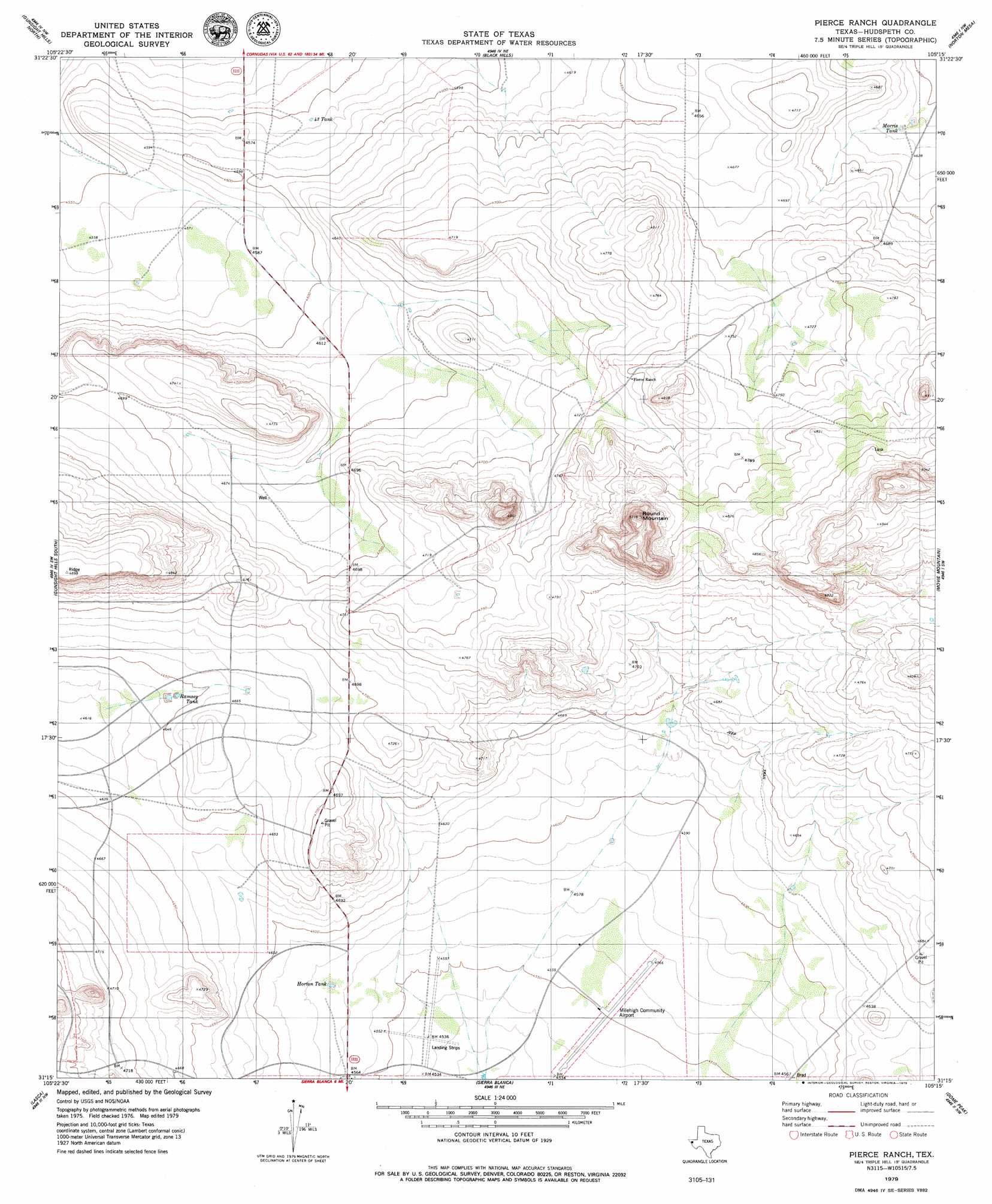
Pierce Ranch Topo Map Texas
To zoom in, hover over the map of Pierce Ranch
USGS Topo Quad 31105c3 - 1:24,000 scale
| Topo Map Name: | Pierce Ranch |
| USGS Topo Quad ID: | 31105c3 |
| Print Size: | ca. 21 1/4" wide x 27" high |
| Southeast Coordinates: | 31.25° N latitude / 105.25° W longitude |
| Map Center Coordinates: | 31.3125° N latitude / 105.3125° W longitude |
| U.S. State: | TX |
| Filename: | o31105c3.jpg |
| Download Map JPG Image: | Pierce Ranch topo map 1:24,000 scale |
| Map Type: | Topographic |
| Topo Series: | 7.5´ |
| Map Scale: | 1:24,000 |
| Source of Map Images: | United States Geological Survey (USGS) |
| Alternate Map Versions: |
Pierce Ranch TX 1979, updated 1979 Download PDF Buy paper map Pierce Ranch TX 2010 Download PDF Buy paper map Pierce Ranch TX 2012 Download PDF Buy paper map Pierce Ranch TX 2016 Download PDF Buy paper map |
1:24,000 Topo Quads surrounding Pierce Ranch
Granite Mountain |
Baylor Draw |
Scratch Ranch |
Black Mountains |
Babb Canyon |
Diablo Canyon East |
Gunsight Hills North |
Black Hills |
Norton Mesa |
Sneed Mountain Ne |
Small |
Gunsight Hills South |
Pierce Ranch |
Movie Mountain |
Sneed Mountain |
Silver King Canyon |
Lasca |
Sierra Blanca |
Dome Peak |
Bean Hills |
Neely Canyon |
Sierra Blanca Sw |
Devil Ridge |
Grayton Lake |
Allamoore |
> Back to 31105a1 at 1:100,000 scale
> Back to 31104a1 at 1:250,000 scale
> Back to U.S. Topo Maps home
Pierce Ranch topo map: Gazetteer
Pierce Ranch: Airports
Milehigh Community Airport elevation 1387m 4550′Pierce Ranch: Reservoirs
Fortythree Tank elevation 1389m 4557′Horton Tank elevation 1397m 4583′
Morris Tank elevation 1409m 4622′
Ramsey Tank elevation 1418m 4652′
Pierce Ranch: Summits
Round Mountain elevation 1558m 5111′Pierce Ranch digital topo map on disk
Buy this Pierce Ranch topo map showing relief, roads, GPS coordinates and other geographical features, as a high-resolution digital map file on DVD: