Fort Hancock Nw Topo Map Texas
To zoom in, hover over the map of Fort Hancock Nw
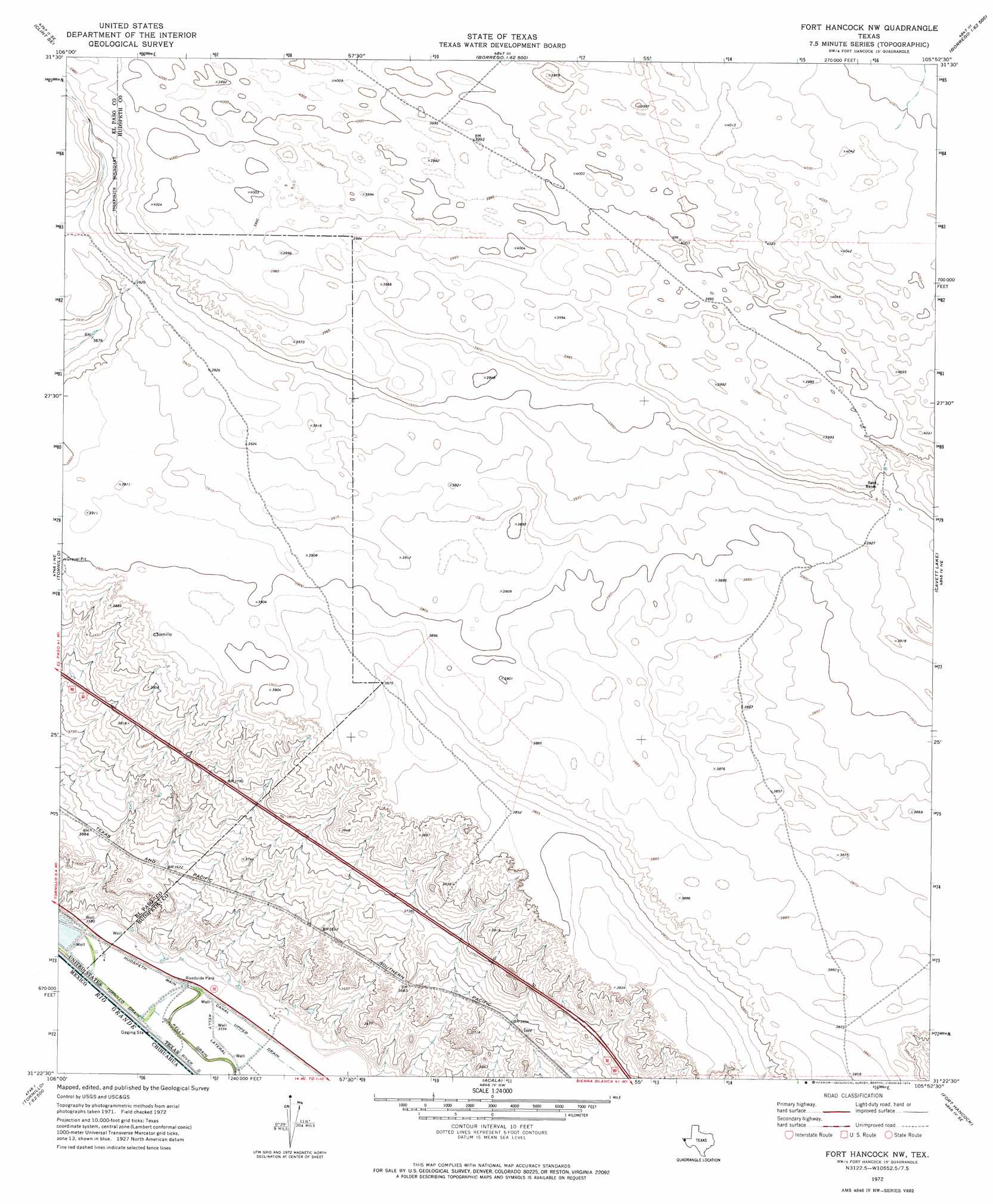
USGS Topo Quad 31105d8 - 1:24,000 scale
| Topo Map Name: | Fort Hancock Nw |
| USGS Topo Quad ID: | 31105d8 |
| Print Size: | ca. 21 1/4" wide x 27" high |
| Southeast Coordinates: | 31.375° N latitude / 105.875° W longitude |
| Map Center Coordinates: | 31.4375° N latitude / 105.9375° W longitude |
| U.S. State: | TX |
| Filename: | o31105d8.jpg |
| Download Map JPG Image: | Fort Hancock Nw topo map 1:24,000 scale |
| Map Type: | Topographic |
| Topo Series: | 7.5´ |
| Map Scale: | 1:24,000 |
| Source of Map Images: | United States Geological Survey (USGS) |
| Alternate Map Versions: |
Fort Hancock NW TX 1972, updated 1974 Download PDF Buy paper map Fort Hancock NW TX 2010 Download PDF Buy paper map Fort Hancock NW TX 2013 Download PDF Buy paper map Fort Hancock NW TX 2016 Download PDF Buy paper map |
1:24,000 Topo Quads surrounding Fort Hancock Nw
Clint Nw |
Clint Ne |
Padre Canyon |
Wildhorse Draw |
Tepee Butte |
Clint |
Clint Se |
T P Well |
Whiterock Hills |
Tepee Butte Sw |
Isla |
Tornillo |
Fort Hancock Nw |
Cavett Lake |
Diablo Canyon West |
Acala |
Fort Hancock |
Campo Grande Mountain |
||
Mcnary |
Esperanza |
> Back to 31105a1 at 1:100,000 scale
> Back to 31104a1 at 1:250,000 scale
> Back to U.S. Topo Maps home
Fort Hancock Nw topo map: Gazetteer
Fort Hancock Nw: Canals
Kelly Drain elevation 1083m 3553′Kelly Lateral elevation 1083m 3553′
Fort Hancock Nw digital topo map on disk
Buy this Fort Hancock Nw topo map showing relief, roads, GPS coordinates and other geographical features, as a high-resolution digital map file on DVD: