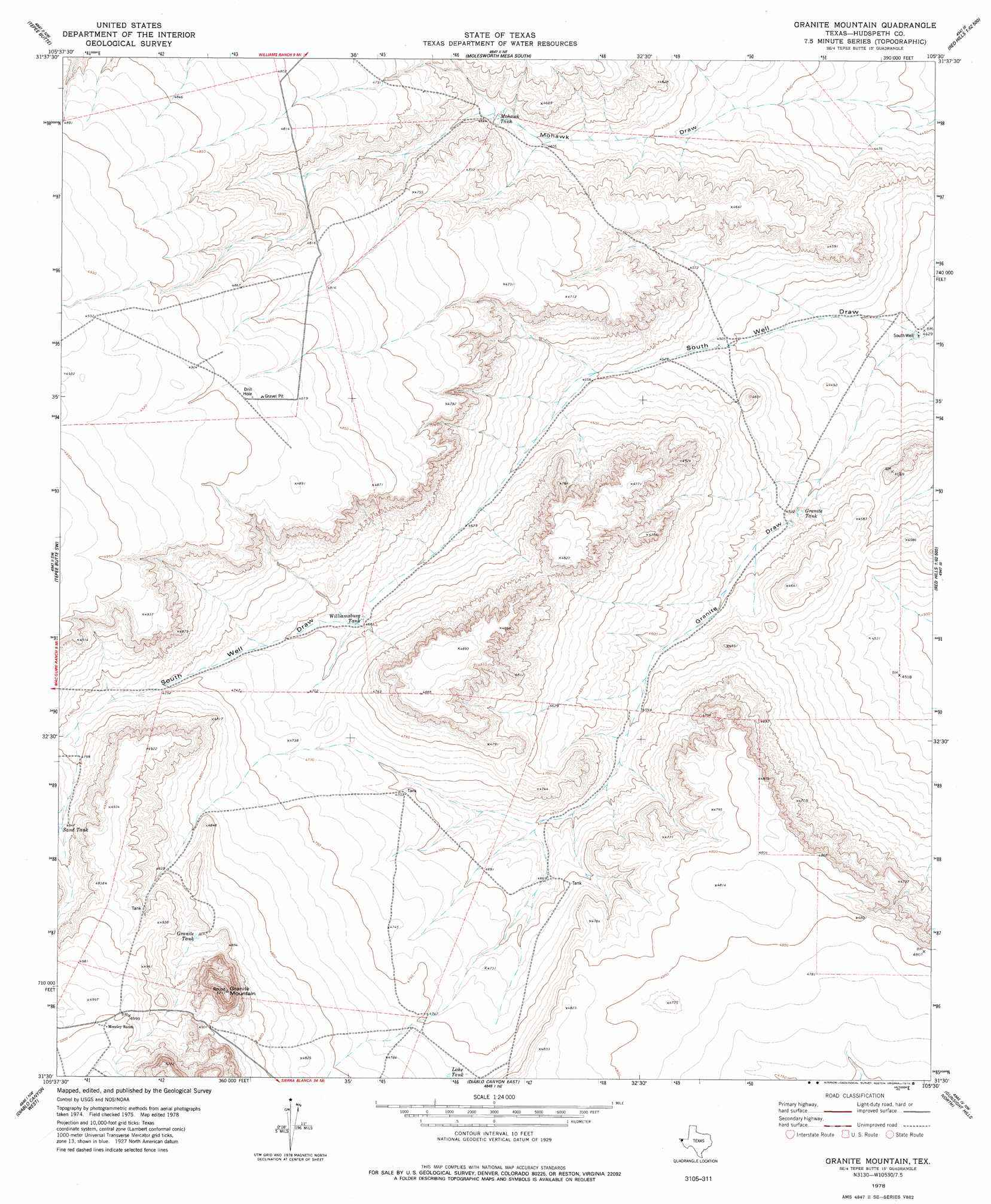
Granite Mountain Topo Map Texas
To zoom in, hover over the map of Granite Mountain
USGS Topo Quad 31105e5 - 1:24,000 scale
| Topo Map Name: | Granite Mountain |
| USGS Topo Quad ID: | 31105e5 |
| Print Size: | ca. 21 1/4" wide x 27" high |
| Southeast Coordinates: | 31.5° N latitude / 105.5° W longitude |
| Map Center Coordinates: | 31.5625° N latitude / 105.5625° W longitude |
| U.S. State: | TX |
| Filename: | o31105e5.jpg |
| Download Map JPG Image: | Granite Mountain topo map 1:24,000 scale |
| Map Type: | Topographic |
| Topo Series: | 7.5´ |
| Map Scale: | 1:24,000 |
| Source of Map Images: | United States Geological Survey (USGS) |
| Alternate Map Versions: |
Granite Mountain TX 1978, updated 1978 Download PDF Buy paper map Granite Mountain TX 2010 Download PDF Buy paper map Granite Mountain TX 2013 Download PDF Buy paper map Granite Mountain TX 2016 Download PDF Buy paper map |
1:24,000 Topo Quads surrounding Granite Mountain
Buckhorn Draw West |
Buckhorn Draw East |
Molesworth Mesa North |
Cornudas |
Mickey Draw West |
Wildhorse Draw |
Tepee Butte |
Molesworth Mesa South |
Adobe House Tank |
Hueco Station |
Whiterock Hills |
Tepee Butte Sw |
Granite Mountain |
Baylor Draw |
Scratch Ranch |
Cavett Lake |
Diablo Canyon West |
Diablo Canyon East |
Gunsight Hills North |
Black Hills |
Fort Hancock |
Campo Grande Mountain |
Small |
Gunsight Hills South |
Pierce Ranch |
> Back to 31105e1 at 1:100,000 scale
> Back to 31104a1 at 1:250,000 scale
> Back to U.S. Topo Maps home
Granite Mountain topo map: Gazetteer
Granite Mountain: Reservoirs
Granite Tank elevation 1378m 4520′Granite Tank elevation 1479m 4852′
Lake Tank elevation 1454m 4770′
Mohawk Tank elevation 1412m 4632′
Sand Tank elevation 1476m 4842′
Williamsburg Tank elevation 1428m 4685′
Granite Mountain: Summits
Granite Mountain elevation 1572m 5157′Granite Mountain: Valleys
Granite Draw elevation 1351m 4432′Mohawk Draw elevation 1353m 4438′
Granite Mountain: Wells
South Well elevation 1351m 4432′Granite Mountain digital topo map on disk
Buy this Granite Mountain topo map showing relief, roads, GPS coordinates and other geographical features, as a high-resolution digital map file on DVD: