Molesworth Mesa South Topo Map Texas
To zoom in, hover over the map of Molesworth Mesa South
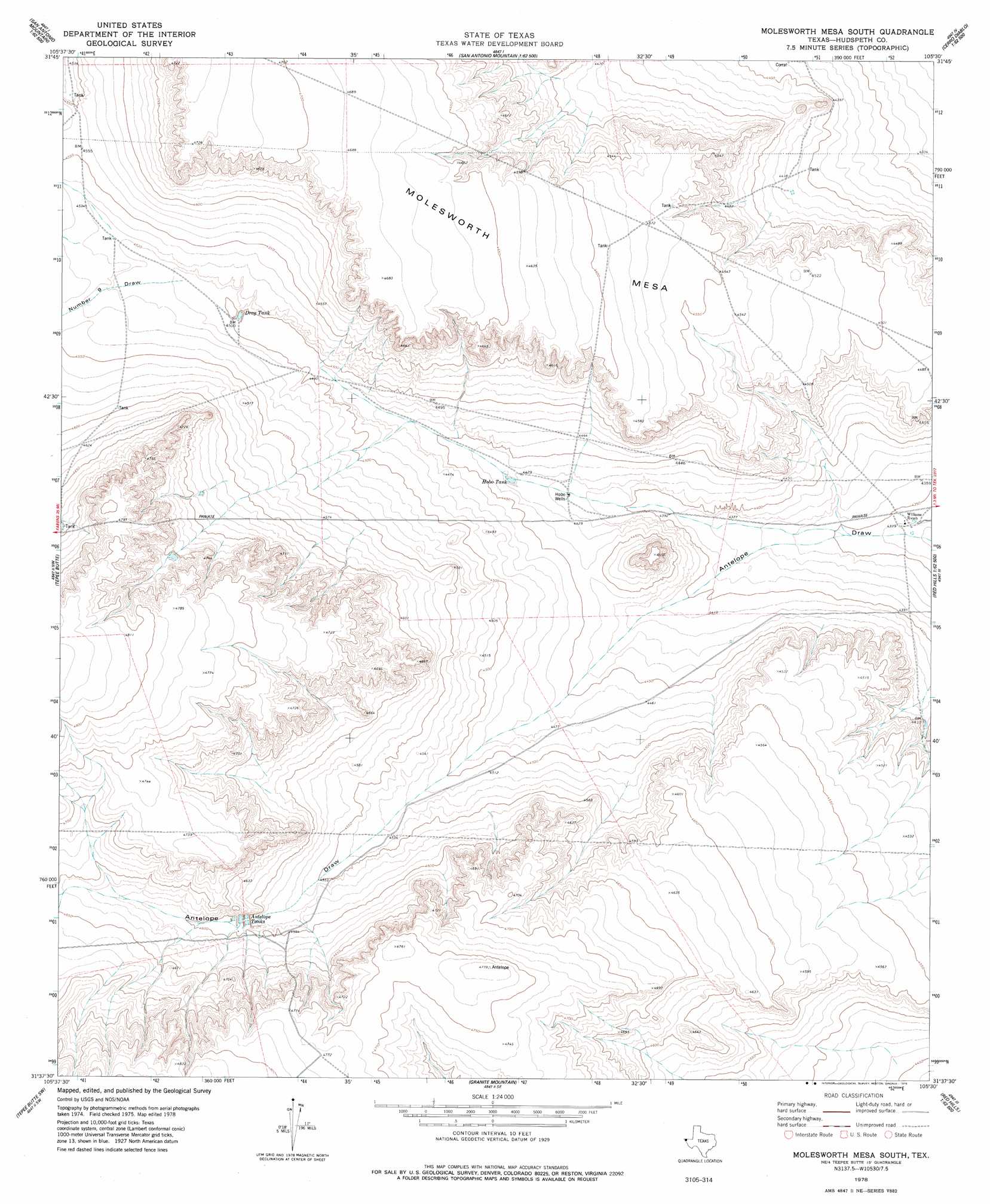
USGS Topo Quad 31105f5 - 1:24,000 scale
| Topo Map Name: | Molesworth Mesa South |
| USGS Topo Quad ID: | 31105f5 |
| Print Size: | ca. 21 1/4" wide x 27" high |
| Southeast Coordinates: | 31.625° N latitude / 105.5° W longitude |
| Map Center Coordinates: | 31.6875° N latitude / 105.5625° W longitude |
| U.S. State: | TX |
| Filename: | o31105f5.jpg |
| Download Map JPG Image: | Molesworth Mesa South topo map 1:24,000 scale |
| Map Type: | Topographic |
| Topo Series: | 7.5´ |
| Map Scale: | 1:24,000 |
| Source of Map Images: | United States Geological Survey (USGS) |
| Alternate Map Versions: |
Molesworth Mesa South TX 1978, updated 1978 Download PDF Buy paper map Molesworth Mesa South TX 2010 Download PDF Buy paper map Molesworth Mesa South TX 2012 Download PDF Buy paper map Molesworth Mesa South TX 2016 Download PDF Buy paper map |
1:24,000 Topo Quads surrounding Molesworth Mesa South
Hobo Tank |
Big Heiser Tank |
Sixteen Mountains |
Cerro Diablo |
C And L Draw |
Buckhorn Draw West |
Buckhorn Draw East |
Molesworth Mesa North |
Cornudas |
Mickey Draw West |
Wildhorse Draw |
Tepee Butte |
Molesworth Mesa South |
Adobe House Tank |
Hueco Station |
Whiterock Hills |
Tepee Butte Sw |
Granite Mountain |
Baylor Draw |
Scratch Ranch |
Cavett Lake |
Diablo Canyon West |
Diablo Canyon East |
Gunsight Hills North |
Black Hills |
> Back to 31105e1 at 1:100,000 scale
> Back to 31104a1 at 1:250,000 scale
> Back to U.S. Topo Maps home
Molesworth Mesa South topo map: Gazetteer
Molesworth Mesa South: Lakes
Antelope Tanks elevation 1402m 4599′Drag Tank elevation 1372m 4501′
Hobo Tank elevation 1351m 4432′
Molesworth Mesa South: Valleys
Number Nine Draw elevation 1374m 4507′Molesworth Mesa South: Wells
Hobo Wells elevation 1346m 4416′Molesworth Mesa South digital topo map on disk
Buy this Molesworth Mesa South topo map showing relief, roads, GPS coordinates and other geographical features, as a high-resolution digital map file on DVD: