Tepee Butte Topo Map Texas
To zoom in, hover over the map of Tepee Butte
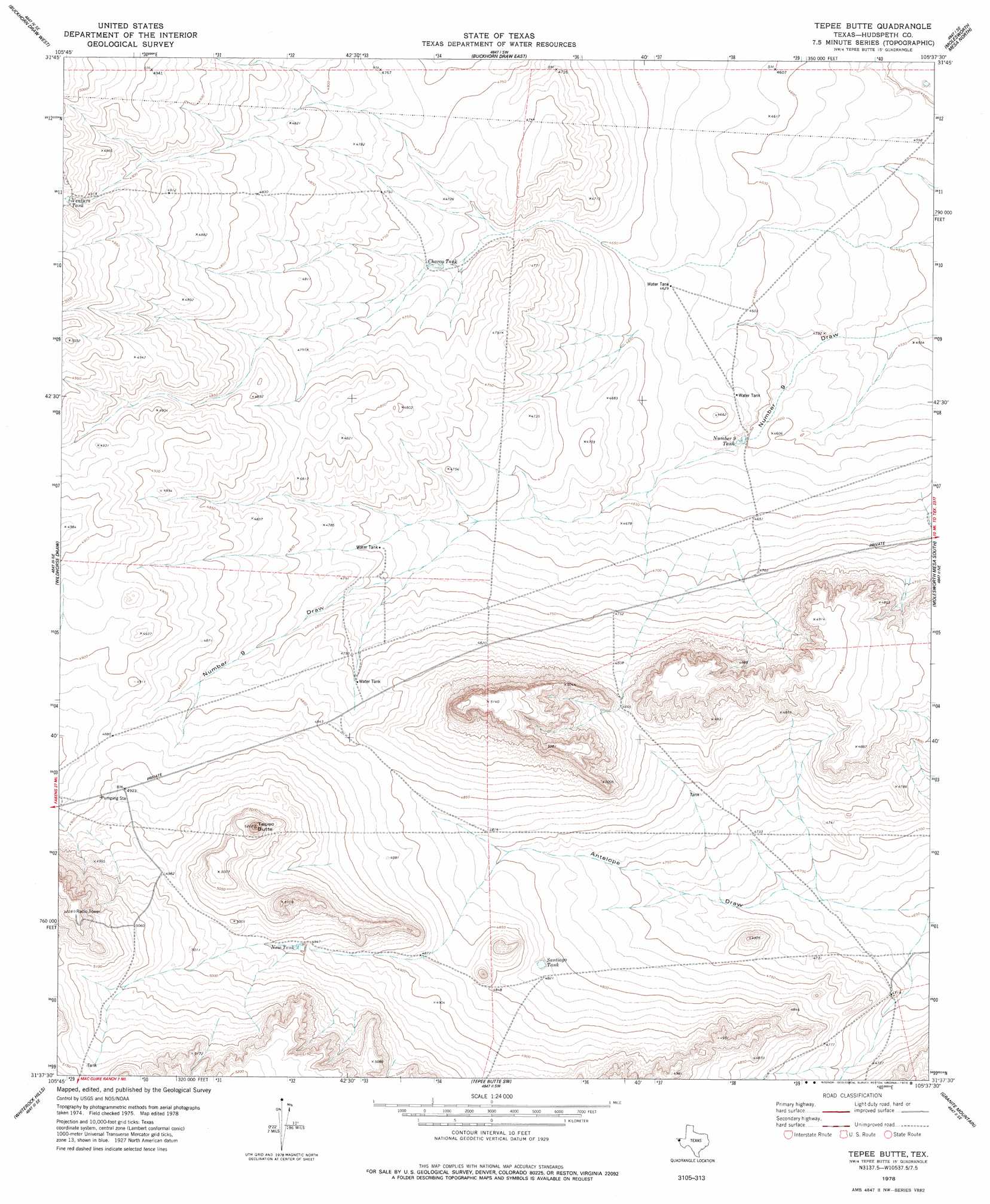
USGS Topo Quad 31105f6 - 1:24,000 scale
| Topo Map Name: | Tepee Butte |
| USGS Topo Quad ID: | 31105f6 |
| Print Size: | ca. 21 1/4" wide x 27" high |
| Southeast Coordinates: | 31.625° N latitude / 105.625° W longitude |
| Map Center Coordinates: | 31.6875° N latitude / 105.6875° W longitude |
| U.S. State: | TX |
| Filename: | o31105f6.jpg |
| Download Map JPG Image: | Tepee Butte topo map 1:24,000 scale |
| Map Type: | Topographic |
| Topo Series: | 7.5´ |
| Map Scale: | 1:24,000 |
| Source of Map Images: | United States Geological Survey (USGS) |
| Alternate Map Versions: |
Tepee Butte TX 1978, updated 1978 Download PDF Buy paper map Tepee Butte TX 2010 Download PDF Buy paper map Tepee Butte TX 2012 Download PDF Buy paper map Tepee Butte TX 2016 Download PDF Buy paper map |
1:24,000 Topo Quads surrounding Tepee Butte
Cerro Alto Mountain |
Hobo Tank |
Big Heiser Tank |
Sixteen Mountains |
Cerro Diablo |
Phone Line Canyon |
Buckhorn Draw West |
Buckhorn Draw East |
Molesworth Mesa North |
Cornudas |
Padre Canyon |
Wildhorse Draw |
Tepee Butte |
Molesworth Mesa South |
Adobe House Tank |
T P Well |
Whiterock Hills |
Tepee Butte Sw |
Granite Mountain |
Baylor Draw |
Fort Hancock Nw |
Cavett Lake |
Diablo Canyon West |
Diablo Canyon East |
Gunsight Hills North |
> Back to 31105e1 at 1:100,000 scale
> Back to 31104a1 at 1:250,000 scale
> Back to U.S. Topo Maps home
Tepee Butte topo map: Gazetteer
Tepee Butte: Reservoirs
Charco Tank elevation 1436m 4711′New Tank elevation 1509m 4950′
Number Nine Tank elevation 1406m 4612′
Santiago Tank elevation 1470m 4822′
Ventura Tank elevation 1510m 4954′
Tepee Butte: Summits
Tepee Butte elevation 1572m 5157′Tepee Butte digital topo map on disk
Buy this Tepee Butte topo map showing relief, roads, GPS coordinates and other geographical features, as a high-resolution digital map file on DVD: