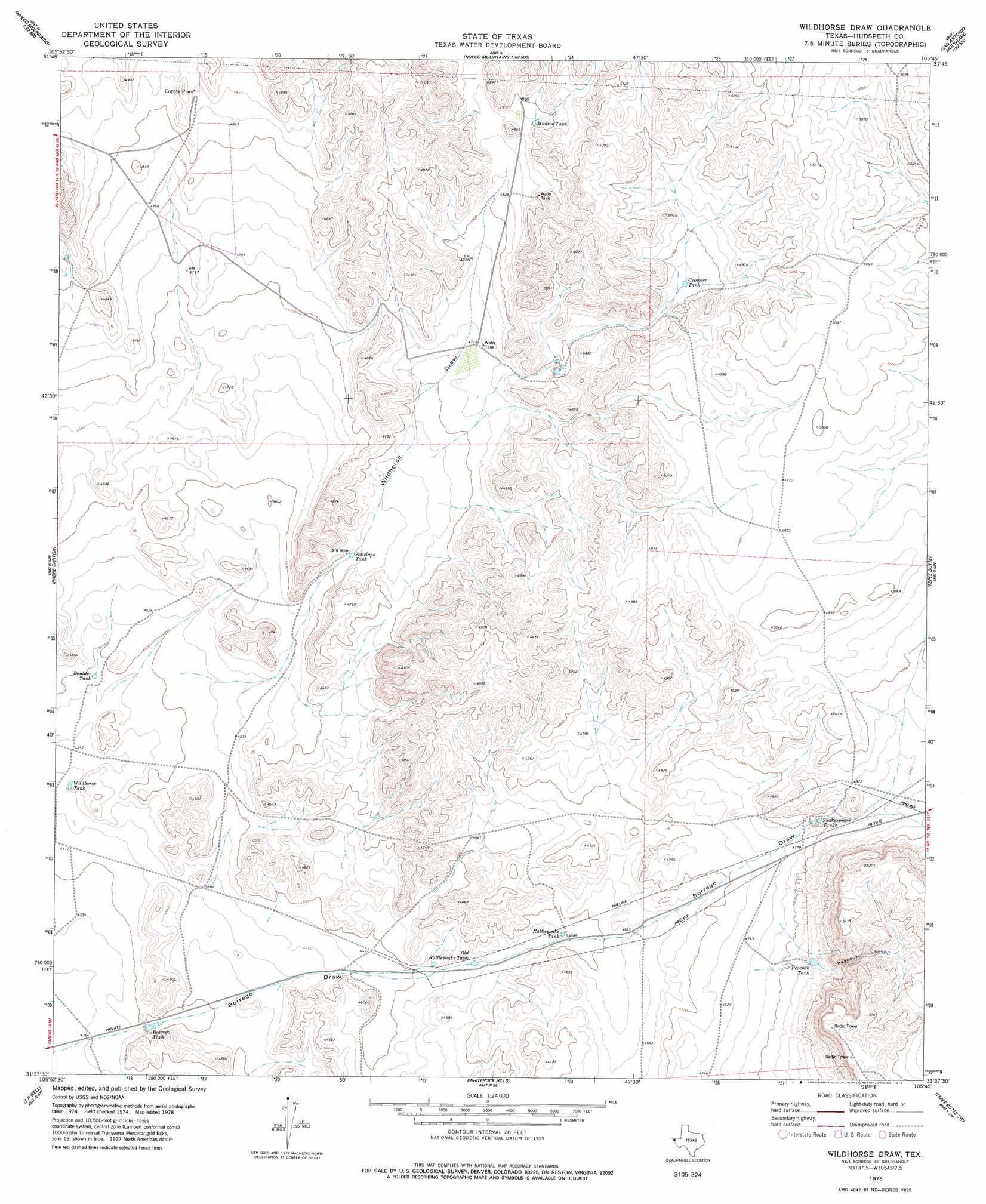
Wildhorse Draw Topo Map Texas
To zoom in, hover over the map of Wildhorse Draw
USGS Topo Quad 31105f7 - 1:24,000 scale
| Topo Map Name: | Wildhorse Draw |
| USGS Topo Quad ID: | 31105f7 |
| Print Size: | ca. 21 1/4" wide x 27" high |
| Southeast Coordinates: | 31.625° N latitude / 105.75° W longitude |
| Map Center Coordinates: | 31.6875° N latitude / 105.8125° W longitude |
| U.S. State: | TX |
| Filename: | o31105f7.jpg |
| Download Map JPG Image: | Wildhorse Draw topo map 1:24,000 scale |
| Map Type: | Topographic |
| Topo Series: | 7.5´ |
| Map Scale: | 1:24,000 |
| Source of Map Images: | United States Geological Survey (USGS) |
| Alternate Map Versions: |
Wildhorse Draw TX 1978, updated 1978 Download PDF Buy paper map Wildhorse Draw TX 2010 Download PDF Buy paper map Wildhorse Draw TX 2012 Download PDF Buy paper map Wildhorse Draw TX 2016 Download PDF Buy paper map |
1:24,000 Topo Quads surrounding Wildhorse Draw
Hueco Tanks |
Cerro Alto Mountain |
Hobo Tank |
Big Heiser Tank |
Sixteen Mountains |
Helms West Well |
Phone Line Canyon |
Buckhorn Draw West |
Buckhorn Draw East |
Molesworth Mesa North |
Clint Ne |
Padre Canyon |
Wildhorse Draw |
Tepee Butte |
Molesworth Mesa South |
Clint Se |
T P Well |
Whiterock Hills |
Tepee Butte Sw |
Granite Mountain |
Tornillo |
Fort Hancock Nw |
Cavett Lake |
Diablo Canyon West |
Diablo Canyon East |
> Back to 31105e1 at 1:100,000 scale
> Back to 31104a1 at 1:250,000 scale
> Back to U.S. Topo Maps home
Wildhorse Draw topo map: Gazetteer
Wildhorse Draw: Populated Places
Coyote Place elevation 1475m 4839′Wildhorse Draw: Reservoirs
Antelope Tank elevation 1408m 4619′Borrego Tank elevation 1340m 4396′
Boulder Tank elevation 1370m 4494′
Crowder Tank elevation 1487m 4878′
Monroe Tank elevation 1489m 4885′
Old Rattlesnake Tank elevation 1383m 4537′
Peacock Tank elevation 1475m 4839′
Rattlesnake Tank elevation 1398m 4586′
Shakespeare Tanks elevation 1463m 4799′
Wildhorse Tank elevation 1354m 4442′
Wildhorse Draw: Valleys
Peacock Canyon elevation 1483m 4865′Wildhorse Draw elevation 1375m 4511′
Wildhorse Draw digital topo map on disk
Buy this Wildhorse Draw topo map showing relief, roads, GPS coordinates and other geographical features, as a high-resolution digital map file on DVD: