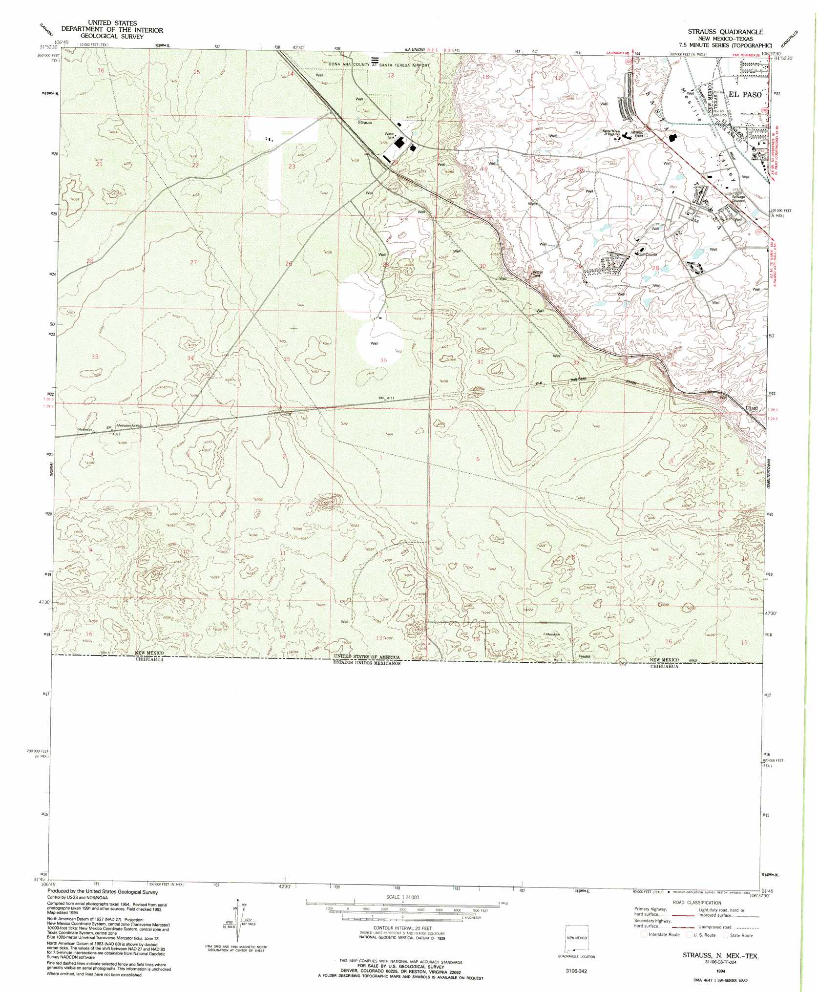
Strauss Topo Map New Mexico
To zoom in, hover over the map of Strauss
USGS Topo Quad 31106g6 - 1:24,000 scale
| Topo Map Name: | Strauss |
| USGS Topo Quad ID: | 31106g6 |
| Print Size: | ca. 21 1/4" wide x 27" high |
| Southeast Coordinates: | 31.75° N latitude / 106.625° W longitude |
| Map Center Coordinates: | 31.8125° N latitude / 106.6875° W longitude |
| U.S. States: | NM, TX |
| Filename: | o31106g6.jpg |
| Download Map JPG Image: | Strauss topo map 1:24,000 scale |
| Map Type: | Topographic |
| Topo Series: | 7.5´ |
| Map Scale: | 1:24,000 |
| Source of Map Images: | United States Geological Survey (USGS) |
| Alternate Map Versions: |
Strauss NM 1955, updated 1962 Download PDF Buy paper map Strauss NM 1994, updated 1994 Download PDF Buy paper map Strauss NM 1996, updated 2002 Download PDF Buy paper map Strauss NM 2010 Download PDF Buy paper map Strauss NM 2013 Download PDF Buy paper map Strauss NM 2017 Download PDF Buy paper map |
1:24,000 Topo Quads surrounding Strauss
Afton |
Little Black Mountain |
La Mesa |
Anthony |
Newman Sw |
Kilbourne Hole |
Lanark |
La Union |
Canutillo |
North Franklin Mountain |
Potrillo |
Noria |
Strauss |
Smeltertown |
El Paso |
Ysleta Nw |
||||
> Back to 31106e1 at 1:100,000 scale
> Back to 31106a1 at 1:250,000 scale
> Back to U.S. Topo Maps home
Strauss topo map: Gazetteer
Strauss: Canals
Crawford Lateral elevation 1146m 3759′West Drain elevation 1146m 3759′
Strauss: Populated Places
Lizard elevation 1216m 3989′Mastodon elevation 1254m 4114′
Orange elevation 1148m 3766′
Santa Teresa elevation 1156m 3792′
Strauss elevation 1253m 4110′
Strauss: Post Offices
Orange Post Office (historical) elevation 1148m 3766′Strauss Post Office (historical) elevation 1253m 4110′
Strauss: Wells
10067 Water Well elevation 1244m 4081′10141 Water Well elevation 1182m 3877′
10143 Water Well elevation 1255m 4117′
10144 Water Well elevation 1240m 4068′
10154 Water Well elevation 1165m 3822′
10156 Water Well elevation 1182m 3877′
10157 Water Well elevation 1252m 4107′
10161 Water Well elevation 1254m 4114′
10166 Water Well elevation 1187m 3894′
10167 Water Well elevation 1202m 3943′
10169 Water Well elevation 1187m 3894′
10174 Water Well elevation 1253m 4110′
10175 Water Well elevation 1245m 4084′
10176 Water Well elevation 1189m 3900′
NM 4911302 Water Well elevation 1146m 3759′
P 16 Water Well elevation 1253m 4110′
Q 268 Water Well elevation 1155m 3789′
Q-70 Water Well elevation 1219m 3999′
Strauss digital topo map on disk
Buy this Strauss topo map showing relief, roads, GPS coordinates and other geographical features, as a high-resolution digital map file on DVD: