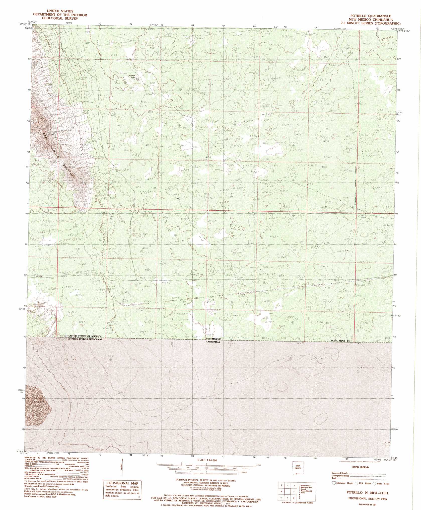
Potrillo Topo Map New Mexico
To zoom in, hover over the map of Potrillo
USGS Topo Quad 31106g8 - 1:24,000 scale
| Topo Map Name: | Potrillo |
| USGS Topo Quad ID: | 31106g8 |
| Print Size: | ca. 21 1/4" wide x 27" high |
| Southeast Coordinates: | 31.75° N latitude / 106.875° W longitude |
| Map Center Coordinates: | 31.8125° N latitude / 106.9375° W longitude |
| U.S. State: | NM |
| Filename: | o31106g8.jpg |
| Download Map JPG Image: | Potrillo topo map 1:24,000 scale |
| Map Type: | Topographic |
| Topo Series: | 7.5´ |
| Map Scale: | 1:24,000 |
| Source of Map Images: | United States Geological Survey (USGS) |
| Alternate Map Versions: |
Potrillo NM 1985, updated 1985 Download PDF Buy paper map Potrillo NM 2010 Download PDF Buy paper map Potrillo NM 2013 Download PDF Buy paper map Potrillo NM 2017 Download PDF Buy paper map |
1:24,000 Topo Quads surrounding Potrillo
Mount Aden Sw |
Aden Crater |
Afton |
Little Black Mountain |
La Mesa |
Potrillo Peak |
Mount Riley |
Kilbourne Hole |
Lanark |
La Union |
Guzmans Lookout Mountain |
Mount Riley Se |
Potrillo |
Noria |
Strauss |
> Back to 31106e1 at 1:100,000 scale
> Back to 31106a1 at 1:250,000 scale
> Back to U.S. Topo Maps home
Potrillo topo map: Gazetteer
Potrillo: Mines
Federal 'H' Number One Mine elevation 1317m 4320′Potrillo: Populated Places
Potrillo elevation 1292m 4238′Potrillo: Post Offices
Portillo Post Office (historical) elevation 1292m 4238′Potrillo: Reservoirs
Gerrys Tank elevation 1241m 4071′Potrillo digital topo map on disk
Buy this Potrillo topo map showing relief, roads, GPS coordinates and other geographical features, as a high-resolution digital map file on DVD: