P O L Ranch Topo Map New Mexico
To zoom in, hover over the map of P O L Ranch
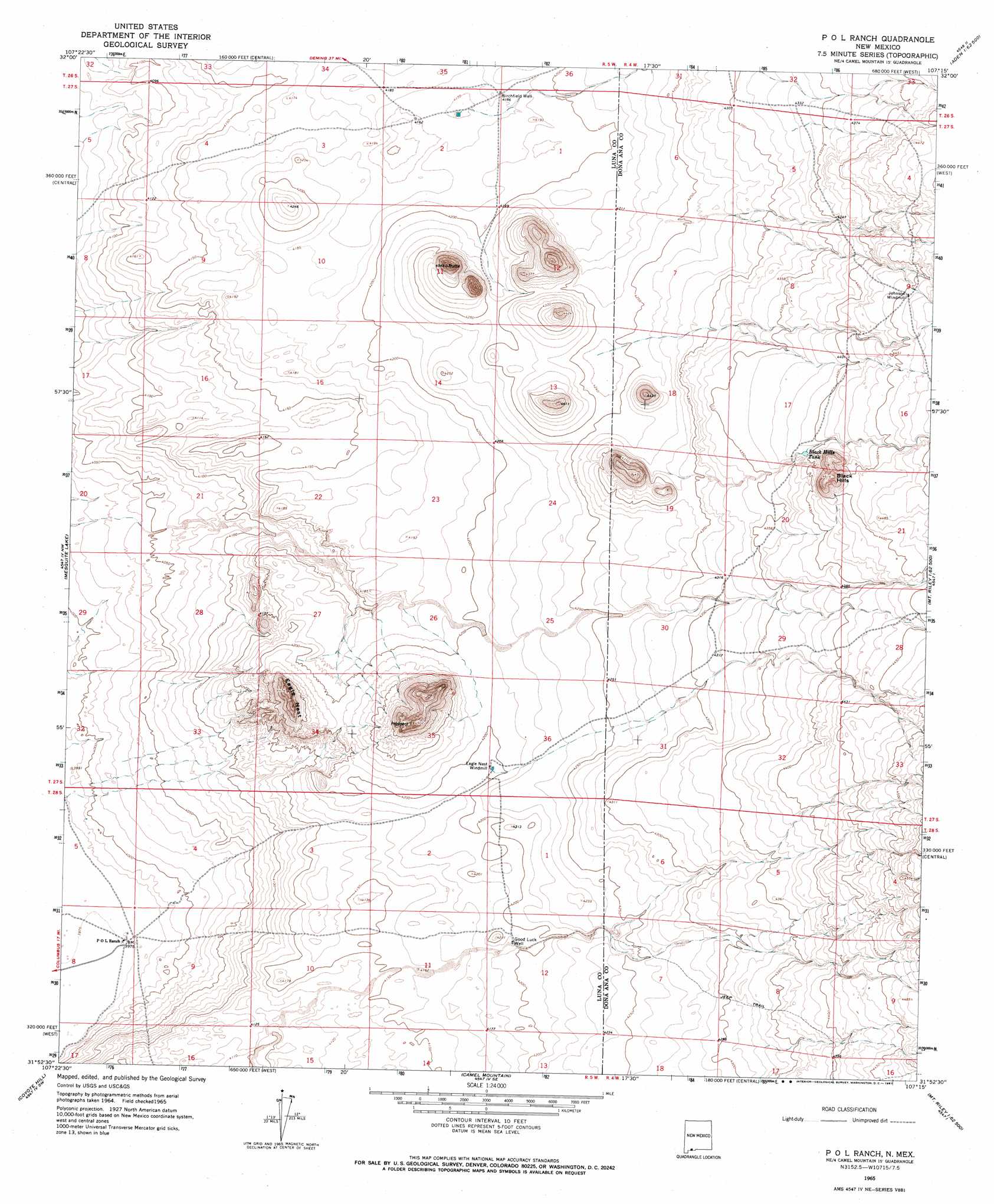
USGS Topo Quad 31107h3 - 1:24,000 scale
| Topo Map Name: | P O L Ranch |
| USGS Topo Quad ID: | 31107h3 |
| Print Size: | ca. 21 1/4" wide x 27" high |
| Southeast Coordinates: | 31.875° N latitude / 107.25° W longitude |
| Map Center Coordinates: | 31.9375° N latitude / 107.3125° W longitude |
| U.S. State: | NM |
| Filename: | o31107h3.jpg |
| Download Map JPG Image: | P O L Ranch topo map 1:24,000 scale |
| Map Type: | Topographic |
| Topo Series: | 7.5´ |
| Map Scale: | 1:24,000 |
| Source of Map Images: | United States Geological Survey (USGS) |
| Alternate Map Versions: |
P O L Ranch NM 1965, updated 1967 Download PDF Buy paper map P O L Ranch NM 2010 Download PDF Buy paper map P O L Ranch NM 2013 Download PDF Buy paper map P O L Ranch NM 2017 Download PDF Buy paper map |
1:24,000 Topo Quads surrounding P O L Ranch
Florida Gap |
Akela |
Cambray |
Mount Aden |
Aden Hills |
Gym Peak |
Sibley Hole |
X-7 Ranch |
Mount Aden Sw |
Aden Crater |
Columbus Ne |
Mesquite Lake |
P O L Ranch |
Potrillo Peak |
Mount Riley |
Columbus Se |
Coyote Hill |
Camel Mountain |
Guzmans Lookout Mountain |
Mount Riley Se |
> Back to 31107e1 at 1:100,000 scale
> Back to 31106a1 at 1:250,000 scale
> Back to U.S. Topo Maps home
P O L Ranch topo map: Gazetteer
P O L Ranch: Reservoirs
Black Hills Tank elevation 1336m 4383′P O L Ranch: Summits
Black Hills elevation 1404m 4606′Eagle Nest elevation 1341m 4399′
P O L Ranch: Wells
00870 Water Well elevation 1276m 4186′00873 Water Well elevation 1280m 4199′
01020 Water Well elevation 1279m 4196′
06065 Water Well elevation 1212m 3976′
Birchfield Well elevation 1276m 4186′
Good Luck Well elevation 1278m 4192′
P O L Ranch digital topo map on disk
Buy this P O L Ranch topo map showing relief, roads, GPS coordinates and other geographical features, as a high-resolution digital map file on DVD: