Whitewater Mountains Topo Map New Mexico
To zoom in, hover over the map of Whitewater Mountains
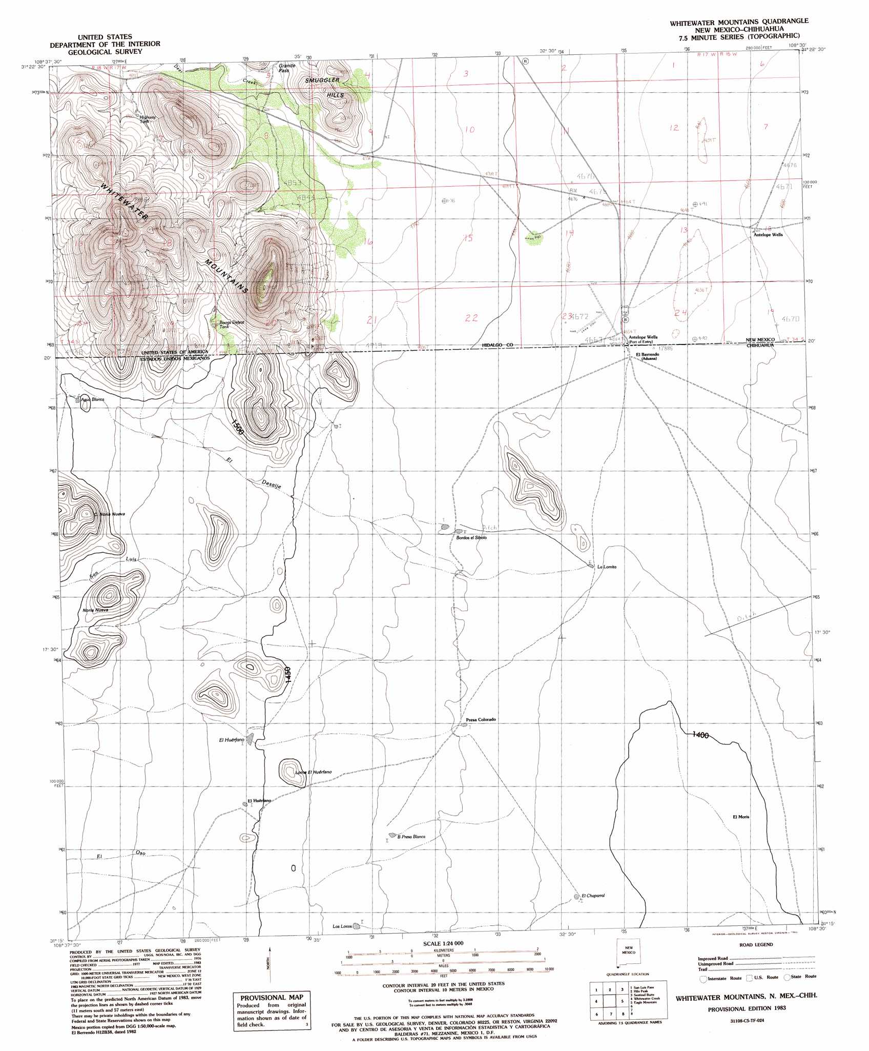
USGS Topo Quad 31108c5 - 1:24,000 scale
| Topo Map Name: | Whitewater Mountains |
| USGS Topo Quad ID: | 31108c5 |
| Print Size: | ca. 21 1/4" wide x 27" high |
| Southeast Coordinates: | 31.25° N latitude / 108.5° W longitude |
| Map Center Coordinates: | 31.3125° N latitude / 108.5625° W longitude |
| U.S. State: | NM |
| Filename: | o31108c5.jpg |
| Download Map JPG Image: | Whitewater Mountains topo map 1:24,000 scale |
| Map Type: | Topographic |
| Topo Series: | 7.5´ |
| Map Scale: | 1:24,000 |
| Source of Map Images: | United States Geological Survey (USGS) |
| Alternate Map Versions: |
Whitewater Mountains NM 1983, updated 1983 Download PDF Buy paper map Whitewater Mountains NM 2010 Download PDF Buy paper map Whitewater Mountains NM 2013 Download PDF Buy paper map Whitewater Mountains NM 2017 Download PDF Buy paper map |
1:24,000 Topo Quads surrounding Whitewater Mountains
Animas Peak |
Center Peak |
Horse Mountain |
U Bar Ridge |
Sheridan Canyon |
Fitzpatricks |
San Luis Pass |
Hilo Peak |
Sentinel Butte |
Pierce Peak |
Lang Canyon |
Whitewater Creek |
Whitewater Mountains |
Eagle Mountain |
Dog Mountains |
> Back to 31108a1 at 1:100,000 scale
> Back to 31108a1 at 1:250,000 scale
> Back to U.S. Topo Maps home
Whitewater Mountains topo map: Gazetteer
Whitewater Mountains: Populated Places
Antelope Wells elevation 1422m 4665′Whitewater Mountains: Ranges
Whitewater Mountains elevation 1728m 5669′Whitewater Mountains: Reservoirs
Boogs Defeat Tank elevation 1519m 4983′Highway Tank elevation 1490m 4888′
Whitewater Mountains: Valleys
Playas Valley elevation 1421m 4662′Whitewater Mountains: Wells
Antelope Wells elevation 1608m 5275′Whitewater Mountains digital topo map on disk
Buy this Whitewater Mountains topo map showing relief, roads, GPS coordinates and other geographical features, as a high-resolution digital map file on DVD: