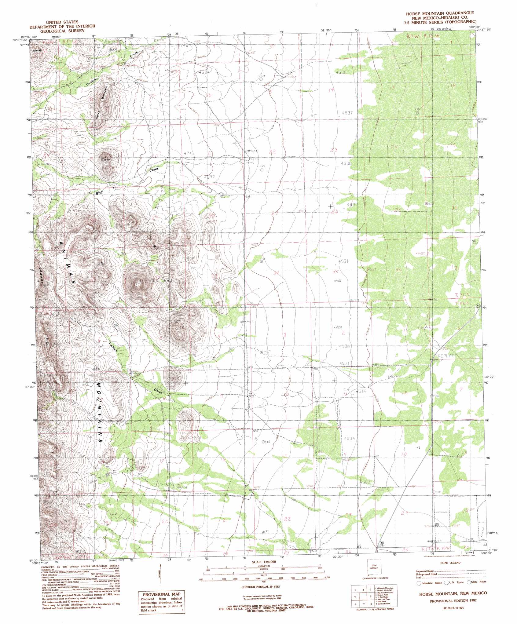
Horse Mountain Topo Map New Mexico
To zoom in, hover over the map of Horse Mountain
USGS Topo Quad 31108e5 - 1:24,000 scale
| Topo Map Name: | Horse Mountain |
| USGS Topo Quad ID: | 31108e5 |
| Print Size: | ca. 21 1/4" wide x 27" high |
| Southeast Coordinates: | 31.5° N latitude / 108.5° W longitude |
| Map Center Coordinates: | 31.5625° N latitude / 108.5625° W longitude |
| U.S. State: | NM |
| Filename: | o31108e5.jpg |
| Download Map JPG Image: | Horse Mountain topo map 1:24,000 scale |
| Map Type: | Topographic |
| Topo Series: | 7.5´ |
| Map Scale: | 1:24,000 |
| Source of Map Images: | United States Geological Survey (USGS) |
| Alternate Map Versions: |
Horse Mountain NM 1982, updated 1982 Download PDF Buy paper map Horse Mountain NM 2010 Download PDF Buy paper map Horse Mountain NM 2013 Download PDF Buy paper map Horse Mountain NM 2017 Download PDF Buy paper map |
1:24,000 Topo Quads surrounding Horse Mountain
Tank Mountain |
Whitmire Pass |
Playas Lake South |
Hachita Peak |
Doyle Peak |
Animas Peak Ne |
Gillespie Mountain |
Walnut Wells Ne |
Big Hatchet Peak |
Hatchet Ranch |
Animas Peak |
Center Peak |
Horse Mountain |
U Bar Ridge |
Sheridan Canyon |
Fitzpatricks |
San Luis Pass |
Hilo Peak |
Sentinel Butte |
Pierce Peak |
Lang Canyon |
Whitewater Creek |
Whitewater Mountains |
Eagle Mountain |
Dog Mountains |
> Back to 31108e1 at 1:100,000 scale
> Back to 31108a1 at 1:250,000 scale
> Back to U.S. Topo Maps home
Horse Mountain topo map: Gazetteer
Horse Mountain: Post Offices
Walnut Wells Post Office (historical) elevation 1359m 4458′Horse Mountain: Streams
Bluff Creek elevation 1430m 4691′Tullous Creek elevation 1454m 4770′
Horse Mountain: Wells
Old Walnut Wells elevation 1363m 4471′Walnut Wells elevation 1359m 4458′
Horse Mountain digital topo map on disk
Buy this Horse Mountain topo map showing relief, roads, GPS coordinates and other geographical features, as a high-resolution digital map file on DVD: