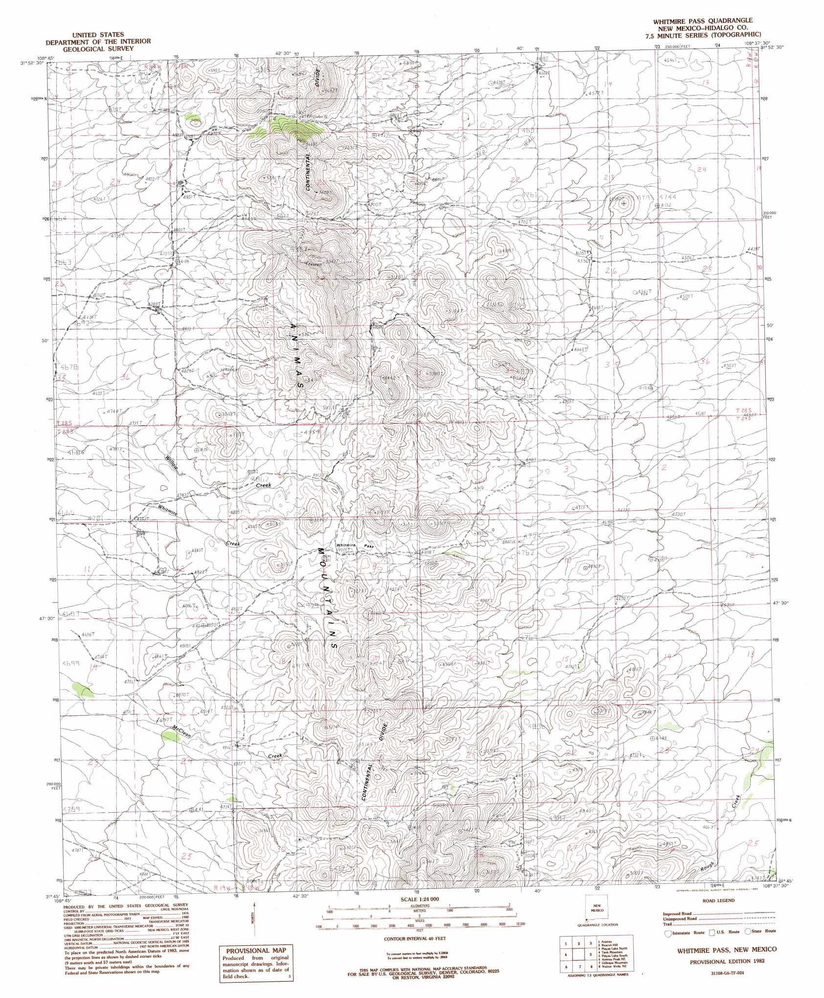
Whitmire Pass Topo Map New Mexico
To zoom in, hover over the map of Whitmire Pass
USGS Topo Quad 31108g6 - 1:24,000 scale
| Topo Map Name: | Whitmire Pass |
| USGS Topo Quad ID: | 31108g6 |
| Print Size: | ca. 21 1/4" wide x 27" high |
| Southeast Coordinates: | 31.75° N latitude / 108.625° W longitude |
| Map Center Coordinates: | 31.8125° N latitude / 108.6875° W longitude |
| U.S. State: | NM |
| Filename: | o31108g6.jpg |
| Download Map JPG Image: | Whitmire Pass topo map 1:24,000 scale |
| Map Type: | Topographic |
| Topo Series: | 7.5´ |
| Map Scale: | 1:24,000 |
| Source of Map Images: | United States Geological Survey (USGS) |
| Alternate Map Versions: |
Whitmire Pass NM 1982, updated 1982 Download PDF Buy paper map Whitmire Pass NM 2010 Download PDF Buy paper map Whitmire Pass NM 2013 Download PDF Buy paper map Whitmire Pass NM 2017 Download PDF Buy paper map |
1:24,000 Topo Quads surrounding Whitmire Pass
Cotton City |
Table Top Mountain |
South Pyramid Peak |
Coyote Peak |
Brockman |
Antelope Pass |
Animas |
Beacon Hill |
Playas Lake North |
Playas Peak |
Indian Peak |
Tank Mountain |
Whitmire Pass |
Playas Lake South |
Hachita Peak |
Mount Baldy |
Animas Peak Ne |
Gillespie Mountain |
Walnut Wells Ne |
Big Hatchet Peak |
Clanton Draw |
Animas Peak |
Center Peak |
Horse Mountain |
U Bar Ridge |
> Back to 31108e1 at 1:100,000 scale
> Back to 31108a1 at 1:250,000 scale
> Back to U.S. Topo Maps home
Whitmire Pass topo map: Gazetteer
Whitmire Pass: Gaps
Whitmire Pass elevation 1517m 4977′Whitmire Pass: Mines
Black Streak Claim elevation 1520m 4986′Rincon elevation 1705m 5593′
Whitmire Pass digital topo map on disk
Buy this Whitmire Pass topo map showing relief, roads, GPS coordinates and other geographical features, as a high-resolution digital map file on DVD: