Paul Spur Topo Map Arizona
To zoom in, hover over the map of Paul Spur
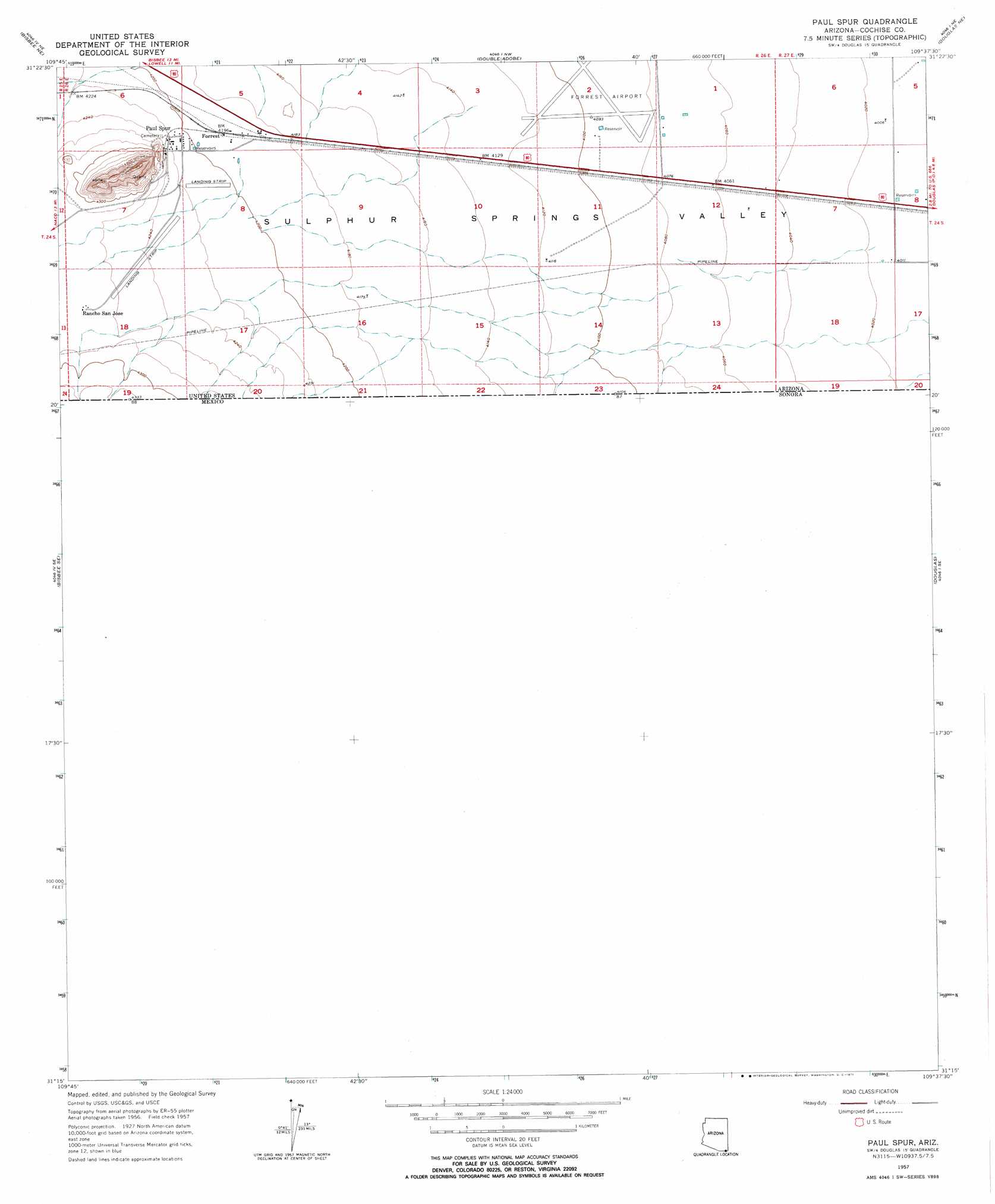
USGS Topo Quad 31109c6 - 1:24,000 scale
| Topo Map Name: | Paul Spur |
| USGS Topo Quad ID: | 31109c6 |
| Print Size: | ca. 21 1/4" wide x 27" high |
| Southeast Coordinates: | 31.25° N latitude / 109.625° W longitude |
| Map Center Coordinates: | 31.3125° N latitude / 109.6875° W longitude |
| U.S. State: | AZ |
| Filename: | o31109c6.jpg |
| Download Map JPG Image: | Paul Spur topo map 1:24,000 scale |
| Map Type: | Topographic |
| Topo Series: | 7.5´ |
| Map Scale: | 1:24,000 |
| Source of Map Images: | United States Geological Survey (USGS) |
| Alternate Map Versions: |
Paul Spur AZ 1957, updated 1959 Download PDF Buy paper map Paul Spur AZ 1957, updated 1971 Download PDF Buy paper map Paul Spur AZ 1957, updated 1971 Download PDF Buy paper map Paul Spur AZ 2011 Download PDF Buy paper map Paul Spur AZ 2014 Download PDF Buy paper map |
1:24,000 Topo Quads surrounding Paul Spur
Potter Mountain |
Gleeson Se |
Mcneal |
Leslie Canyon |
Pedregosa Mountains West |
Bisbee |
Bisbee Ne |
Double Adobe |
Douglas Ne |
College Peaks |
Naco |
Bisbee Se |
Paul Spur |
Douglas |
East Of Douglas |
> Back to 31109a1 at 1:100,000 scale
> Back to 31108a1 at 1:250,000 scale
> Back to U.S. Topo Maps home
Paul Spur topo map: Gazetteer
Paul Spur: Airports
Cochise College Airport elevation 1261m 4137′Forrest Airport elevation 1250m 4101′
Rancho San Jose Airstrip elevation 1293m 4242′
Paul Spur: Populated Places
Forrest elevation 1279m 4196′Paul Spur elevation 1287m 4222′
Paul Spur digital topo map on disk
Buy this Paul Spur topo map showing relief, roads, GPS coordinates and other geographical features, as a high-resolution digital map file on DVD: