Bruno Peak Topo Map Arizona
To zoom in, hover over the map of Bruno Peak
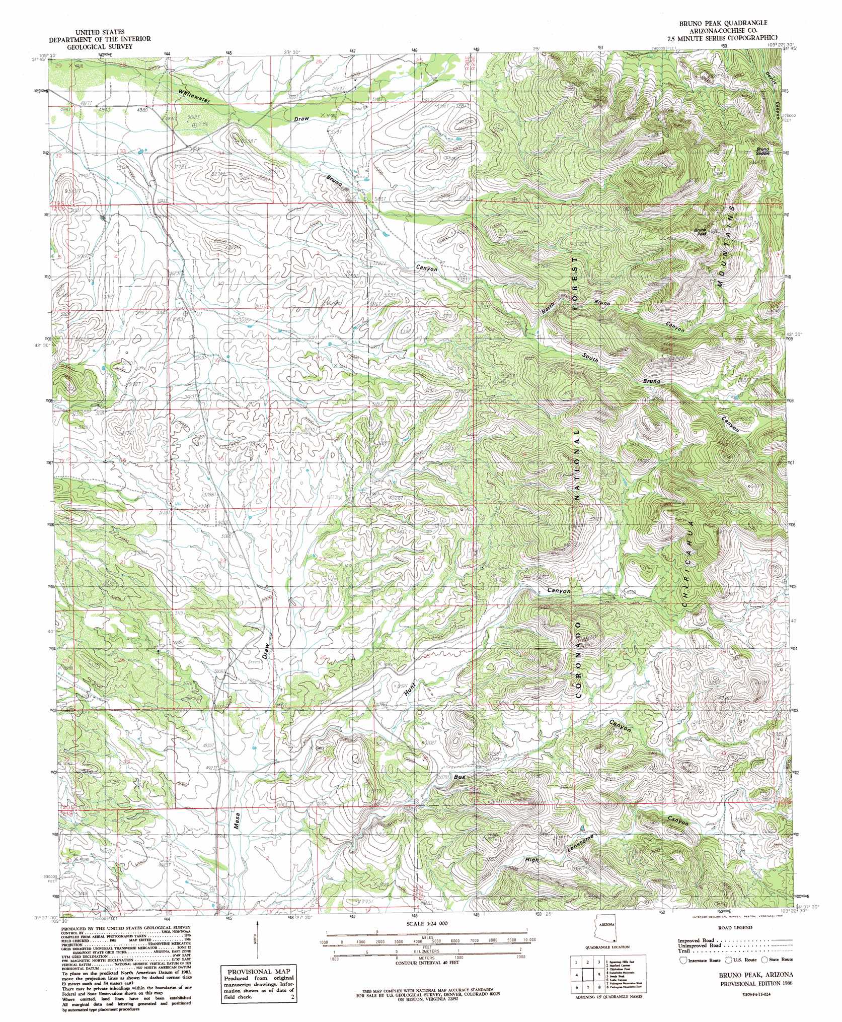
USGS Topo Quad 31109f4 - 1:24,000 scale
| Topo Map Name: | Bruno Peak |
| USGS Topo Quad ID: | 31109f4 |
| Print Size: | ca. 21 1/4" wide x 27" high |
| Southeast Coordinates: | 31.625° N latitude / 109.375° W longitude |
| Map Center Coordinates: | 31.6875° N latitude / 109.4375° W longitude |
| U.S. State: | AZ |
| Filename: | o31109f4.jpg |
| Download Map JPG Image: | Bruno Peak topo map 1:24,000 scale |
| Map Type: | Topographic |
| Topo Series: | 7.5´ |
| Map Scale: | 1:24,000 |
| Source of Map Images: | United States Geological Survey (USGS) |
| Alternate Map Versions: |
Bruno Peak AZ 1986, updated 1986 Download PDF Buy paper map Bruno Peak AZ 1986, updated 1986 Download PDF Buy paper map Bruno Peak AZ 1996, updated 2003 Download PDF Buy paper map Bruno Peak AZ 2012 Download PDF Buy paper map Bruno Peak AZ 2014 Download PDF Buy paper map |
| FStopo: | US Forest Service topo Bruno Peak is available: Download FStopo PDF Download FStopo TIF |
1:24,000 Topo Quads surrounding Bruno Peak
Sulphur Hills |
Pat Hills South |
Fife Peak |
Rustler Park |
Portal |
Squaretop Hills West |
Squaretop Hills East |
Stanford Canyon |
Chiricahua Peak |
Portal Peak |
Elfrida |
Swisshelm Mountain |
Bruno Peak |
Swede Peak |
Apache |
Mcneal |
Leslie Canyon |
Pedregosa Mountains West |
Pedregosa Mountains East |
Paramore Crater |
Double Adobe |
Douglas Ne |
College Peaks |
Cinder Hill |
Lazy J Ranch |
> Back to 31109e1 at 1:100,000 scale
> Back to 31108a1 at 1:250,000 scale
> Back to U.S. Topo Maps home
Bruno Peak topo map: Gazetteer
Bruno Peak: Gaps
Bruno Saddle elevation 1991m 6532′Bruno Peak: Reservoirs
Boot Stock Tank elevation 1559m 5114′Bower Tank elevation 1645m 5396′
Bruno Tank elevation 1657m 5436′
Devils Canyon Tank elevation 1794m 5885′
Glenn Tank elevation 1690m 5544′
Lower Bruno Tank elevation 1590m 5216′
North Bruno Tank elevation 1791m 5875′
Warner Tank elevation 1748m 5734′
Willcox Tank elevation 1624m 5328′
Winkler Tank elevation 1742m 5715′
Bruno Peak: Summits
Bruno Peak elevation 2095m 6873′Bruno Peak: Trails
Devils Canyon 237 elevation 1836m 6023′Bruno Peak: Valleys
Bruno Canyon elevation 1545m 5068′Hunt Canyon elevation 1497m 4911′
North Bruno Canyon elevation 1671m 5482′
South Bruno Canyon elevation 1671m 5482′
Bruno Peak digital topo map on disk
Buy this Bruno Peak topo map showing relief, roads, GPS coordinates and other geographical features, as a high-resolution digital map file on DVD: