Hay Mountain Topo Map Arizona
To zoom in, hover over the map of Hay Mountain
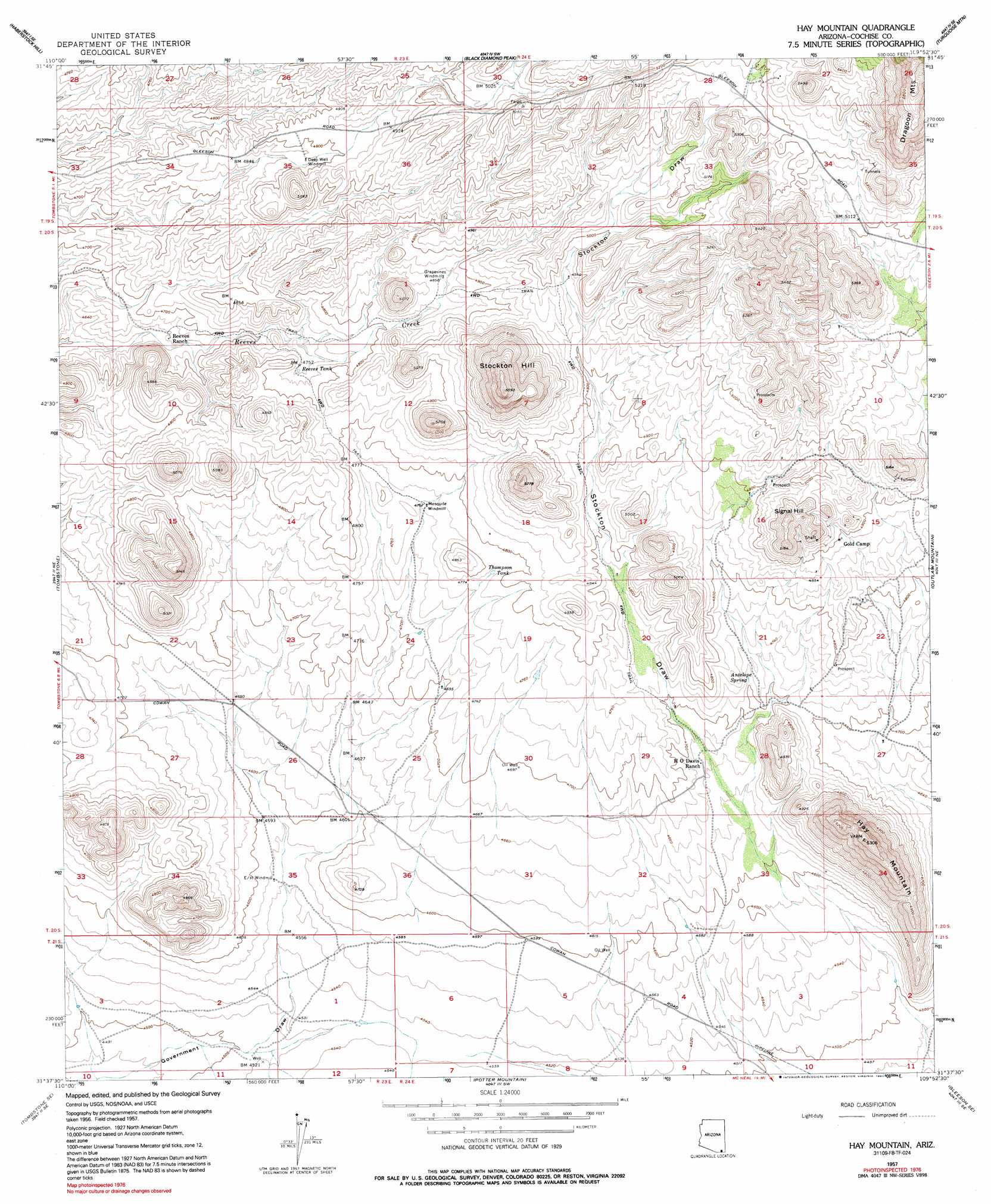
USGS Topo Quad 31109f8 - 1:24,000 scale
| Topo Map Name: | Hay Mountain |
| USGS Topo Quad ID: | 31109f8 |
| Print Size: | ca. 21 1/4" wide x 27" high |
| Southeast Coordinates: | 31.625° N latitude / 109.875° W longitude |
| Map Center Coordinates: | 31.6875° N latitude / 109.9375° W longitude |
| U.S. State: | AZ |
| Filename: | o31109f8.jpg |
| Download Map JPG Image: | Hay Mountain topo map 1:24,000 scale |
| Map Type: | Topographic |
| Topo Series: | 7.5´ |
| Map Scale: | 1:24,000 |
| Source of Map Images: | United States Geological Survey (USGS) |
| Alternate Map Versions: |
Hay Mountain AZ 1957, updated 1959 Download PDF Buy paper map Hay Mountain AZ 1957, updated 1964 Download PDF Buy paper map Hay Mountain AZ 1957, updated 1991 Download PDF Buy paper map Hay Mountain AZ 1996, updated 2002 Download PDF Buy paper map Hay Mountain AZ 2011 Download PDF Buy paper map Hay Mountain AZ 2014 Download PDF Buy paper map |
1:24,000 Topo Quads surrounding Hay Mountain
Saint David |
Knob Hill |
Cochise Stronghold |
Pearce |
Sulphur Hills |
Land |
Haberstock Hill |
Black Diamond Peak |
Turquoise Mountain |
Squaretop Hills West |
Fairbank |
Tombstone |
Hay Mountain |
Outlaw Mountain |
Elfrida |
Lewis Springs |
Tombstone Se |
Potter Mountain |
Gleeson Se |
Mcneal |
Nicksville |
Hereford |
Bisbee |
Bisbee Ne |
Double Adobe |
> Back to 31109e1 at 1:100,000 scale
> Back to 31108a1 at 1:250,000 scale
> Back to U.S. Topo Maps home
Hay Mountain topo map: Gazetteer
Hay Mountain: Reservoirs
Reeves Tank elevation 1451m 4760′Thompson Tank elevation 1457m 4780′
Hay Mountain: Springs
Antelope Spring elevation 1438m 4717′Hay Mountain: Summits
Hay Mountain elevation 1609m 5278′Signal Hill elevation 0m 0′
Stockton Hill elevation 1672m 5485′
Hay Mountain: Valleys
Stockton Draw elevation 1396m 4580′Hay Mountain digital topo map on disk
Buy this Hay Mountain topo map showing relief, roads, GPS coordinates and other geographical features, as a high-resolution digital map file on DVD: