Nogales Topo Map Arizona
To zoom in, hover over the map of Nogales
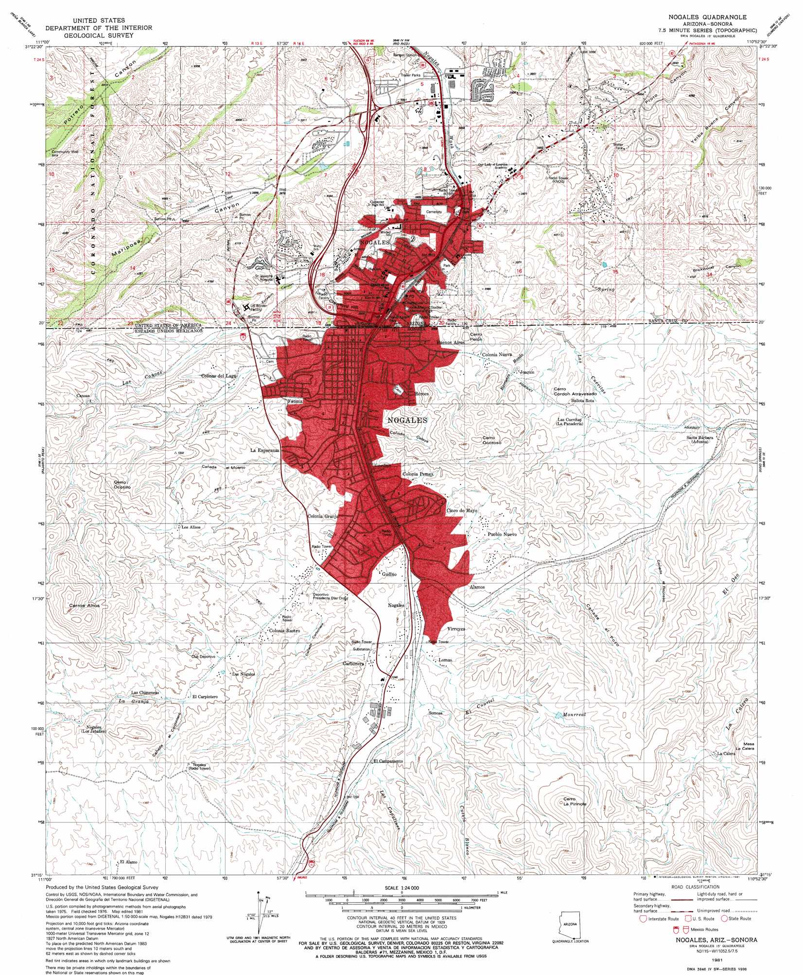
USGS Topo Quad 31110c8 - 1:24,000 scale
| Topo Map Name: | Nogales |
| USGS Topo Quad ID: | 31110c8 |
| Print Size: | ca. 21 1/4" wide x 27" high |
| Southeast Coordinates: | 31.25° N latitude / 110.875° W longitude |
| Map Center Coordinates: | 31.3125° N latitude / 110.9375° W longitude |
| U.S. State: | AZ |
| Filename: | o31110c8.jpg |
| Download Map JPG Image: | Nogales topo map 1:24,000 scale |
| Map Type: | Topographic |
| Topo Series: | 7.5´ |
| Map Scale: | 1:24,000 |
| Source of Map Images: | United States Geological Survey (USGS) |
| Alternate Map Versions: |
Nogales AZ 1981, updated 1981 Download PDF Buy paper map Nogales AZ 2004, updated 2007 Download PDF Buy paper map Nogales AZ 2012 Download PDF Buy paper map Nogales AZ 2014 Download PDF Buy paper map |
| FStopo: | US Forest Service topo Nogales is available: Download FStopo PDF Download FStopo TIF |
1:24,000 Topo Quads surrounding Nogales
Murphy Peak |
Tubac |
San Cayetano Mountains |
Patagonia |
Mount Hughes |
Ruby |
Pena Blanca Lake |
Rio Rico |
Cumero Canyon |
Harshaw |
Alamo Spring |
Pajarito Peak |
Nogales |
Kino Springs |
Duquesne |
> Back to 31110a1 at 1:100,000 scale
> Back to 31110a1 at 1:250,000 scale
> Back to U.S. Topo Maps home
Nogales topo map: Gazetteer
Nogales: Parks
Kino Park elevation 1159m 3802′Nasib Karam Park elevation 1210m 3969′
Nogales: Populated Places
Nogales elevation 1168m 3832′Nogales: Summits
Crawford Hill elevation 1217m 3992′Nogales: Valleys
Ephriah Canyon elevation 1164m 3818′Mariposa Canyon elevation 1146m 3759′
Nogales digital topo map on disk
Buy this Nogales topo map showing relief, roads, GPS coordinates and other geographical features, as a high-resolution digital map file on DVD: