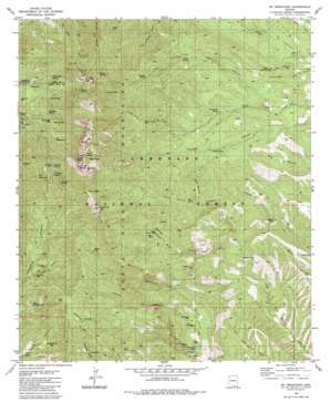
Mount Wrightson Topo Map Arizona
To zoom in, hover over the map of Mount Wrightson
USGS Topo Quad 31110f7 - 1:24,000 scale
| Topo Map Name: | Mount Wrightson |
| USGS Topo Quad ID: | 31110f7 |
| Print Size: | ca. 21 1/4" wide x 27" high |
| Southeast Coordinates: | 31.625° N latitude / 110.75° W longitude |
| Map Center Coordinates: | 31.6875° N latitude / 110.8125° W longitude |
| U.S. State: | AZ |
| Filename: | o31110f7.jpg |
| Download Map JPG Image: | Mount Wrightson topo map 1:24,000 scale |
| Map Type: | Topographic |
| Topo Series: | 7.5´ |
| Map Scale: | 1:24,000 |
| Source of Map Images: | United States Geological Survey (USGS) |
| Alternate Map Versions: |
Mt. Wrightson AZ 1981, updated 1981 Download PDF Buy paper map Mt. Wrightson AZ 1981, updated 1981 Download PDF Buy paper map Mount Wrightson AZ 1996, updated 2002 Download PDF Buy paper map Mount Wrightson AZ 2012 Download PDF Buy paper map Mount Wrightson AZ 2014 Download PDF Buy paper map |
| FStopo: | US Forest Service topo Mount Wrightson is available: Download FStopo PDF Download FStopo TIF |
1:24,000 Topo Quads surrounding Mount Wrightson
> Back to 31110e1 at 1:100,000 scale
> Back to 31110a1 at 1:250,000 scale
> Back to U.S. Topo Maps home
Mount Wrightson topo map: Gazetteer
Mount Wrightson: Basins
Walker Basin elevation 1736m 5695′Mount Wrightson: Dams
Green Dam elevation 1444m 4737′Mount Wrightson: Flats
Juniper Flat elevation 1885m 6184′Mount Wrightson: Gaps
Baldy Saddle elevation 2559m 8395′Florida Saddle elevation 2380m 7808′
Josephine Saddle elevation 2158m 7080′
Riley Saddle elevation 2419m 7936′
Mount Wrightson: Lakes
Bathtub Water elevation 1481m 4858′Mount Wrightson: Mines
Arizona Pittsburg Mine elevation 1707m 5600′Armada Mine elevation 1433m 4701′
Black Eagle Mine elevation 1645m 5396′
Connecticut Mine elevation 1720m 5643′
Crystal Mine (historical) elevation 1715m 5626′
Daniels Mine elevation 1601m 5252′
Dixie Mine elevation 1820m 5971′
Double Header Mine elevation 1543m 5062′
East Compadre Shaft elevation 1666m 5465′
Florida Mine elevation 2019m 6624′
Hosey Mine elevation 1714m 5623′
Little Joker Mine elevation 1514m 4967′
Little Shot Mine elevation 2083m 6833′
Lucky Ledge Mine elevation 1686m 5531′
Ojero Mine (historical) elevation 2174m 7132′
Old Madera Mine elevation 2041m 6696′
Philadelphia Mine elevation 1482m 4862′
Rock Candy Mountain Mine elevation 1935m 6348′
Saint Louis Mine elevation 1513m 4963′
Silver King Mine elevation 1758m 5767′
Snyder Mine elevation 1647m 5403′
Tiajuana Mine elevation 1842m 6043′
Ultimo Mine elevation 1455m 4773′
Walker Mine elevation 1833m 6013′
Wildcat Mine elevation 1983m 6505′
Mount Wrightson: Parks
Roundup Picnic Ground elevation 1667m 5469′Mount Wrightson: Reservoirs
Bathtub Tank elevation 1491m 4891′Canyon Tank elevation 1443m 4734′
El Pilar Tank elevation 1512m 4960′
El Pilar Tank elevation 1514m 4967′
Fish Canyon Tank elevation 1620m 5314′
Little Casa Tank elevation 1487m 4878′
Sawmill Canyon Tank elevation 1641m 5383′
Upper Walker Tank elevation 1732m 5682′
Mount Wrightson: Springs
Aliso Spring elevation 1781m 5843′Anaconda Spring elevation 1442m 4730′
Armour Spring elevation 2487m 8159′
Baldy Spring elevation 2667m 8750′
Bear Spring elevation 1725m 5659′
Bellows Spring elevation 2485m 8152′
Bog Springs elevation 1779m 5836′
Dutch John Spring elevation 1826m 5990′
Florida Spring elevation 2193m 7194′
Kent Spring elevation 2028m 6653′
McBeth Spring elevation 2147m 7043′
Robinson Spring elevation 1664m 5459′
Sawmill Spring elevation 2103m 6899′
Sprung Spring elevation 2127m 6978′
Sweetwater Spring elevation 1699m 5574′
Sylvester Spring elevation 1836m 6023′
Tunnel Spring elevation 1723m 5652′
Mount Wrightson: Streams
Cave Creek elevation 1585m 5200′Mount Wrightson: Summits
Ditch Mountain elevation 1963m 6440′Florida Peak elevation 2480m 8136′
Jack Mountain elevation 2270m 7447′
Josephine Peak elevation 2563m 8408′
McCleary Peak elevation 2546m 8353′
Mount Wrightson elevation 2853m 9360′
Old Baldy elevation 2465m 8087′
Mount Wrightson: Trails
Cave Canyon Trail One Hundred Forty-Seven elevation 1880m 6167′Kent Spring Trail 156 elevation 2019m 6624′
Old Baldy National Recreation Trail Loop elevation 1888m 6194′
Onal Recreation Trail elevation 2412m 7913′
Sawmill Canyon Trail 146 elevation 1669m 5475′
Sweetwater Baldy Saddle Trail 143 elevation 1890m 6200′
Walker Basin Trail Number One Hundred Thirty Six elevation 2016m 6614′
Mount Wrightson: Valleys
Copper Canyon elevation 1658m 5439′East Sawmill Canyon elevation 1584m 5196′
Jones Canyon elevation 1426m 4678′
Walker Canyon elevation 1505m 4937′
Mount Wrightson: Wells
Juniper Well elevation 1893m 6210′Mount Wrightson digital topo map on disk
Buy this Mount Wrightson topo map showing relief, roads, GPS coordinates and other geographical features, as a high-resolution digital map file on DVD:


