Green Valley Topo Map Arizona
To zoom in, hover over the map of Green Valley
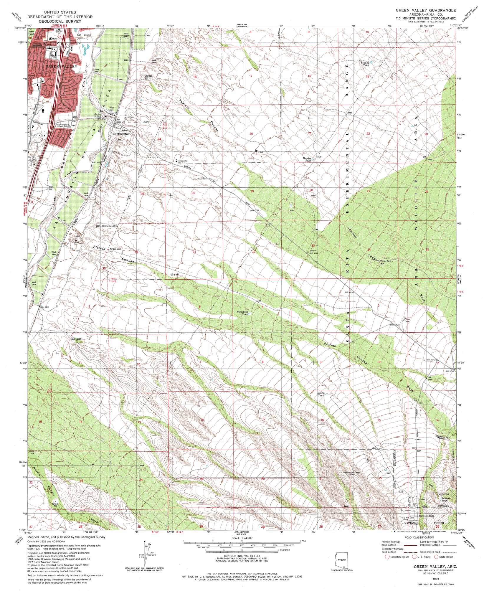
USGS Topo Quad 31110g8 - 1:24,000 scale
| Topo Map Name: | Green Valley |
| USGS Topo Quad ID: | 31110g8 |
| Print Size: | ca. 21 1/4" wide x 27" high |
| Southeast Coordinates: | 31.75° N latitude / 110.875° W longitude |
| Map Center Coordinates: | 31.8125° N latitude / 110.9375° W longitude |
| U.S. State: | AZ |
| Filename: | o31110g8.jpg |
| Download Map JPG Image: | Green Valley topo map 1:24,000 scale |
| Map Type: | Topographic |
| Topo Series: | 7.5´ |
| Map Scale: | 1:24,000 |
| Source of Map Images: | United States Geological Survey (USGS) |
| Alternate Map Versions: |
Green Valley AZ 1981, updated 1982 Download PDF Buy paper map Green Valley AZ 2004, updated 2006 Download PDF Buy paper map Green Valley AZ 2012 Download PDF Buy paper map Green Valley AZ 2014 Download PDF Buy paper map |
| FStopo: | US Forest Service topo Green Valley is available: Download FStopo PDF Download FStopo TIF |
1:24,000 Topo Quads surrounding Green Valley
San Xavier Mission Sw |
San Xavier Mission |
Tucson Sw |
Tucson Se |
Vail |
Samaniego Peak |
Twin Buttes |
Sahuarita |
Corona De Tucson |
Mount Fagan |
Batamote Hills |
Esperanza Mill |
Green Valley |
Helvetia |
Empire Ranch |
Saucito Mountain |
Amado |
Mount Hopkins |
Mount Wrightson |
Sonoita |
Murphy Peak |
Tubac |
San Cayetano Mountains |
Patagonia |
Mount Hughes |
> Back to 31110e1 at 1:100,000 scale
> Back to 31110a1 at 1:250,000 scale
> Back to U.S. Topo Maps home
Green Valley topo map: Gazetteer
Green Valley: Airports
Continental Airport elevation 874m 2867′Green Valley: Arroyos
Box Canyon Wash elevation 1036m 3398′Florida Canyon Wash elevation 879m 2883′
Sawmill Canyon Wash elevation 868m 2847′
Green Valley: Crossings
Continental Interchange elevation 884m 2900′Green Valley Interchange elevation 878m 2880′
Green Valley: Populated Places
Continental elevation 873m 2864′Green Valley elevation 885m 2903′
Green Valley: Reservoirs
Horseshoe Tank elevation 991m 3251′Hughes Tank elevation 971m 3185′
Juniper Tank elevation 1267m 4156′
Kinney Tank elevation 959m 3146′
Muhlenbergia Tank elevation 1015m 3330′
South Tank elevation 1080m 3543′
West Tank elevation 983m 3225′
Green Valley: Valleys
Mary A Canyon elevation 905m 2969′Green Valley: Wells
Amado Well elevation 907m 2975′Benson Wells elevation 1149m 3769′
Melendrez Well elevation 1126m 3694′
Green Valley digital topo map on disk
Buy this Green Valley topo map showing relief, roads, GPS coordinates and other geographical features, as a high-resolution digital map file on DVD: