Corona De Tucson Topo Map Arizona
To zoom in, hover over the map of Corona De Tucson
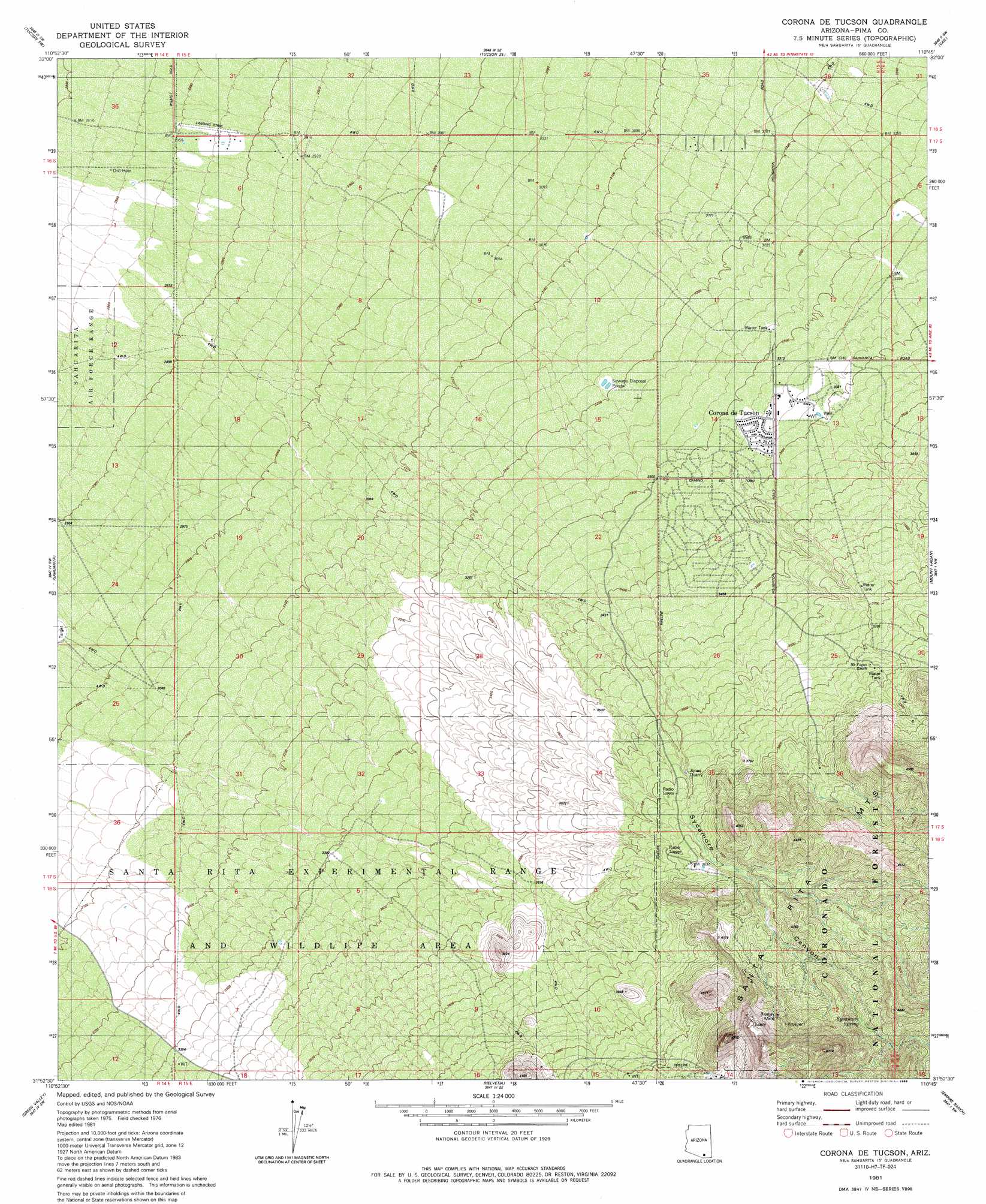
USGS Topo Quad 31110h7 - 1:24,000 scale
| Topo Map Name: | Corona De Tucson |
| USGS Topo Quad ID: | 31110h7 |
| Print Size: | ca. 21 1/4" wide x 27" high |
| Southeast Coordinates: | 31.875° N latitude / 110.75° W longitude |
| Map Center Coordinates: | 31.9375° N latitude / 110.8125° W longitude |
| U.S. State: | AZ |
| Filename: | o31110h7.jpg |
| Download Map JPG Image: | Corona De Tucson topo map 1:24,000 scale |
| Map Type: | Topographic |
| Topo Series: | 7.5´ |
| Map Scale: | 1:24,000 |
| Source of Map Images: | United States Geological Survey (USGS) |
| Alternate Map Versions: |
Corona De Tucson AZ 1981, updated 1981 Download PDF Buy paper map Corona De Tucson AZ 1981, updated 1986 Download PDF Buy paper map Corona De Tucson AZ 1996, updated 2002 Download PDF Buy paper map Corona De Tucson AZ 2012 Download PDF Buy paper map Corona De Tucson AZ 2014 Download PDF Buy paper map |
| FStopo: | US Forest Service topo Corona De Tucson is available: Download FStopo PDF Download FStopo TIF |
1:24,000 Topo Quads surrounding Corona De Tucson
Cat Mountain |
Tucson |
Tucson East |
Tanque Verde Peak |
Mica Mountain |
San Xavier Mission |
Tucson Sw |
Tucson Se |
Vail |
Rincon Peak |
Twin Buttes |
Sahuarita |
Corona De Tucson |
Mount Fagan |
The Narrows |
Esperanza Mill |
Green Valley |
Helvetia |
Empire Ranch |
Spring Water Canyon |
Amado |
Mount Hopkins |
Mount Wrightson |
Sonoita |
Elgin |
> Back to 31110e1 at 1:100,000 scale
> Back to 31110a1 at 1:250,000 scale
> Back to U.S. Topo Maps home
Corona De Tucson topo map: Gazetteer
Corona De Tucson: Mines
Bluejay Mine elevation 1349m 4425′Jones Quarry elevation 1123m 3684′
Corona De Tucson: Populated Places
Corona de Tucson elevation 1000m 3280′Corona De Tucson: Springs
Sycamore Spring elevation 1284m 4212′Corona De Tucson: Valleys
Sycamore Canyon elevation 1139m 3736′Corona De Tucson digital topo map on disk
Buy this Corona De Tucson topo map showing relief, roads, GPS coordinates and other geographical features, as a high-resolution digital map file on DVD: