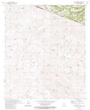
Alamo Spring Topo Map Arizona
To zoom in, hover over the map of Alamo Spring
USGS Topo Quad 31111c2 - 1:24,000 scale
| Topo Map Name: | Alamo Spring |
| USGS Topo Quad ID: | 31111c2 |
| Print Size: | ca. 21 1/4" wide x 27" high |
| Southeast Coordinates: | 31.25° N latitude / 111.125° W longitude |
| Map Center Coordinates: | 31.3125° N latitude / 111.1875° W longitude |
| U.S. State: | AZ |
| Filename: | o31111c2.jpg |
| Download Map JPG Image: | Alamo Spring topo map 1:24,000 scale |
| Map Type: | Topographic |
| Topo Series: | 7.5´ |
| Map Scale: | 1:24,000 |
| Source of Map Images: | United States Geological Survey (USGS) |
| Alternate Map Versions: |
Alamo Spring AZ 1980, updated 1980 Download PDF Buy paper map Alamo Spring AZ 2004, updated 2007 Download PDF Buy paper map Alamo Spring AZ 2012 Download PDF Buy paper map Alamo Spring AZ 2014 Download PDF Buy paper map |
| FStopo: | US Forest Service topo Alamo Spring is available: Download FStopo PDF Download FStopo TIF |
1:24,000 Topo Quads surrounding Alamo Spring
Wilbur Canyon |
Arivaca |
Murphy Peak |
Tubac |
San Cayetano Mountains |
Cumero Mountain |
Bartlett Mountain |
Ruby |
Pena Blanca Lake |
Rio Rico |
Alamo Spring |
Pajarito Peak |
Nogales |
||
> Back to 31111a1 at 1:100,000 scale
> Back to 31110a1 at 1:250,000 scale
> Back to U.S. Topo Maps home
Alamo Spring topo map: Gazetteer
Alamo Spring: Reservoirs
Border Tank elevation 1278m 4192′Chiladote Tank elevation 1391m 4563′
Coyote Tank elevation 1423m 4668′
Soto Tank elevation 1327m 4353′
Tonto Tank elevation 1315m 4314′
Alamo Spring: Springs
Alamo Spring elevation 1353m 4438′Alamo Spring: Trails
Summit Motorway elevation 1478m 4849′Alamo Spring digital topo map on disk
Buy this Alamo Spring topo map showing relief, roads, GPS coordinates and other geographical features, as a high-resolution digital map file on DVD:


