San Miguel Topo Map Arizona
To zoom in, hover over the map of San Miguel
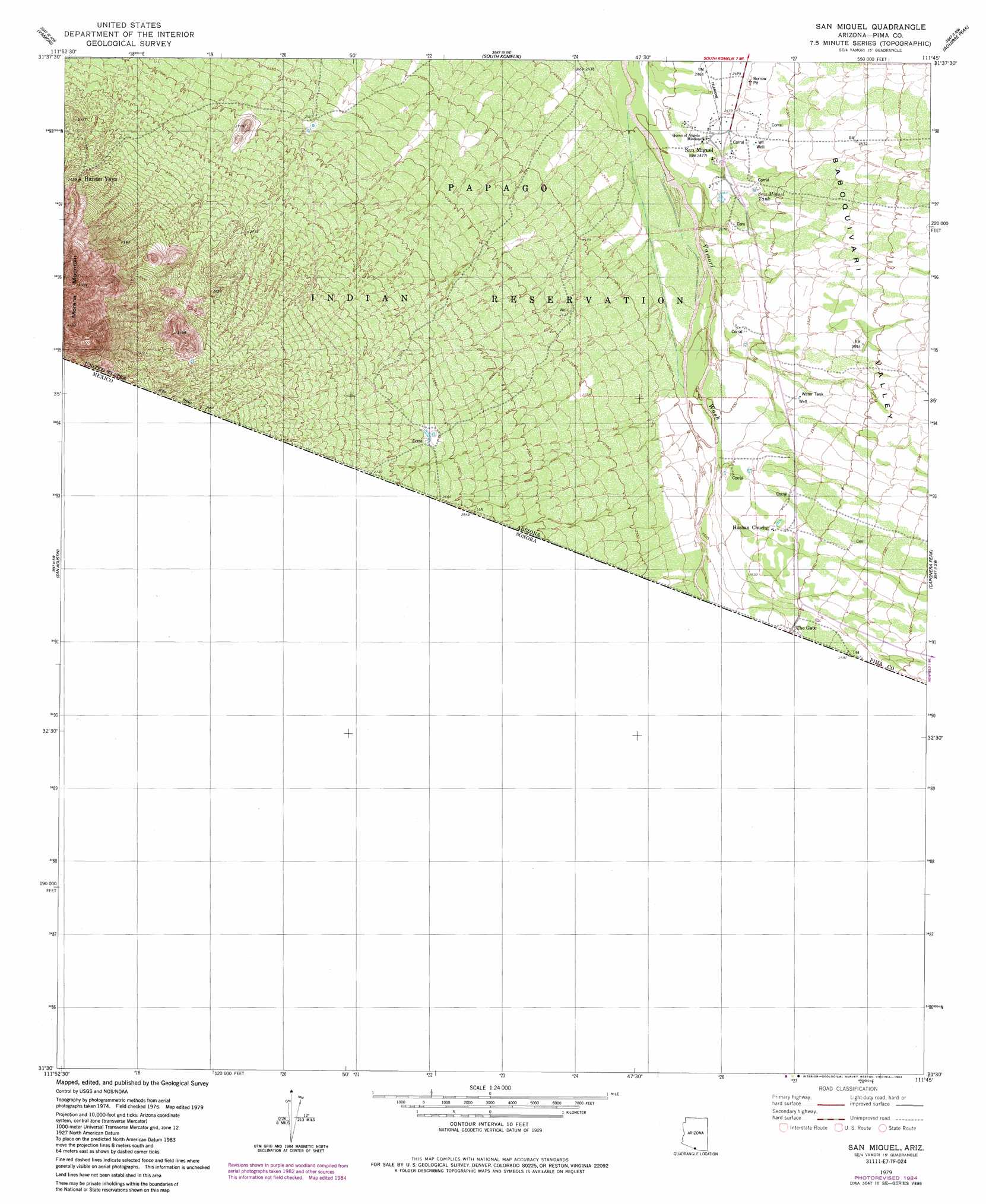
USGS Topo Quad 31111e7 - 1:24,000 scale
| Topo Map Name: | San Miguel |
| USGS Topo Quad ID: | 31111e7 |
| Print Size: | ca. 21 1/4" wide x 27" high |
| Southeast Coordinates: | 31.5° N latitude / 111.75° W longitude |
| Map Center Coordinates: | 31.5625° N latitude / 111.8125° W longitude |
| U.S. State: | AZ |
| Filename: | o31111e7.jpg |
| Download Map JPG Image: | San Miguel topo map 1:24,000 scale |
| Map Type: | Topographic |
| Topo Series: | 7.5´ |
| Map Scale: | 1:24,000 |
| Source of Map Images: | United States Geological Survey (USGS) |
| Alternate Map Versions: |
San Miguel AZ 1979, updated 1979 Download PDF Buy paper map San Miguel AZ 1979, updated 1984 Download PDF Buy paper map San Miguel AZ 1996, updated 2003 Download PDF Buy paper map San Miguel AZ 2011 Download PDF Buy paper map San Miguel AZ 2014 Download PDF Buy paper map |
1:24,000 Topo Quads surrounding San Miguel
Chukut Kuk |
Cowlic |
Topawa |
Chiuli Shaik |
Baboquivari Peak |
Tecolote Ranch |
Vamori |
South Komelik |
Aguirre Peak |
Mildred Peak |
San Agustin |
San Miguel |
Caponera Peak |
Presumido Peak |
|
Sasabe |
||||
> Back to 31111e1 at 1:100,000 scale
> Back to 31110a1 at 1:250,000 scale
> Back to U.S. Topo Maps home
San Miguel topo map: Gazetteer
San Miguel: Populated Places
Haivan Vaya elevation 868m 2847′Hashan Chuchg elevation 772m 2532′
San Miguel elevation 754m 2473′
San Miguel: Reservoirs
San Miguel Tank elevation 0m 0′San Miguel: Valleys
Baboquivari Valley elevation 757m 2483′San Miguel digital topo map on disk
Buy this San Miguel topo map showing relief, roads, GPS coordinates and other geographical features, as a high-resolution digital map file on DVD: